Marion and Alfred Lorenz Marion and Alfred Lorenz
  • Home
  • Itineraries
    • Africa
      • Tanzania
      • Morocco
    • Central America
      • Belize
      • Costa Rica
      • Guatemala
      • Honduras
      • Nicaragua
      • Panama
    • North America
      • Canada
      • Mexico
      • United States
    • South America
      • Argentina
      • Bolivia
      • Brazil
      • Chile
      • Colombia
      • Ecuador
      • Paraguay
      • Peru
      • Uruguay
    • From Hamburg to Buenos Aires
    • Asia
      • Cambodia
      • Laos
      • Thailand
      • Vietnam
    • Europe
      • Central Europe
      • France
      • Italy
      • Portugal
      • Scandinavia
      • Spain
  • Mountains
    • Africa - Overview
    • Central America - Overview
    • North America - Overview
    • South America - Overview
    • Asia - Overview
    • Europe / Scandinavia - Overview
    • Europe / South - Overview
  • Pictures
    • Pictures Africa
      • Pictures Morocco
      • Pictures Tansania
    • Pictures Central America
    • Pictures North America
      • Pictures Canada
      • Pictures Mexico
      • Pictures United States
    • Pictures South America
      • Pictures Argentina
      • Pictures Bolivia
      • Pictures Brazil
      • Pictures Chile
      • Pictures Colombia
      • Pictures Ecuador
      • Pictures Paraguay
      • Pictures Peru
      • Pictures Uruguay
    • Pictures Asia
      • Pictures Cambodia
      • Pictures Laos
      • Pictures Thailand
      • Pictures Vietnam
    • Pictures Europe
      • Pictures Central Europe
      • Pictures France
      • Pictures Italy
      • Pictures Portugal
      • Pictures Scandinavia
      • Pictures Spain
    • Pictures - From Hamburg to Buenos Aires with a cargo ship
  • Maps
    • Maps Africa
      • Map Morocco
      • Map Tanzania
    • Map America Entire
    • Map Central America
    • Maps North America
      • Map Alaska and Canada - West
      • Map Mexico
      • Map United States - Northwest
      • Map United States - Southwest
    • Maps South America
      • Map South America - Northwest
      • Map South America - Central
      • Map South America - South
    • Map Southeast Asia
    • Maps Europe
      • Map Central Europe
      • Map France
      • Map Italy
      • Map Portugal and Spain
      • Map Scandinavia
      • Map Spain - Mallorca
  • GPS Coordinates
    • GPS - Africa
    • GPS - Central America
    • GPS - North America
    • GPS - South America
    • GPS - Asia
    • GPS - Europe
  • Guestbook
  • About
    • About Marion and Alfred
    • Chronology
    • Newsletter Subscription
  1. You are here:  
  2. Home

Iquique and Arica

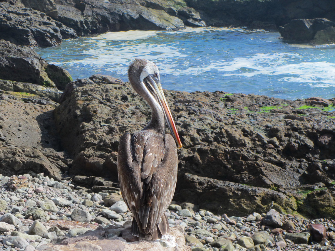
Iquique and Arica are with approximately 150,000 inhabitants each, the two biggest cities in the far North of Chile. Both are located beautifully on the Pacific Ocean surrounded by the pristine Atacama Desert in the back. This part of the desert is famous for its nitrate cities and geoglyphs, which were built between 1000 and 1400 BC by the local tribes. Most of the nitrate cities were established during the nitrate boom, which started mid of the 19th century. Most of them are abundant now, because the development of the artificial fabrication of nitrate mid of the 20th centuries stopped the boom.

Pelican on the beach close to Iquique


When we came back to Mendoza on May 24th 2012 from our second return to Germany, we wanted to head as fast as possible in the North of Chile because the climate there is much more reasonable in late fall. But first we had to cross the Andes. The only possibility in this season is the tunnel Cristo Redentor, the direct connection between Mendoza and Santiago de Chile.

Read more …
Add new comment

Volcan Tinguiririca

Volcan Tinguiririca is with 4280 meters sea level one of the most dominant mountains 200 kilometers South of Santiago de Chile and 50km East of San Fernando. It is located in an extreme remote but beautiful environment. An aircraft crashed on its slopes in the early spring of 1972. One of the survivor went down after 72 days (!) to get help. Earlier rescue was impossible due to enormous amount of snow and bad weather. Some passengers survived because they had eaten the dead people. This touching story is described in the book "ALIVE".

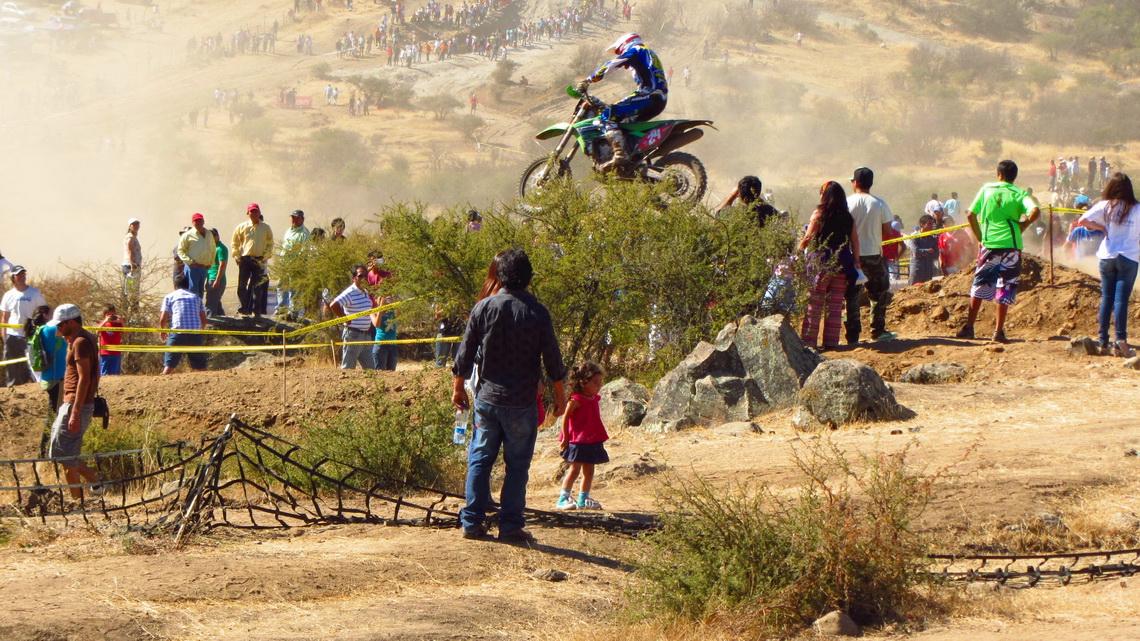
There are the superb hot springs Termas del Flaco on the base of Volcan Tinguiririca. Few kilometers South is the bustling city Talca with approximately 200,000 inhabitants. Paso Maule or Pehuenche leads to Argentina via a pristine and marvelous landscape. Highlights are the hot springs Termas Campanario, the waterfalls Cascada del Arco Iris and the incredible blue lake Lago Maule. When we came to Talca we could watch an exciting event. 

World Motocross Championship 2012

Read more …
1 comment

Chiloe and Valdivia

Chiloe is with 9,600 sq km the second biggest island of South America, located more than 1000km south of Santiago in the Pacific Ocean. It is a hilly and green but harsh land with more than 2200mm precipitation per year. Most of its population live in the two bigger towns Ancud and Castro, which have about 20,000 inhabitants each. Many descendants of the native tribe Huilliche live in its smaller villages and settlements. Thanks to its isolated location, Chiloe suffered less from the mainstream of Spanish colonial development.

Chiloe is famous for salmon farming, its fine wooden churches, picturesque Palafitos (houses on stilts above the water), pristine beaches, dense cold rain forests, abundant fauna and flora. Huge areas are protected by national, regional or private parks.

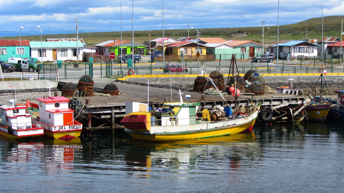
250km North of Chiloe is the city of Valdivia, which has with more than 120,000 people approximately the same population like Chiloe. We came March 12th 2012 to Chiloe via the Panamericana (Ruta 5) and the usual ferry from Pargua. Close to Pargua is the pretty fishing port Maulin.

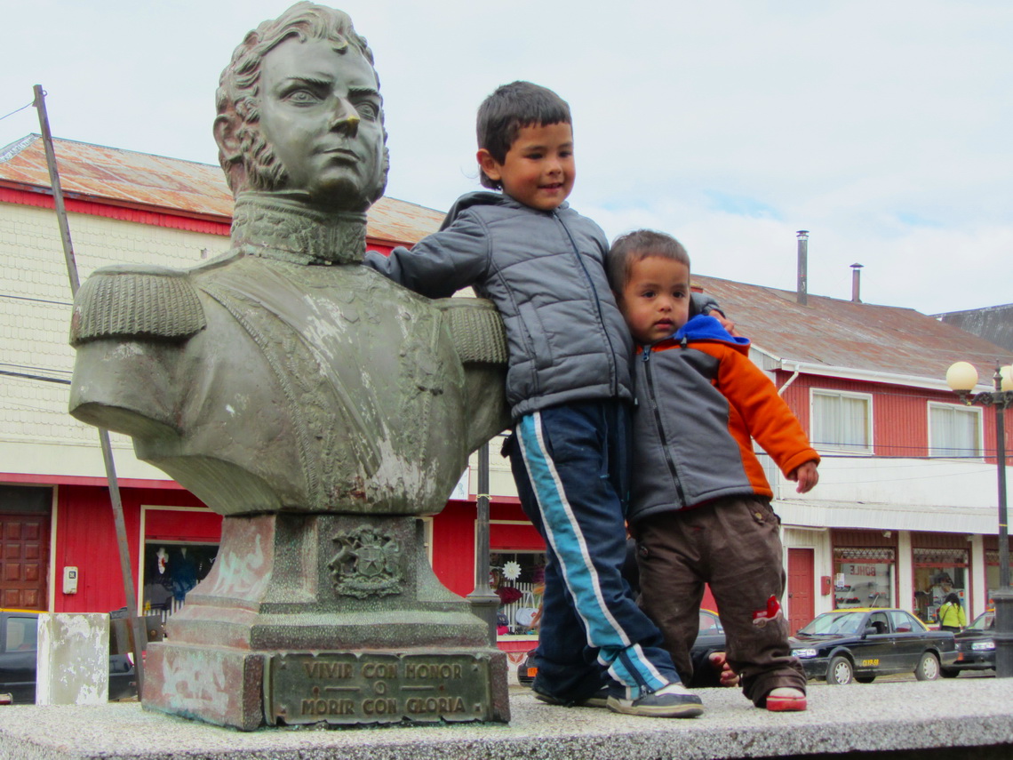
Boys of Maullin with Bernardo O'Higgins, the Chilean National Hero

Boys of Maulin with Bernado O'Higgis, the Chilean National Hero

Read more …
Add new comment

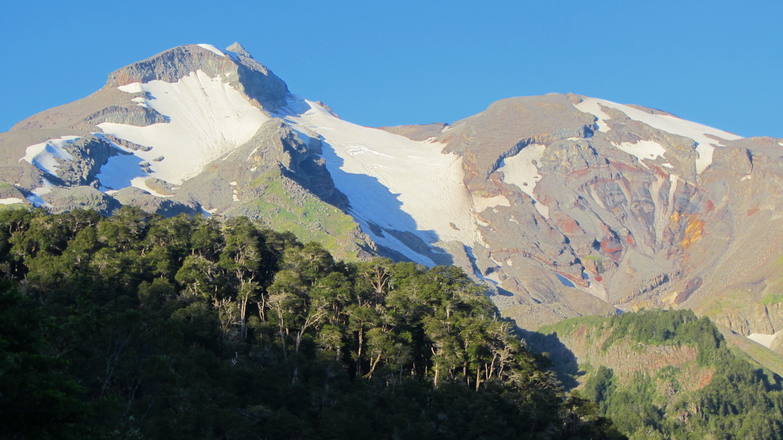
Volcan Chillan and Volcan Antuco

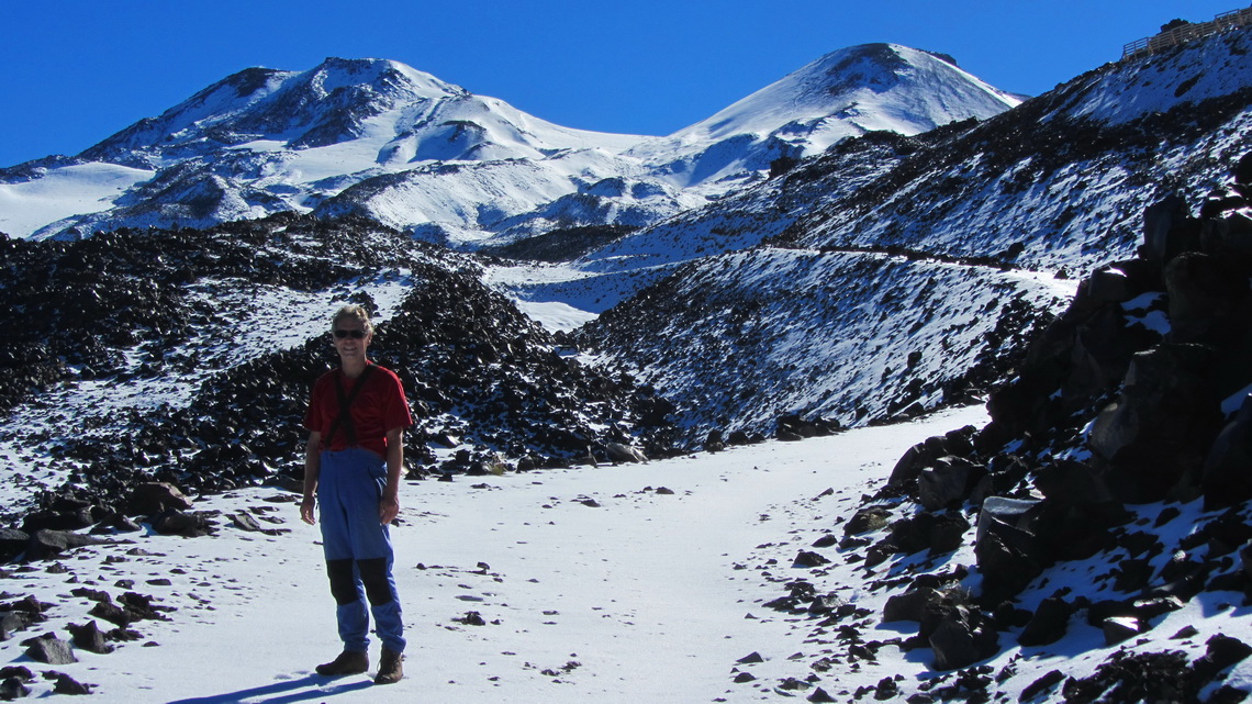
The twin Volcanoes Chillan Viejo (old) and Nuevo (new) are 80 kilometers East of the town Chillan and the hot springs with the same name. This region is famous for its ski resort, the largest in Chile. Both volcanoes are active with some smoking rocks as well as the neighboring Nevados de Chillan. Besides their relatively low height of approximately 3200 meters the glaciation is quite big. 

Volcanoes Chillan Nuevo and Viejo


50 km South of the Volcanoes Chillan is the Parque Nacional Laguna del Laja. The lake Laguna Laja originated in the year 1873 due to a heavy eruption of the Volcan Antuco. This mountain is also a perfect black and / or white cone of close to 3000 meters height dominating the landscape of the national park. But it is excelled by the rough Sierra Velluda with its huge glaciers.

End of February 2012 we headed fast to the small village Bulnes to visit our friends Petra and Paddy in the winery Vina Chillan, see www.vinachillan.cl. This is one of the southernmost wineries on earth driven by Ruedi, like Petra and Paddy a Swiss citizen.

Read more …
Add new comment

Volcan Lanin, the king of the lake districts

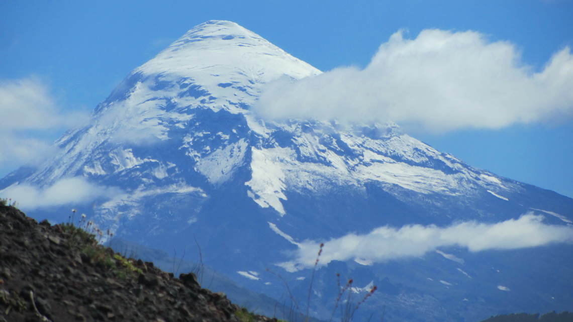
Volcan Lanin is with 3746 meters sea level the highest point of both lake districts, Argentina and Chile. It overtowers all nearby mountains more than several hundreds meters, only Cerro Tronador more 200km South achieves with 3478 meters a similar altitude. Volcan Lanin is a perfect cone of more than 2500 meters vertical highness and it is supposed to be one of the most beautiful mountains on earth. 

Majestic Volcan Lanin seen from the ascent to Volcan Achen Niyeu

The access to the summit of Volcan Lanin is relatively easy: First a six to seven hike to the upper hut Refugio CAJA from the ranger's office on the Paso Mamuil Malal or Tromen on its Argentine side, followed by another six hours trip over snow, scree and some rocks to the top. Due to several accidents on the mountains are the rangers very strict; they check your whole equipment like crampons and if you can use them properly.

In Argentina is the marvelous and huge park Parque Nacional Lanin North and South of the volcano with superb hiking capabilities, magical forests and beautific lakes.

Read more …
Add new comment

Volcan Calbuco

Volcan Calbuco is one of the most active in Chile. Its last major eruption was in the year 1961. The outburst of 1893 blew up its summit cone. Thus its shape is not so perfectly like the neighboring Volcan Osorno, which is supposed to be one of the most beautiful mountains on earth. Both volcanoes are located close to the lake Lago Llanquihue in the marvelous Lake District, the X region of Chile. Puerto Montt is its capital, a bustling city of more than 120,000 people and situated on the north shore of the fjord Seno de Reloncavi. 20km North of Puerto Montt is one of the major tourist destination in southern Chile: Puerto Varas on the southwest side of the huge Lago Llanquihue. Both towns have obvious Austrian, German and Swiss influence like the whole Lake District of Chile.

Volcan Calbuco at sunset - our route is the ridge on the left


We arrived in Puerto Montt three days prior to Tommy's return fly to Germany in the morning of January 31st 2012 and it was raining cats and dogs. We used the time to visit Nuevo Braunau and Puerto Varas, which have also some beauty at bad weather.

Read more …
Add new comment

Carretera Austral

The last section between Puerto Montt and Cochrane of the Carretera Austral (Southern Highway) in the South of Chile was opened foremost in 1988. Nowadays this street leads to Villa O'Higgins close to the southern continental ice-field Campo de Hielo Sur. It is mainly a rough, dirty and dusty road including some sea crossings by ferries.

Driving the more than 1000 km of the Carretera Austral is still an adventure in very dense cold rain forest between steep mountains and vast glaciers in an extremely thin populated environment. Just few settlements with some people are located on this route. There is only one bigger city: Coyhaique the capital of the XI region of Chile, Aysen.

Besides the harsh climate even sometimes in summer, the tourism industry detects more and more the incredible beauty of the landscape. Consequently the numbers of travelers increase from all of the world. A specialty might be the unusual high quantity of people from Israel. Somebody from there told us that this part of Patagonia is the Praised Land and every Israeli has to visit it, ... .

We fully confirm the marvelous and stunning landscape and we were very lucky: January 2012 was an outstanding weather with sun and heat nearly every day thanks to Global Warming! We came to the small and quiet town of Cochrane mid of January from Argentina over the remote Paso Rodolfo Roballos.

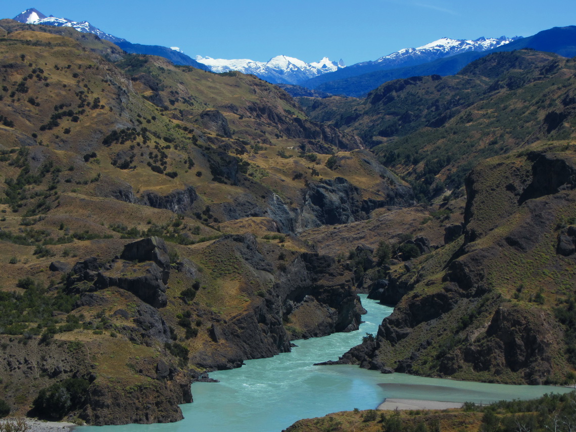
Fierce Rio Baker between the northern and southern continental ice-fields

Read more …
Add new comment

Perito Moreno Parque Nacional and Cueva de los Manos

Parque Nacional Perito Moreno is with approximately 1200 visitors one of the remotes national park in Argentina. Perito (master) Francisco Moreno explored the geography, fauna and flora of Patagonia at the turn of the 19th / 20th century. Not only this park is named after him, also a small town and the famous glacier (see article Cerro Torre, Cerro Fitz Roy and Glaciar Perito Moreno).

This park is a rough and windswept area decorated with cobalt and aquamarine blue lakes, snowy peaks and glaciers. It is located on the southeast side of Cerro San Lorenzo, which is with 3706 meters sea level one of the highest mountains in Patagonia. The entrance to the Perito Moreno national park is free of charge as well as two basic campsites.

200km northeast is the cave Cueva de los Manos, which had been declared as world heritage by the UNESCO in 1999. There are fabulous and more than 9000 years old paintings, mainly of left hands.

We had some stormy weather, when we came to the lake Lago Burmeister in the Perito Moreno national park on January 10th 2012. The campsite is very nice in forest directly on the lake. Fortunately it provides good wind protection. We walked half the way on the north shore of the lake and we enjoyed the nature besides the hefty wind.

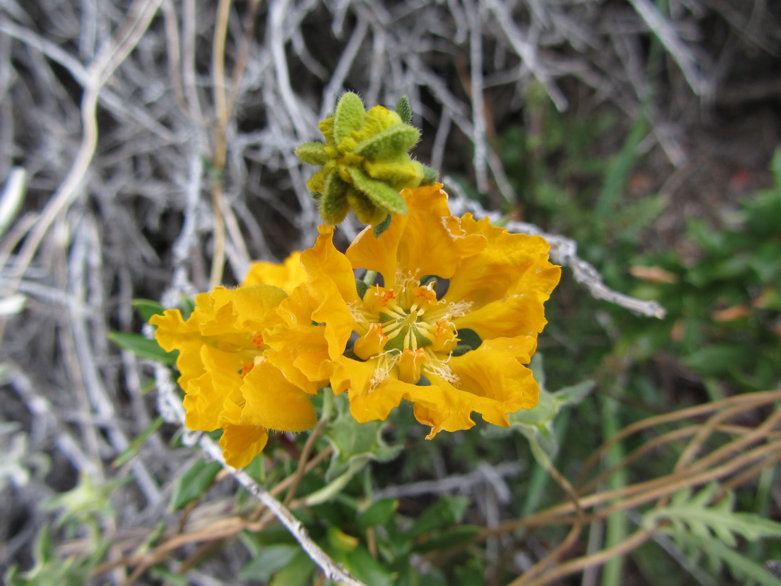
Yellow flowers


Read more …
1 comment

Cerro Torre, Cerro Fitz Roy and Glaciar Perito Moreno

UNESCO declared the Los Glaciares National Park in the province Santa Cruz a World Heritage Site in 1981. In the southern part it includes the Perito Moreno glacier, a white giant whose 5 km long front rises 60 meters above the lake Lago Argentina, the largest lake in Argentina. Perito Moreno is one of the last glaciers which increases still and it moves more than 2 meters per day. Great masses of ice crash every hour into the lake.

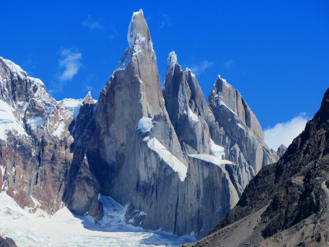
In the northern part of the Los Glaciares National Park are some of the most imposing mountains of on earth. The granite monolith Cerro Fitz Roy is with 3405 meters the highest point of southern Patagonia, which rises which its satellites directly over the Argentine steppe. Behind is a chain of pinnacle, which are the eastern border of the Campo del Hielo Sur, the biggest ice-field outside the poles and Greenland. The most famous, tallest and challenging is 3102 meter high Cerro Torre, both  dream and nightmare of every top climber.

Cerro Torre, Torre Egger and Cerro Standhardt

Read more …
Add new comment

Pali Aike and Torres del Paine - Christmas 2011

Pali Aike is a fine and remote National Park in southern continental Chile, located close to the Strait of Magellan and the Atlantic. The name Pali Aike is from the original tribe Tehuelche and means Devil's Country. It is a harsh volcanic steppe decorated with extinct craters, caves and other volcanic formations. Wildlife is abundant, for instance you might see Guanacos, Eagles, Armadillos or Grey Foxes. The entrance to the Pali Aike National Park is free of charge as well as a nice campground. There are several superb hikes.

We came back to the Torres del Paine National Park on December 22nd 2011, because Tommy, Marion's brother wanted to hike the W. This is the most popular part of the Circuito Grande, which we did few weeks ago. There are some "side" hikes at the Guarderia Lago Grey like the viewpoints Mirador Zapata and Mirador Ferrier.

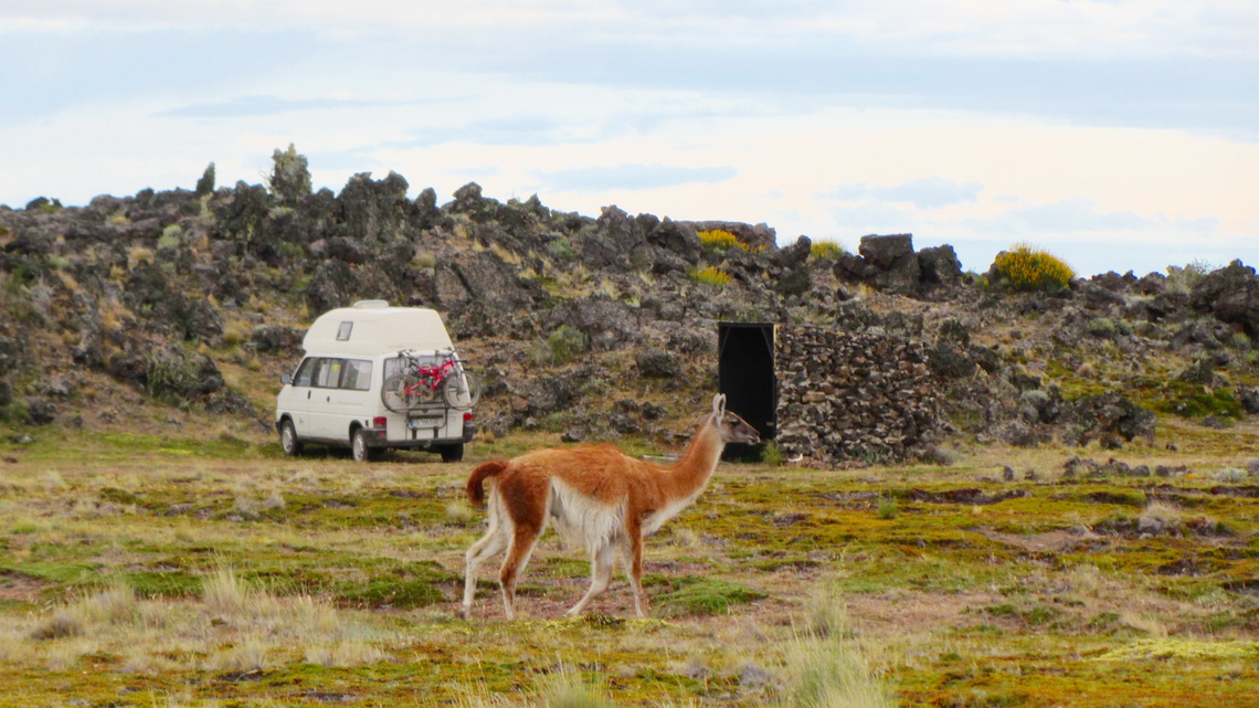
After visiting the cave, we spent the shortest night in the Pali Aike National Park totally alone and celebrated midsummer with some beer watched by some Guanacos.

Our campground

Read more …
1 comment

Tierra del Fuego - Argentina

There are two bigger cities in the Argentine part of Tierra del Fuego: Rio Grande and Ushuaia. The first one is a military base and famous for sport fishing. The latter one is the perfect synthesis of sea, ice and mountains. Ushuaia is situated on the Beagle Channel with huge, steep and glaciated pinnacles in its background. The natural Beagle Channel connects the Atlantic with the Pacific Ocean. It was discovered by Charles Darwin's expedition in the 19th century and named after the used vessel.

But Ushuaia has more superlatives: It is the main gateway to the Antarctic, 90% of the visitors start from here. It is the southernmost city of the world if you consider the Chilean Puerto Williams as a village (60,000 inhabitants versus 2,500). It is literally the end of the world. It has the most southern ski resort, starting more or less at sea level. It is the main touristic destination of Tierra del Fuego and consequently a little crowded in its seasons.

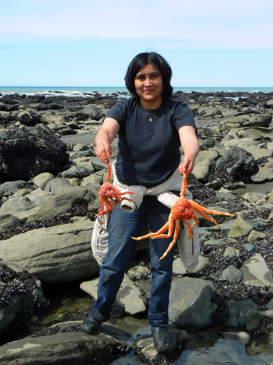
On the way to Rio Grande we made a rest on the shore of the Atlantic Ocean and strolled a little bit on its beach. Several other people were looking for sea food. Suddenly Marion detected something red under the rocks in the water - two very big sea spiders. She called two girls and they were very exited and happy!

Lucky Argentine girl with two Centollas - Sea Spiders


Read more …
1 comment

Tierra del Fuego - Chile

Tierra del Fuego is with its 47,000 square kilometers the largest island of South America and it is located at its southern end: Fin del Mundo - the end of the world. It is shared between Argentina and Chile, approximately two third belong to Chile. The Argentine part is much more populated, but only a little more than 100,000 people live in whole Tierra del Fuego. Its is a harsh island with two different geographical regions: North and East is the windswept pampa; South and West are the Andes with steep pinnacles, huge glaciers, remote fjords and numberless islands in front.

The first people came 10,000 years ago to Tierra del Fuego and were able to deal with the hard conditions. But the European immigrants exploited and eradicated the native people at the end of the 19th century. Hernando Magellan gave Tierra del Fuego its name - Fireland, because he saw a lot of fires on the island which were used by some of the native tribes for their communication.  

The Chilean part is a little bit sleepy with only one bigger town: Porvenir with just 5,500 inhabitants. Therefore the nature is more or less intact with abundant flora and fauna but non endemic animals like innumerably Sheep, Rabbits or Castors disturb the balance of its nature.

We crossed the strait of Magellan directly from Punta Arenas to Porvenir in the morning of December 4th 2011. This was a pleasant 4 hour trip in calm waters on a sunny day - nobody got seasick.

Our first impression of Tierra del Fuego

Read more …
1 comment

Punta Arenas and its surroundings

Punta Arenas is with 140,000 inhabitants the biggest city in southern Patagonia and the capital of the XII region Magallanes y Antartica of Chile. The busy industrial town is located on the Strait of Magellan and it is the most important port in this area. It is also a famous cruise and tourist destination.

Its environment is beautiful with forests, mountains, lakes and the Pacific Ocean. Few kilometers West of Punta Arenas is the National Park Reserva Nacional Magallanes with a lot of nature including hiking capabilities and viewpoints. But there are also a small skiing area, many radio transmitters and a military station on its highest point Monte Fewton.

South of Punta Arenas at the very end of continental South America is a remote area on the Strait of Magellan with superb trekking possibilities like Monte Tarn (825 meters), or the lighthouse Faro Cabo San Isidro. 

Punta Arenas and the Strait of Magellan

Read more …
2 comments

Torres del Paine - Circuito Grande

The Torres del Paine National Park in southern Chile is probably the finest and most famous National Park of South America. Rising close to 3,000 meters above the Patagonian steppe, the Torres del Paine dominates the landscape with sensational granite pillars, spectacular glaciers and marvelous lakes. It provides excellent hiking possibilities like the more than 100km long Paine Circuit, which can be done in 8 to 10 days. All needed facilities like campgrounds with hot showers, mountain huts or food stores are available. but the weather is very changeable. It is located 150km North of Puerto Natales, the second biggest town of Chilean Patagonia.

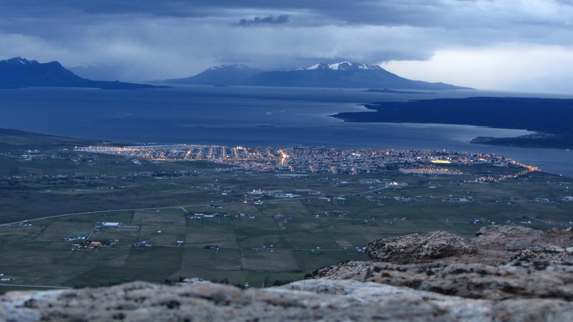
Puerto Natales is on the windswept shores of Seno Ultima Esperanza - Last Hope Sound. The 16,000 people city is the bustling hub for the Torres del Paine National Park. Both, the city and the park, are very crowded with tourists between mid of December and end of February.

We crossed the Chilean border in the late afternoon of November 5th 2011 after a long drive. We were eager for some sport activities and suddenly we saw a sign Mirador Sierra Dorotea 5 km before Puerto Natales. We were a little bit irritated by the expensive fee of 10 bucks per person an elderly Lady charged from us, but she told us it is including tea or coffee. But we wanted to walk to the viewpoint. It became almost dark, when we arrived at the top after 1.5 hours walking, but the views were still outstanding.

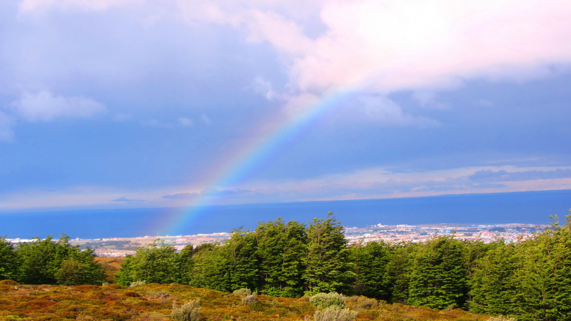
Puerto Natales and Seno Ultima Esperanza seen from the Mirador Sierra Dorotea


Read more …
1 comment

Penguins and more - Atlantic Coast of Patagonia South of Puerto Madryn

South of Puerto Madryn are several highlights like the Museo Paleontologico Egido Feruglio in Trelew with stunning life-sized dinosaur exhibits, the Natural Park Cabo Dos Bahias with rich wildlife, the Monumento Natural Bosques Petrificados with its fossilized gigantic trees and the Parque Nacional Monte Leon with more than 75,000 breeding Penguin pairs in springtime and early summer.

Trelew is a midsized town of about 100,000 people, located 65 km South of Puerto Madryn. Its origin is Welsh and its name is a homage to Lewis Jones, who promoted railway expansion in the province Chubut: tre - town and lew - Lewis. We arrived in Trelew in the late afternoon of October 26th 2011 and spent the night on the shore of the Parque Recreativo Laguna Cacique Chiquichano, close to the planetarium.

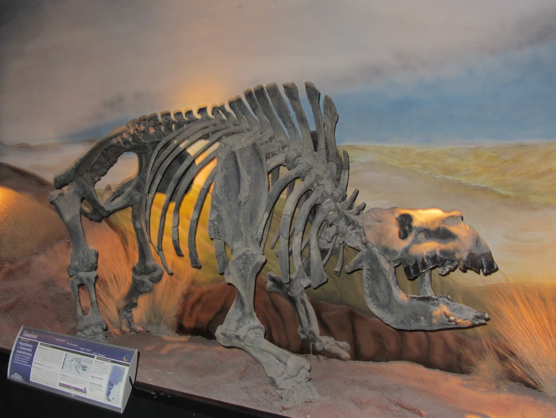
Trelew is famous for its outstanding natural-history museum Museo Paleontologico Egido Feruglio with more than 1700 fossils. It is the paleontological center in Patagonia with the university of Trelew.

2.5 million years old Rhino or Hippo

Read more …
1 comment

Whales and more - Atlantic Coast of Patagonia North of Puerto Madryn

The 3600 sq km big Peninsula Valdez in the province Chubut is one of the nature treasures of Argentina. It bustles of abundant wildlife: Sea Lions, Elephant Seals, Guanacos, Rheas, Penguins and different kinds of birds. But the star is the nearly 12 meters long and 27 tonnes heavy Southern Right Whale. Female bear young and breed in springtime in the shallow waters of the bays between the peninsula and continent. Peninsula Valdez is a World Heritage and consequently protected accordingly. In its center is one of the lowest depression in South America with salt lakes up to 42 meters below sea level. 

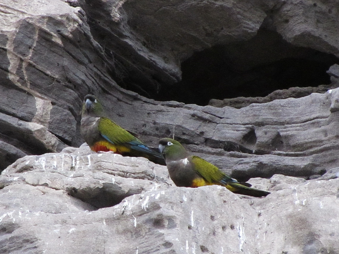
Few hundred km North and 40 km East of the city Viedma is the village Balnerio El Condor with maybe the largest Parrot colony of the world: More or less 35,000 dens of parrots are in its cliff faces. Close is an outstanding Sea Lion colony in La Loberia with several hundred animals.

Pair of Parrots

Read more …
3 comments

Sierra de la Ventana

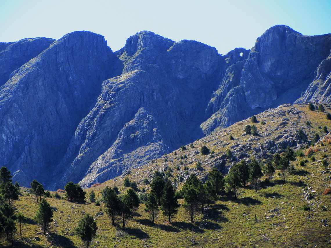
The Sierra de la Ventana is the highest mountain range in the vast province Buenos Aires few kilometers North of Bahia Blanca and 800 Southeast of the capital. There is also the tallest peak close to the Atlantic coast of Argentina, the Cerro Tres Picos with 1239 meters sea level. Ventana means windows: There is a huge one (approx 8 by 5 meters) close to the summit of the Cerro la Ventana. These mountains are supposed to be the oldest in Argentina, but they are relatively rocky.

This region is one of the top holiday destinations with a lot of nature and outdoor activities like hiking, but sometimes a little bit crowded. Some parts of these mountains are protected by the Provincial Park Ernesto Tornquist and consequently regulated by rangers. Ernesto Tornquist is the founder of the biggest town Tornquist in this area.

 Cerro de la Ventana with the window (top right part)


Read more …
4 comments

Buenos Aires

Buenos Aires is the capital of Argentina and it is supposed to be one the ten most populated urban centers of the world. According to Jorge Luis Borges, one of the greatest and famous writers of Argentina, Buenos Aires is breathtaking ugly. On the other hand it is an overwhelming cosmopolitan metropolis with unbelievable nice people, marvelous places and stunning buildings.

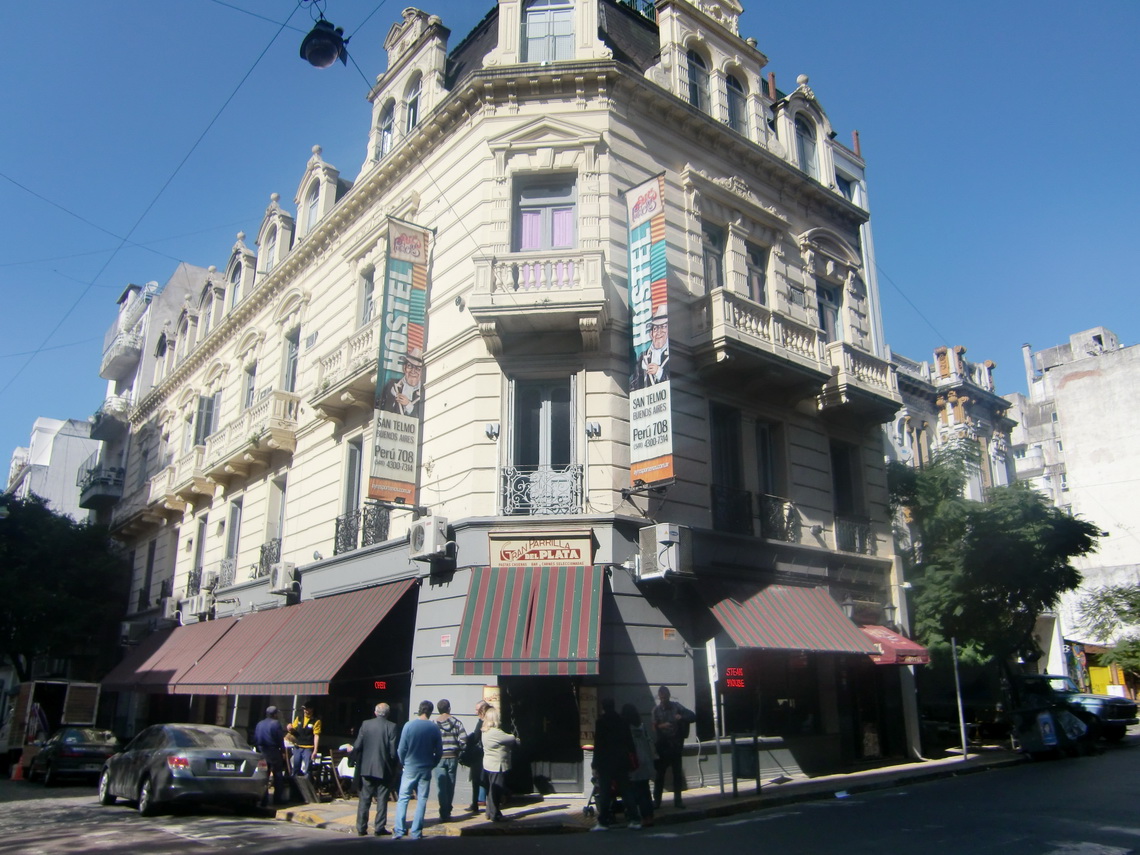
We spent 3 days in Buenos Aires mid of August 2011 before we flew to Germany and 2 days after our return beginning of October. We parked our camper in Colonia del Sacramento in Uruguay, close to the ferry port. Colonia is on the other side of the Rio de la Plata and there is a  frequent  ferry boar service to Buenos Aires. We found the very nice hostel San Telmo (Peru 708) in San Telmo, one of the most exciting quarters of Buenos Aires.  

Our hostel San Telmo


Read more …
1 comment

Uruguay - From Salto to Colonia

Uruguay is the second smallest country in South America, but still twice the size of Austria. It is located east of the large Rio Uruguay, which is the other big conflux of the Rio de la Plata. Uruguay is called the Switzerland of South America due to its stability, prosperity and wealthyness. A lot of banks are in its capital, Montevideo. The landscape is hilly, green and grassy with many cows. In addition Uruguay has nice coasts on the Atlantic Ocean, Rio Uruguay and Rio del la Plata.

We visited the west part of Uruguay on the shores of the big rivers between the second biggest city Salto and the ancient, picturesque town of Colonia del Sacramento. Colonia lies opposite of Buenos Aires on the Rio del la Plata. It is a good place to park the car if you fly from Buenos Aires to your home city. 

The dam of the hydroelectric power plant Salto Grande is the most northern street  between Argentina and Uruguay. The Uruguayan customs was very strict in terms of fresh fruits and vegetables, so we had to eat our bananas and tangerines before we could enter Uruguay. Unfortunately we had had a rich breakfast few minutes before, so we had to to scrap some food.

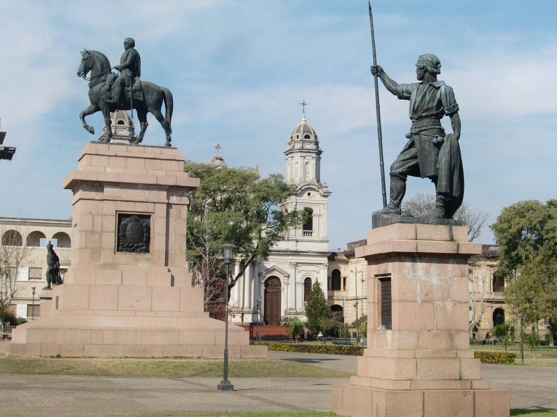
The first city Salto is a pleasant town with a nice main square named after the Uruguayan National hero Jose Gervasio Artigas. He had been the first in South America 1764 who had performed an agriculture reform to the advantage of the local people. He had been defeated by Argentine and Brazilian troops 1819 and he had to move to Paraguay into exile. His reform had been removed to the benefit of the European rich landowners, which had exploited the local people.

Plaza de Artigas of Salto


Read more …
1 comment

Northeast Argentina and the Cascades of Iguazu

The Northeast of Argentina is a little bit different to the other parts: Lush and dense vegetation with some forests thanks to lots of water due to huge rivers and swamps. The absolute highlight is the Cascades of Iguacu in the very North of the province Misiones. The Southern part belongs to Argentina, the Northern to Brazil. Enormous amount of water is falling 70 meters down in more than 250 hundred cascades from a flat Basalt plateau. These waterfalls are ones of the top destinations in South America; thus many tourists visit them and there is a good infrastructure.

Interesting are the ancient Jesuit villages like San Ignacio Mini in Misiones, some other National Parks like Rio Pilcomayo in the province Formosa on the border to Paraguay and hot springs in the county Entre Rios.

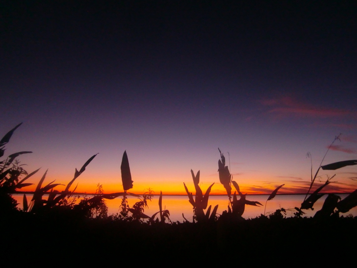
After returning to Argentina and fixing our starter problems with the car (see article Samaipata and its environment) we visited the beautiful lake Laguna Blanca in the National Park Rio Pilcomayo. There was a lot of water because it had rained the last two days, but now the sun was shining on a clear sky and it was pleasant warm during the day. It was the first time this year we used our rubber boots and we were happy about them.

Laguna Blanca after sunset 

Read more …
1 comment

From Asuncion to Ciudad del Este

Paraguay is one of the smaller and less populated countries in South America located between Bolivia, Brazil and Argentina without sea coast. Small means that it is a little bit bigger than Germany. Less populated means fewer inhabitants than Austria or Switzerland. It is divided by the river Paraguay into two major parts: The western Chaco, which is a flat, hot and arid lowland with very few people and the eastern green highlands with 90% of Paraguay's population. Paraguay was the first state in South America with two official languages: Spanish and Guarani of the indigenous people (also Guarani).

Asuncion is the capital of Paraguay on the huge river Rio Paraguay. It is also the economical center and with more than 1 million inhabitants the biggest city in Paraguay. The second one, Ciudad del Este, is located in the three border area between Argentina, Brazil and Paraguay. It is the boom town due to reduced taxes with many, many shops of all kinds like computers or dresses.

We crossed the Southeast of Paraguay, where some beautiful sanctuaries are situated. Our first destination was Asuncion, which is just 40km away from the Argentine border.

Skyline of Asuncion with Rio Paraguay


Read more …
3 comments

Samaipata and its environment

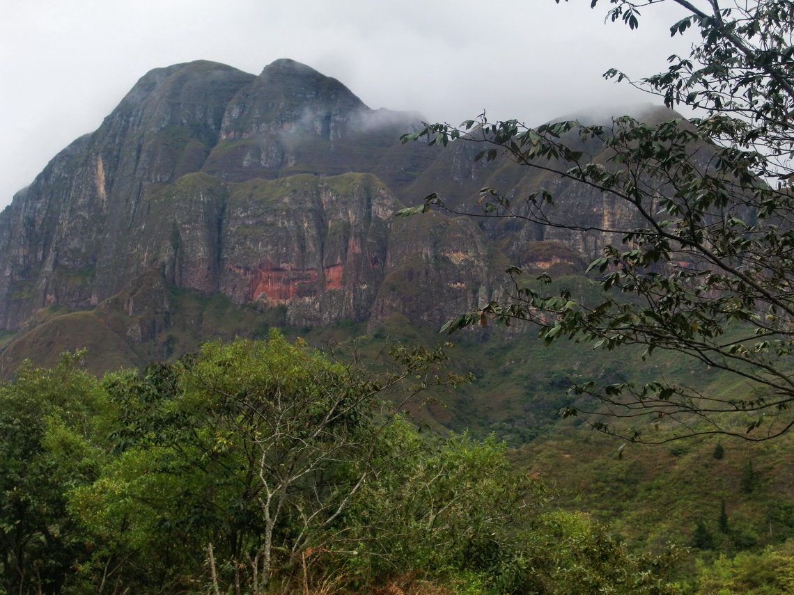
The village Samaipata is located in a marvelous environment in the first eastern ranges of the Andes. Its main attraction is the pre Inca fort El Fuerte de Samaipata, which is an UNESCO world heritage and one of the most important ruins of Bolivia and South America. The Incas used this fort as one their most outposts. East were and still are the very strong tribe Guarani, who defeated several times the Incas and prevent their further extension to East.

20km east of Samaipata are the caves Chorros de Cuevas, a paradise with three cascades, clean and cold water. It is an ideal destination on hot days to refresh and cool down. We drove on a rainy day from Santa Cruz to Samaipata mid of July 2011. The landscape became more and more mountainous and green.

The first ranges of the Andes from East

Read more …
1 comment

From La Paz to Santa Cruz and the National Park Amboro

The National Park Amboro between Cochabamba and Santa Cruz is situated on the lower slopes of the Andes to the Amazonas basin. It is famous for its density of game and insects, for beautiful waterfalls and natural swimming pools, and thick green jungle fauna. There are few camps inside this park, which can be accessed with a guide from the North via Buena Vista or the South via Samiapata.

Cochabamba is the third biggest city in Bolivia with more than 800,000 people. It is located in a nice valley of the Andes at 2570 meter sea level; thus it has a very pleasant climate. It is half the way between La Paz and Santa Cruz, the other two large cities in Bolivia. Its main attraction is the huge Jesus monument "Cristo de la Concordia" on a hill, more than 40 meters high.

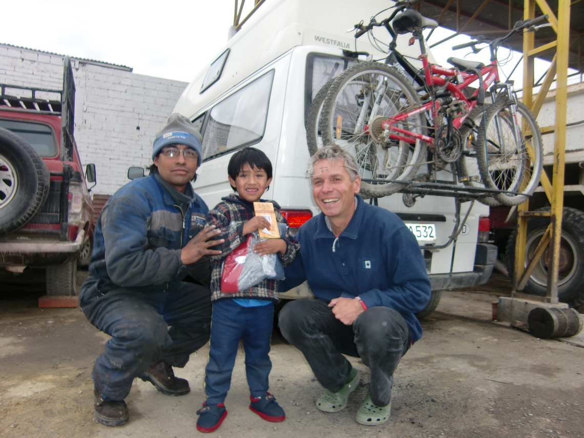
When we left the Hotel Oberland in La Paz we heard a weird noise from the starter of our car. Besides that is was smoking like hell, again. So we decided to go to Eduardo, who manages the Bosch Diesel Service La Paz in El Alto the highest quarter of La Paz, around 4100 meters sea level. They revised the starter, the fuel pump and exchanged all Diesel tubes and the fuel filter. It was a lot of work; consequently we stayed 5 days in the service station. We had all comfort like electricity and hot shower. And we had enough gas for our heater, because it became very cold, especially in the evenings. The last morning we had some fresh snow. Thanks a lot Eduardo and the Bosch Diesel service team (GPS coordinates: S16° 31.944' W68° 10.483'). We used the time to visit the museums in La Paz; we like very much the coca museum and the masks in the folklore museum.

Eduardo and his little son

Read more …
1 comment

Cordillera Real 2011 and Yungas

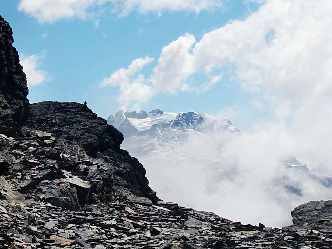
Cordillera Real is the mightiest mountain range in Bolivia with several peaks above 6000 meter. It is situated on the east side of the Altiplano and it gets in summer a lot of precipitation from the Amazon area. Thus the glaciations are heavy for this latitude; the permanent snow line starts at 5200 meter. We climbed in June 2011 Cerro Saturno (5006 meter seal level), Serranias Almillanis (5108 meter) and Cerro Charkini (5392 meter). To achieve the summit of the latter one we had to cross a glacier with huge crevasses.

On the ridge to Cerro Saturno


The Yungas are the lower slopes down to the Amazon basin. They have a rich flora and fauna, thanks to the clouds and rain coming from the Amazonas. A nice tourist destination is the village Coroico, which is accessible now from La Paz by a fully tarred road. But you have to cross the 4650 meter high pass Cumbre Coroico or La Cumbre. Few years ago the descent from this pass was horrible due to a narrow and dirty lane in vertical rocky walls. Many people died in the huge traffic and there are a lot of memorials. This old street is called the Camino de la Muerte, the Death Street. Now it is an outstanding mountain bike tour. If you start at La Cumbre, you have a vertical downhill distance of more than 3400 meters.

Read more …
Add new comment

From Uyuni to La Paz via Potosi

Potosi is with more than 120,000 inhabitants the highest city of our world at 4100 meters sea level. Potosi was the richest town on earth due to enormous silver findings in the mines of the mountain Cerro Rico. The exploitation of silver started already in the 16th century and it was shipped mainly to Europe. But the silver was a curse for the local people, many died in the mines due to inhuman working conditions. Now the silver is gone, but tin and zinc are mined nowadays.  

La Paz is with more than 2,000,000 people the largest city of Bolivia, its economical heart and its seat of government. It is beautifully situated in different valleys of the Altiplano between 3200 and 4100 meters surrounded by very high and white mountains. Famous are the various markets of La Paz, a lot of nice places and the Valle de Luna (moon valley) with stunning earth pinnacles. 

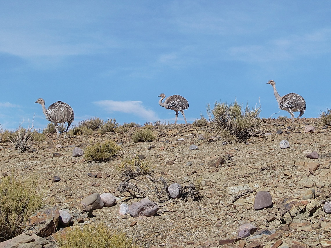
We left Uyuni on June 1st 2011 to the village of Ticatica with some hot springs. We saw Rheas close to the road to Ticatica.

Three Rheas, the Ostriches of Southamerica


Read more …
Add new comment

More Articles …

  1. Volcan Uturuncu and Laguna Colorada
  2. Volcan Tunupa and Salar de Uyuni
  3. Salta and Quebrada de Humahuaca
  4. Volcan Licancabur and Cerro Incahuasi
  5. San Pedro de Atacama and its environment
  6. Volcan Lascar
  7. From Copiapo to Antofagasta
  8. Ojos del Salado, the highest volcano on earth
  9. Cerro San Francisco
  10. From San Juan to La Rioja
  11. Mercedario, one of the giants in the Andes
  12. Cordon del Plata
  13. Sierra de las Quijadas
  14. Sierras de Cordoba
  15. South America - Brazil and Argentina
  16. Crossing the Equator - Baptism and Christmas
  17. Africa - Senegal, Guinea and Sierra Leone
  18. Europe - From Hamburg to Tenerife
  19. Our vessel, the Repubblica Argentina
  20. Monte Adamello
  21. Dolomites - Piz Cunturines
Page 5 of 6
  • Start
  • Prev
  • 1
  • 2
  • 3
  • 4
  • 5
  • 6
  • Next
  • End
Copyright © 2025 Marion and Alfred. All Rights Reserved. Designed by JoomlArt.com. Joomla! is Free Software released under the GNU General Public License.
Bootstrap is a front-end framework of Twitter, Inc. Code licensed under MIT License. Font Awesome font licensed under SIL OFL 1.1.
Powered by T3 Framework