Marion and Alfred Lorenz Marion and Alfred Lorenz
  • Home
  • Itineraries
    • Africa
      • Tanzania
      • Morocco
    • Central America
      • Belize
      • Costa Rica
      • Guatemala
      • Honduras
      • Nicaragua
      • Panama
    • North America
      • Canada
      • Mexico
      • United States
    • South America
      • Argentina
      • Bolivia
      • Brazil
      • Chile
      • Colombia
      • Ecuador
      • Paraguay
      • Peru
      • Uruguay
    • From Hamburg to Buenos Aires
    • Asia
      • Cambodia
      • Laos
      • Thailand
      • Vietnam
    • Europe
      • Central Europe
      • France
      • Italy
      • Portugal
      • Scandinavia
      • Spain
  • Mountains
    • Africa - Overview
    • Central America - Overview
    • North America - Overview
    • South America - Overview
    • Asia - Overview
    • Europe / Scandinavia - Overview
    • Europe / South - Overview
  • Pictures
    • Pictures Africa
      • Pictures Morocco
      • Pictures Tansania
    • Pictures Central America
    • Pictures North America
      • Pictures Canada
      • Pictures Mexico
      • Pictures United States
    • Pictures South America
      • Pictures Argentina
      • Pictures Bolivia
      • Pictures Brazil
      • Pictures Chile
      • Pictures Colombia
      • Pictures Ecuador
      • Pictures Paraguay
      • Pictures Peru
      • Pictures Uruguay
    • Pictures Asia
      • Pictures Cambodia
      • Pictures Laos
      • Pictures Thailand
      • Pictures Vietnam
    • Pictures Europe
      • Pictures Central Europe
      • Pictures France
      • Pictures Italy
      • Pictures Portugal
      • Pictures Scandinavia
      • Pictures Spain
    • Pictures - From Hamburg to Buenos Aires with a cargo ship
  • Maps
    • Maps Africa
      • Map Morocco
      • Map Tanzania
    • Map America Entire
    • Map Central America
    • Maps North America
      • Map Alaska and Canada - West
      • Map Mexico
      • Map United States - Northwest
      • Map United States - Southwest
    • Maps South America
      • Map South America - Northwest
      • Map South America - Central
      • Map South America - South
    • Map Southeast Asia
    • Maps Europe
      • Map Central Europe
      • Map France
      • Map Italy
      • Map Portugal and Spain
      • Map Scandinavia
      • Map Spain - Mallorca
  • GPS Coordinates
    • GPS - Africa
    • GPS - Central America
    • GPS - North America
    • GPS - South America
    • GPS - Asia
    • GPS - Europe
  • Guestbook
  • About
    • About Marion and Alfred
    • Chronology
    • Newsletter Subscription
  1. You are here:  
  2. Home

Volcan Uturuncu and Laguna Colorada

Volcan Uturuncu is with 6008 meters sea level the tallest mountain in the south part of Bolivia. It is an active volcano with two peaks. The last eruptions were in April 2003, after being hundreds of years inactive. There were some mining activities on this mountain and a rough dirty roads leads into the saddle between the two peaks. This road can be used by good 4-wheel cars up to 5400 meters, depending on the snow conditions. Uturuncu lies in a very remote area: The access from Uyuni is one long day by dirty roads, only possible with a 4-wheel car.

The 60 square kilometer big Laguna Colorada (red lake) is 4h drive West of Uturuncu in an altitude of 4275 meters. It is an unique natural spectacle, because the water color seems to be red, green and white depending on the sunset. This is caused by plankton. The plankton attracts a lot of birds like flamingos.

This is the second part of our trip with Fronia and Obet, see also our report Volcan Tunupa and Salar de Uyuni. In this article a map is included. After a cold and uncomfortable night in a hostel in Uyuni we started with Fronia and Obet the long way to the village Quetena Chico, which is the base for the ascent of Volcan Uturuncu.

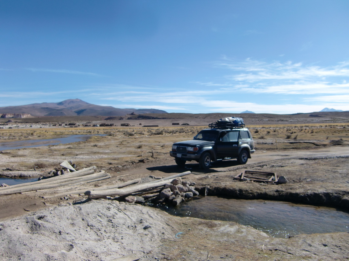
The rough way from Uyuni to Quetena Chico

Read more …
3 comments

Volcan Tunupa and Salar de Uyuni

Salar de Uyuni is with 160 km length and 135 km width the largest salt area of our world at an altitude of approximately 3700 meters. The salt is between 2 and 7 meters thick, so it can be accessed by 4x4 cars if there is not too much water. In the rainy season between December and March Salar de Uyuni becomes a tremendous huge mirror. The water dries in the following months more or less, so the surface becomes totally white. Volcano Tunupa is situated on a peninsula of the Salar de Uyuni and provides fantastic views to the Salar because it overtops Salar de Uyuni more than 1500 meters. Due to its outstanding location Volcano Tunupa is a holy mountain of the Aymara people.

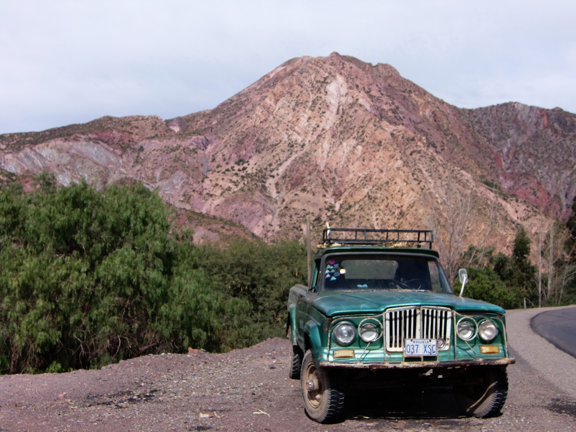
We came to Bolivia in the evening of May 24th 2011. The first town Villazon is a typical border city - mainly a shopping center for Argentina. We continued the next day to Tupiza, a pleasant town in a nice valley surrounded by rocky mountains.

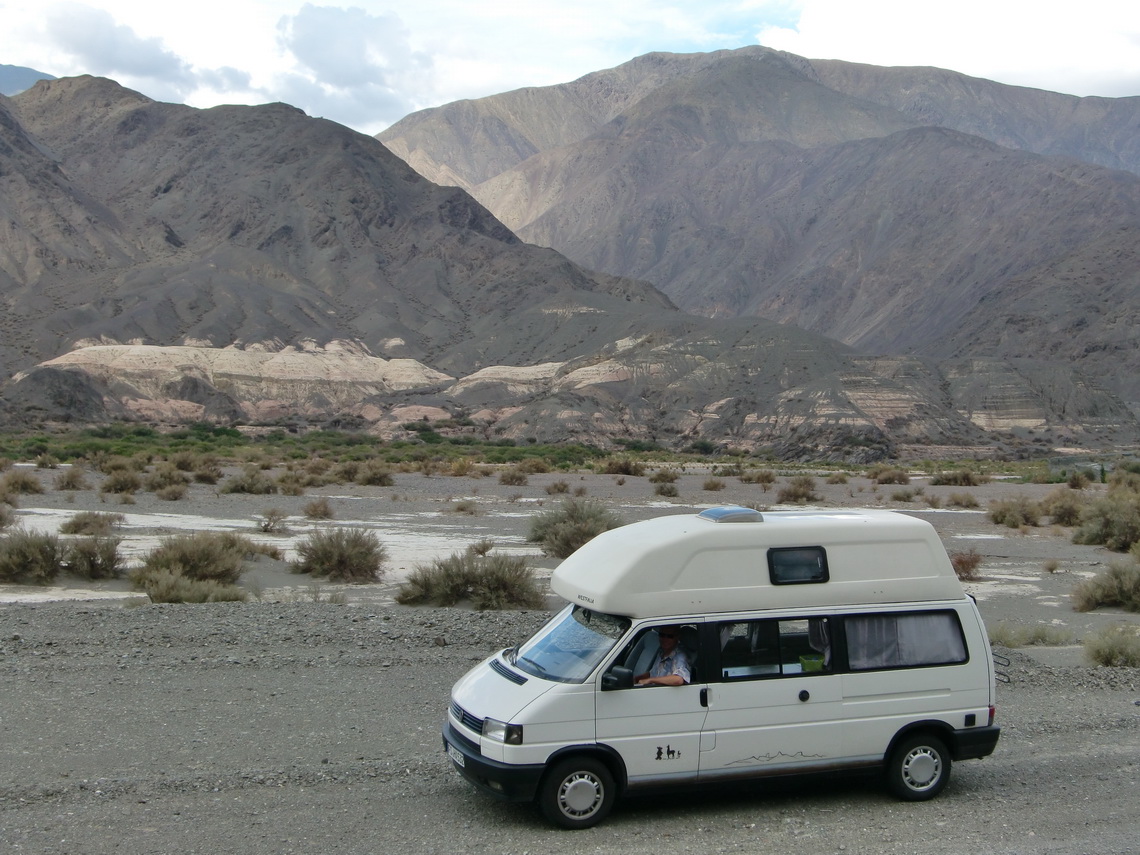
Exciting car on the road between Villazon and Tupiza


Read more …
3 comments

Salta and Quebrada de Humahuaca

Salta is one of the most marvelous cities in South America. It is the only one in Argentina with the add-on "La Linda", which means The Beautiful. No other city in Argentina has so many historical buildings, places and parks. Salta is with approximately 400,000 inhabitants the second biggest city in northwest Argentina. Salta has a pleasant warm climate even in late autumn because it is situated just 1200 meters high on the eastern slopes of the Andes. Closed to Salta is the valley Quebrada de San Lorenzo with more or less tropical flora and fauna. North of Salta in the province Jujuy is the famous gorge Quebrada de Humahuaca, which directs to the border of Bolivia.

A side valley of the Quebrada de Humahuaca leads to the pass Paso de Jama to Chile. We came down this way from Chile, after our disaster with the shock absorbers; see last section in the article about San Pedro de Atacama and its environment. It turned out in Salta that the shock absorbers we had found in Chile were working in the wrong direction. Now we knew why we had become nearly seasick in our car! And we had two Indian Ladies in our car.

We found original German shock absorbers in Salta and a very good Volkswagen technician: Javier L. Torres, whose workshop is in the Catamarca 1050. He is a specialist for engines and he realized that some of the hydraulic tappets of our engine are not tight. Indeed 4 of them had scratches and oil was leaking into the cylinders which weakened the power of the engine and might reduce its life time. He had to disassemble the engine more or less completely, fortunately it worked afterwards perfectly without the buzzing noise it had before.

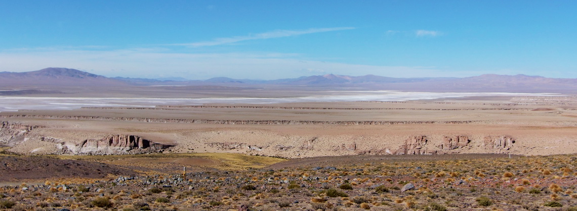
On the way down of Paso de Jama we passed wonderful salt lakes, villages and landscapes in the province Jujuy.

The Argentine side of the Paso de Jama

Read more …
Add new comment

Volcan Licancabur and Cerro Incahuasi

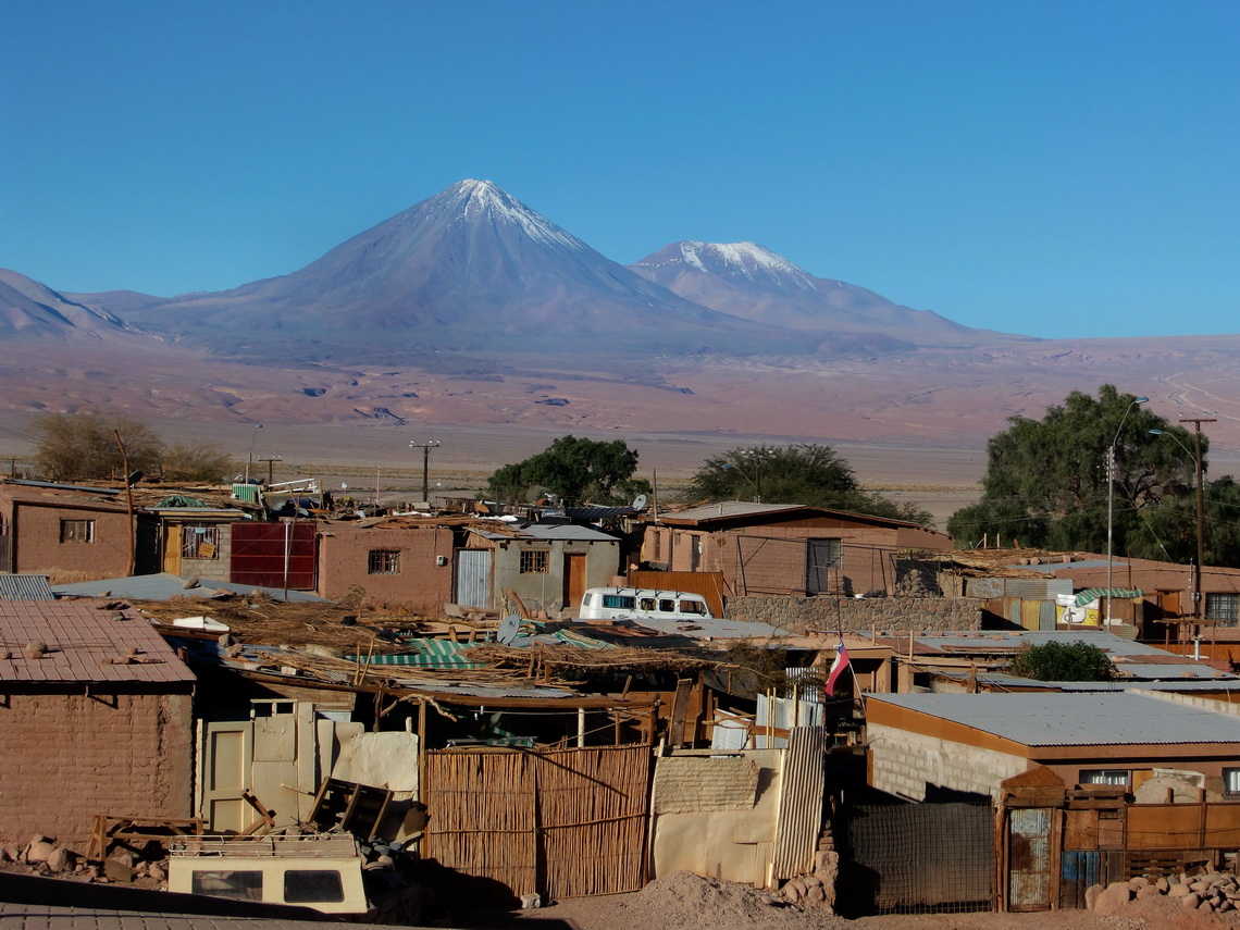
The mountain Volcan Licancabur is the landmark of San Pedro de Atacama. Its shape is a perfect cone, with more than 3,500 meters over San Pedro. But the ascent is not possible on the Chilean side of Licancabur, because a lot of dangerous blockbusters are on this side and nobody knows where they are buried. Hence you have to go to Bolivia if you want to climb up Licancabur. It has one the highest lake of our world in its crater, more than 5,800 meters sea level. On its foot are some ancient ruins built by the Incas as well as on top of Cerro Incahuasi. This mountain is closed to the road to the Paso Jama few kilometers North of Licancabur. 

Volcanoes Licancabur and Juriques with the suburbs of San Pedro

Read more …
Add new comment

San Pedro de Atacama and its environment

San Pedro de Atacama is the archaeological capital of Chile. A lot of ancient villages and sites like Pukara de Quitor are closed to San Pedro. There is also a very nice archaeological museum. San Pedro de Atacama is an oasis in the extreme dry Atacama Desert on foot of the Andes. Its environment is very beautiful with salt lakes, hot springs, gorges, rocks and a lot of volcanoes. South of San Pedro is the Salar de Atacama, the third largest salt lake in the Andes. West of San Pedro is the Valle de la Luna, the moon valley, which gives an imagination of the landscape of the moon. San Pedro is the holiday destination in the north part of Chile. All facilities like excellent restaurants, souvenir shops and tour guides are available. And there are many tourists from nearly every part of the world. The climate of San Pedro is very pleasant, especially in autumn: Always sunny, up to 25°C in the afternoon, but closed to zero in the morning. San Pedro is already more than 2400 meters high.

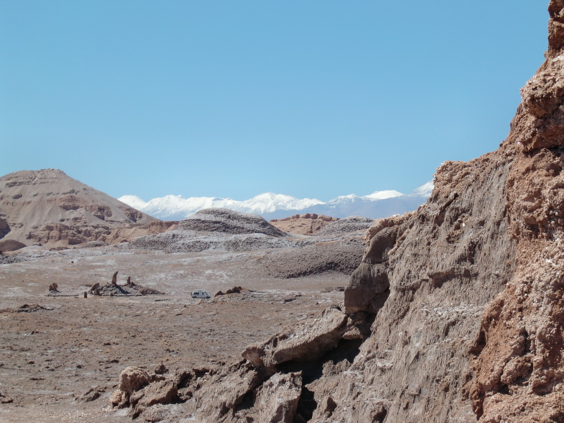
We started our trip to San Pedro de Atacama in the valley Valle de la Luna. This valley is part of the Cordillera de la Sal (salt mountains), which is between the bigger Andes and Cordillera Domeyko. It is built up mainly by a mixture of salt, mud and sand.

In the valley Valle de la Luna with snowy Andes in the background 

Read more …
Add new comment

Volcan Lascar

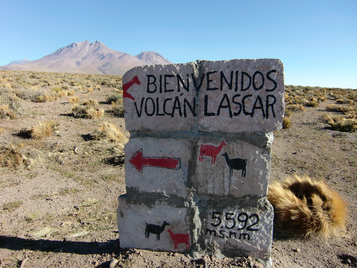
Lascar is the most active volcano in the northern part of Chile. It is a huge mountain with several peaks up to 5592 meters and an enormous smoking crater. The ascent is very popular, because it is just 100 kilometers away from San Pedro de Atacama and a height of 4800 meters can be reached with a good four wheel car. Consequently many tour offices in San Pedro offer the ascent of Lascar. The first destination is the marvelous Laguna Lejia which can be accessed by a dirty gravel road from the village Toconaco, which is located at the main street to the Paso Sico, approximately 40 km south of San Pedro de Atacama. We decided to try to drive to the Laguna Lejia with our camping car. If it became too difficult for our car we had the idea to use our bicycles

Hint that we are on the right way


Read more …
Add new comment

From Copiapo to Antofagasta

Copiapo is the capital of the 3rd region of Chile and one of the major mining cities in Chile. It is a very pleasant town with all facilities. Copiapo was in the news worldwide in the year 2010, because of an mining accident. Fortunately all miners could be rescued after several weeks. Antofagasta is the biggest city in Northern Chile and the capital of the 2nd region. It is located on the Pacific Ocean and it looks much more urbanely like Copiapo - 250,000 inhabitants versus 100,000. Between Copiapo and Antofagasta is the National Park Pan de Azucar on the Pacific with nice beaches and unbelievable game and birds in a very pristine environment. The name Pan de Azucar means sugar bread and its related to the white rocks due to the guano feces of the birds.

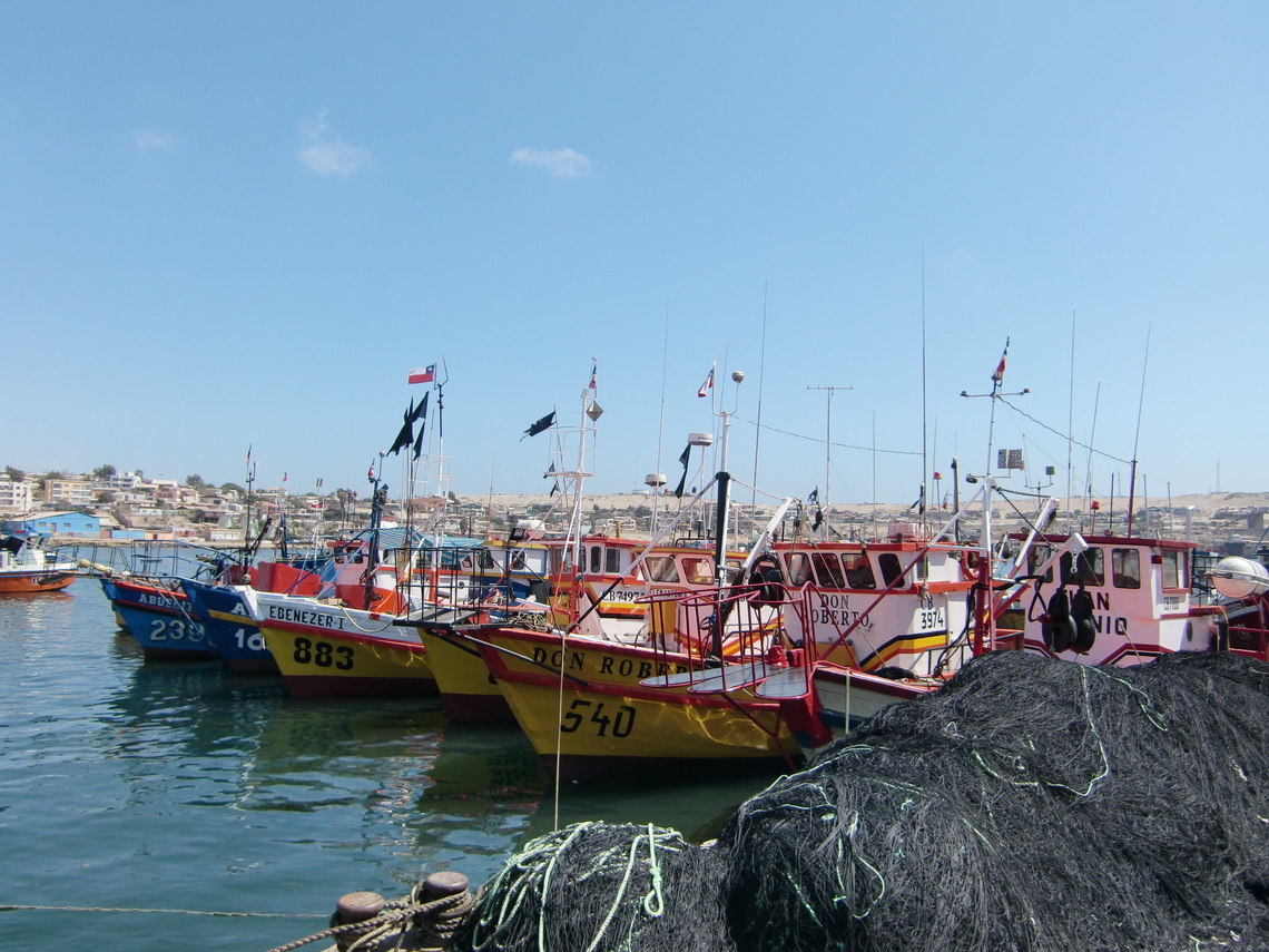
We stayed several times in Copiapo, because we decided to make a sevice on our Camping Car. The problem was the oil filter, first the wrong was delivered and second it was shipped to La Serena, 350km south. But we used the time to explore the beaches, which are 60 to 100km west of Copiapo. Our first destination on the Pacific was Bahia Inglese, a very noble and expensive holiday village. We spent two days there on a nice camping ground to free our car from the dust of the Paso San Francisco. The dust was everywhere, also inside the lockers! Totally different to Bahia Inglese is Caldera, a fishing port few kilometers north. It has a picturesque harbor with a lot of life.

Quaint fishing boats in Caldera

Read more …
Add new comment

Ojos del Salado, the highest volcano on earth

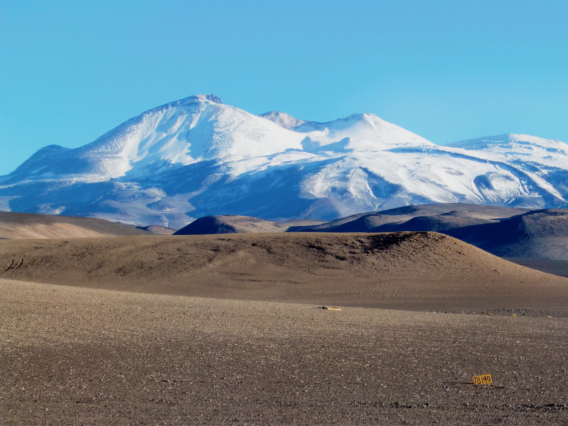
Ojos del Salado is not only the highest volcano on earth, it is with 6893 meters also the highest summit of Chile and of the province Catamarca in Argentina, and it is the second tallest peak of the Andes and outside of Asia of our world. Another particularly of Ojos del Salado in comparison to the other high mountains of Chile and Argentina is that you have to climb the last 50 meter to the summit, not very difficult (grade II to III). But you have to consider the enormous height of more than 6800 meters!

Ojos del Salado has a very good infrastructure including a base camp at the Laguna Verde and two mountain huts on the Chilean standard way to its Chilean summit.

After we had crossed the border between Argentina and Chile on the Paso San Francisco we checked the conditions of the ascent to the Ojos del Salado at the base camp at the Laguna Verde. Indeed there was a German young man on the summit today, and he ensured us that the conditions are very well, e.g. good steps in the snow and no snow on the climbing section. But there were two hooks: We have to pay 160U$ per person for the usage of the huts and we need a permit of DIFROL, which is the Chilean border control. The first one is okay, but the latter one means driving 270km very dirty and dusty road to Copiapo and back - In summary 540km deviation! So we promised Paula and Mario, the two mountain guides which administer the climbing to Ojos del Salado, to come back in two days, if the weather forecast is good.

Ojos del Salado on the left side - unusual white

Read more …
2 comments

Cerro San Francisco

Cerro San Francisco is with 6018 meter high probably the easiest 6000er of our world, both access and ascent. It is situated on the border between Argentina and Chile and closed to the Paso San Francisco, which is with 4753 meters one of the highest pass in the Andes. This pass has the highest density of 6000er on earth outside of the Himalayas. Five of the ten tallest peaks of the Andes are closed to it, including Ojos de Salado which is the second after Aconcagua.

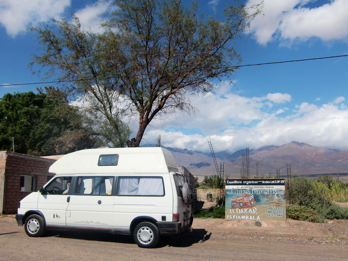
We started our trip to the Paso San Francisco in Fiambala, which is the last bigger settlement on the Argentine side, more than 3000 vertical meters below. Fiambala is a pleasant village with all facilities like Internet and famous thermal springs. It is also one of the major points of the rally Paris Dakar, which had passed Fiambala few weeks before we were there.

Rally Paris Dakar in Argentina - Fiambala is Dakar?

Read more …
1 comment

From San Juan to La Rioja

Between San Juan and La Rioja are the National Parks Talampaya and Ischigualasto / Valle de la Luna in the deserts few km East of the Andes. Both are UNESCO world heritages sites and famous for the dinosaurs, which were found there.

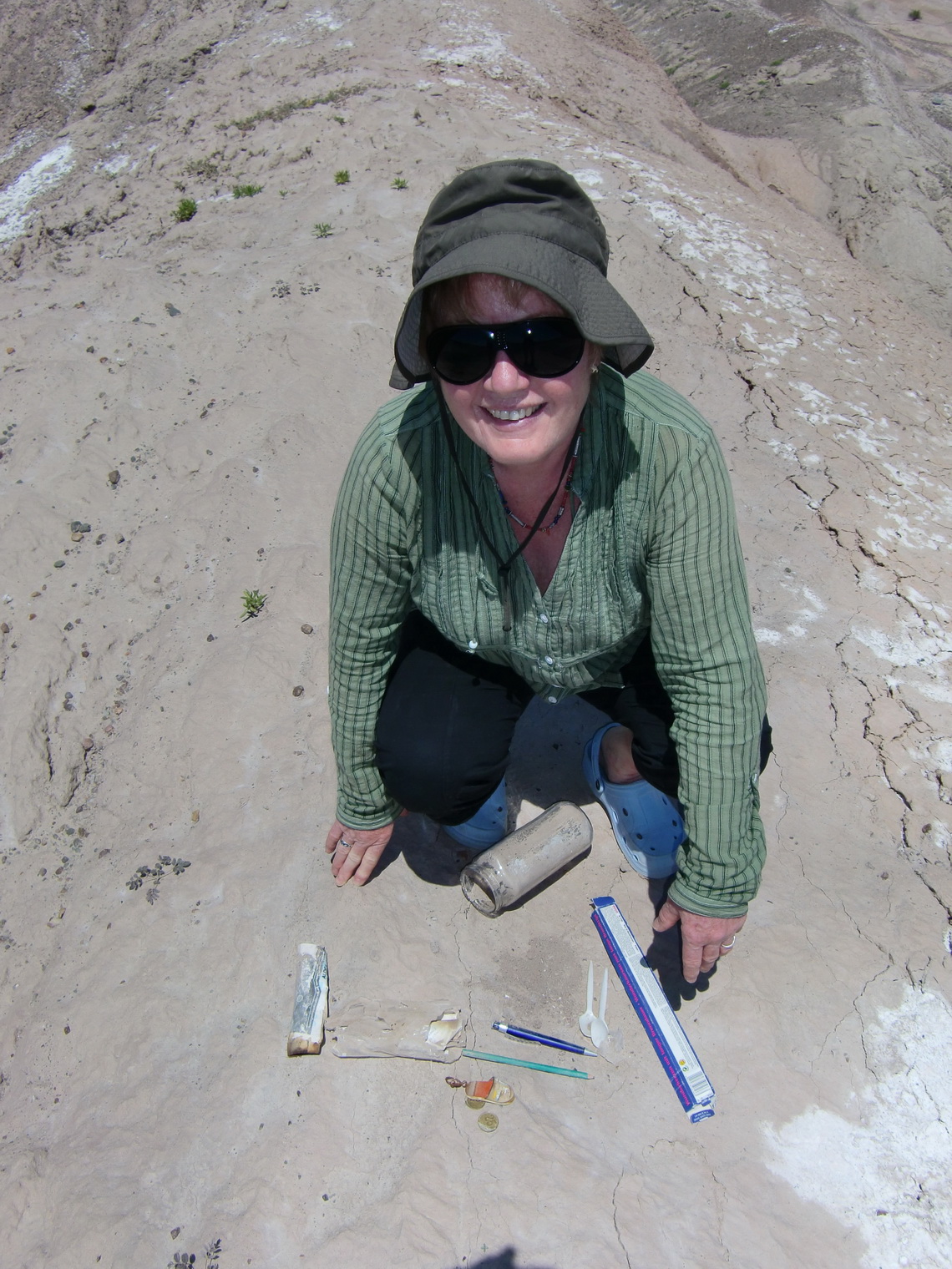
After our ascent to Mercedario we stayed two days at the very nice camping place Palmar del Lago on the artificial lake  Dique Ullum, 30km west of San Juan. In this very dry area we found two Geocaches. Both were in miserably conditions and need consequently some rescue. On the first one (Falla La Laja), we were the first who found it after 10 months. The latter one (Ullum) had been found in September 2009 the last time!

Marion rescues the Ullum Geocache 

Read more …
1 comment

Mercedario, one of the giants in the Andes

Mercedario is with 6770 meters one of the highest summits in the Andes. It lies approximately 80km North of Aconcagua and is very good choice to climb up. In comparison to Aconcagua it is without red tape (no climbing fee!), very remote and a pristine landscape. The ascent is quite long: You start at the Refugio Laguna Blanca with a sea level of 3161 meters, so it is more than 3600 meters difference to the summit. The base town is Barreal, approximately 120km West of San Juan or 200km Northwest of Mendoza. The only paved street to Barreal from San Juan is quite long (more than 250km), because you have circle the first ranges of the Andes in the North.
 
On the way to Barreal
 
Read more …
2 comments

Cordon del Plata

The mountain range Cordon del Plata lies about 100 km west of Mendoza, the biggest town in West Argentina. Mendoza has approximately 1 Million inhabitants, so it is a quite large city. Cordon del Plata is one of the most popular mountain destination for the people of Mendoza. It is also a perfect acclimatization area, because a lot of mountains can be climbed, starting from 3000 meters up to 5930 meters. We started our trip in Mendoza, because there are all facilities like Internet, showers and shopping malls.  

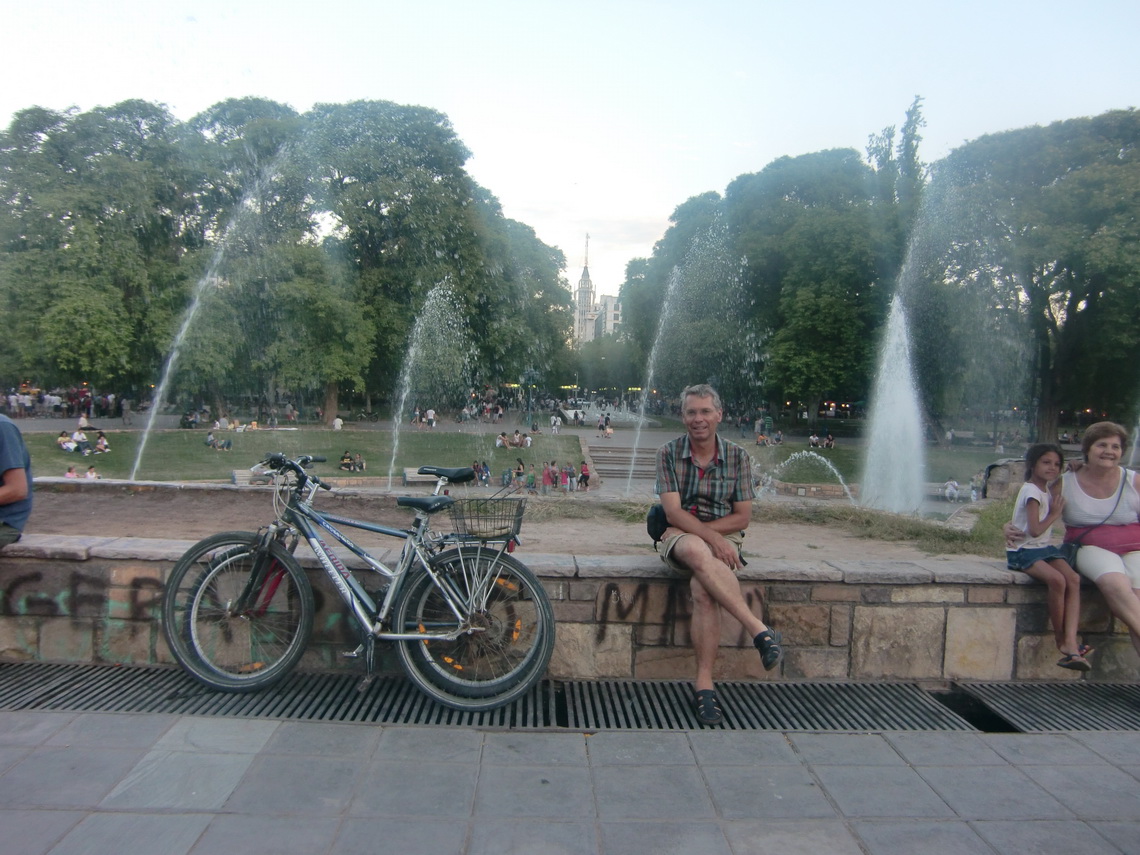
We had been in Mendoza six years ago, and we were impressed about its progress. 2005, few years after the Argentine economical crisis, the streets and a lot of buildings were in a shabby status. Many people were demotivated and frustrated. But now we had the feeling that Mendoza is a pleasant city with modern shopping malls, beautiful places, nice buildings and friendly people.

Plaza Independencia of Mendoza


Read more …
1 comment

Sierra de las Quijadas

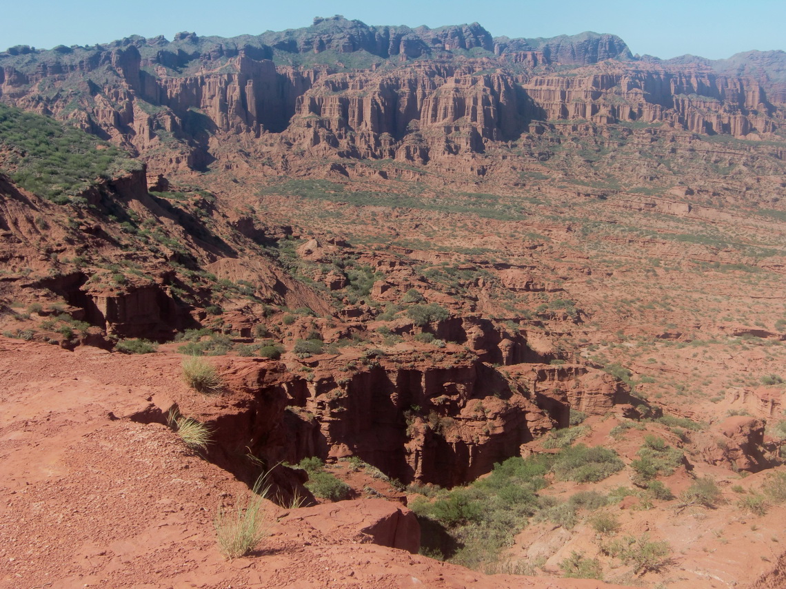
Parque Nacional de Sierra de las Quijadas is located approximately 200km North East of Mendoza. It is very dry region with small mountains up to 1200 meters, deep gorges, cacteens, a lot of dust and so on. The scene is very romantic, a little bit Wild West like. The entry to the park is free, also the Camping place, which is very basic, hot and sunny, but also very clean and remote.

There is just one tree which spends some shadow and a table which benches under its branches. Fortunately we could use this unique place, when we arrived very late in the evening of January 17th 2011. In the morning we walked to several view points (Miradores), which can be accessed easily and without a guide.

Sierra de Quijadas from South Viewpoint

Read more …
Add new comment

Sierras de Cordoba

Sierras de Cordoba is the biggest mountain range in Central Argentina. They are located west of the city Cordoba and more than 500km long, North to South direction. Their highest point is the Cerro Champaqui with 2884 meters. We started our trip in Cordoba, the second biggest city in Argentina. Cordoba is very well known in Austria as well as in Germany, because the German soccer team lost against Austria 2:3 at the 1978 world championship. Cordoba's size is similar to Munich; approximately 1.3 Million people are living there. It has a pleasant inner city and it is famous for the university, its buildings and churches, which are some of the nicest in Argentina.

Cathedral of Cordoba


Read more …
1 comment

South America - Brazil and Argentina

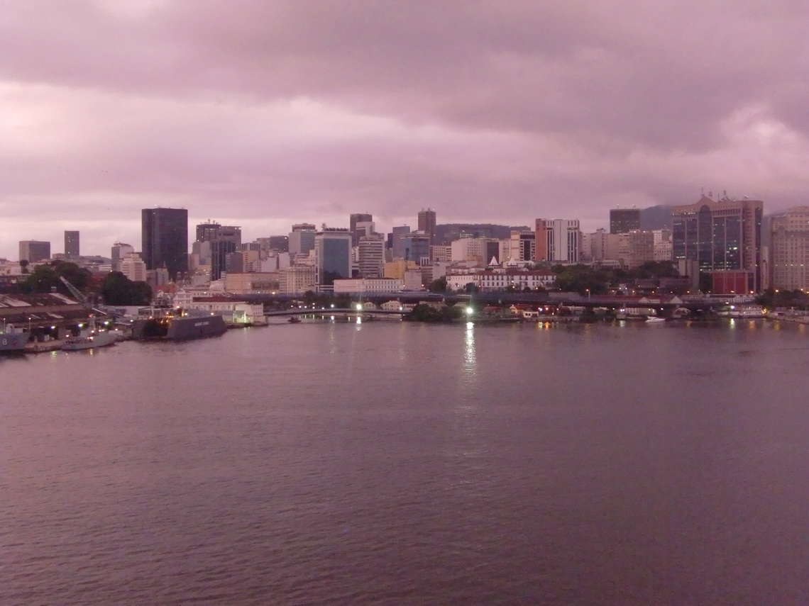
After more than 4 weeks on board of the cargo vessel we came to South America during sunrise of December 28th 2010. It was a very cloudy and misty day, but the temperature was already very warm despite the early morning. We were so excited to see Rio de Janeiro and being finally in South America!

Arrival in Rio de Janeiro at sunrise of December 30th 2010


Read more …
1 comment

Crossing the Equator - Baptism and Christmas

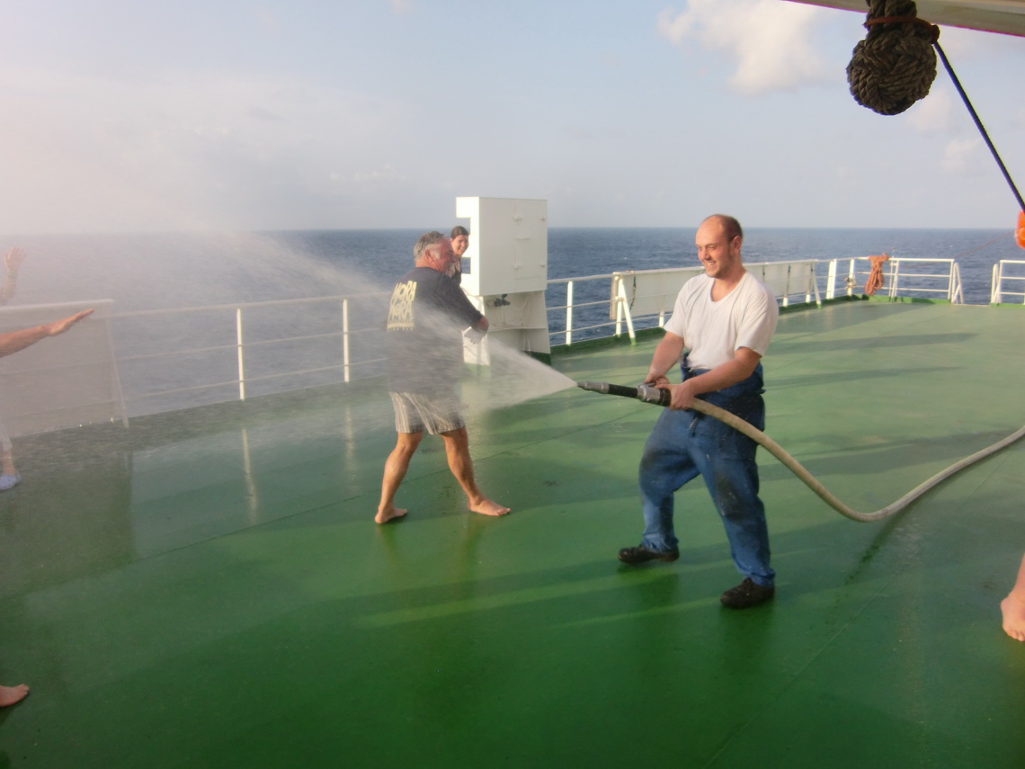
In the late morning of December 23rd we crossed the equator. Everybody was asked to come to the top deck in the late afternoon. Suddenly somebody from the crew shouted equator baptism. He had also a hose in his hand and abruptly lots of water came out of the hose. Warm and very salty!

Still we are relatively dry


Read more …
Add new comment

Africa - Senegal, Guinea and Sierra Leone

Three days after our departure from Vigo, Spain the crew did some security preparations for Africa:

  • Closing of all doors in the living area of the ship 
  • Installation of additional grids and heavy locks to the entrances of the decks 
  • Advising us to close and lock all doors, when we are going outside to the top deck. We could use only one of the five outside doors.
  • Sensitizing us with stories like: Once they had an exercise alarm after they had left an African port. The captain shouted over the loudspeakers 'Fire - Abandon ship'. Suddenly an African stowaway jumped straight forward into the ocean! 

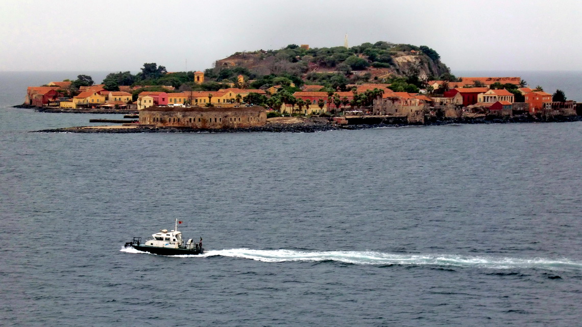
We arrived in Dakar, the capital of Senegal, in the morning of the next day, December 16th 2010. The entrance to Dakar is quite nice, we passed several islands. Very touching for us was the slave island, where the hapless and hopeless colored people had been stored before their long and sad journey to England or America.

Slave Island in front of Dakar


Read more …
2 comments

Europe - From Hamburg to Tenerife

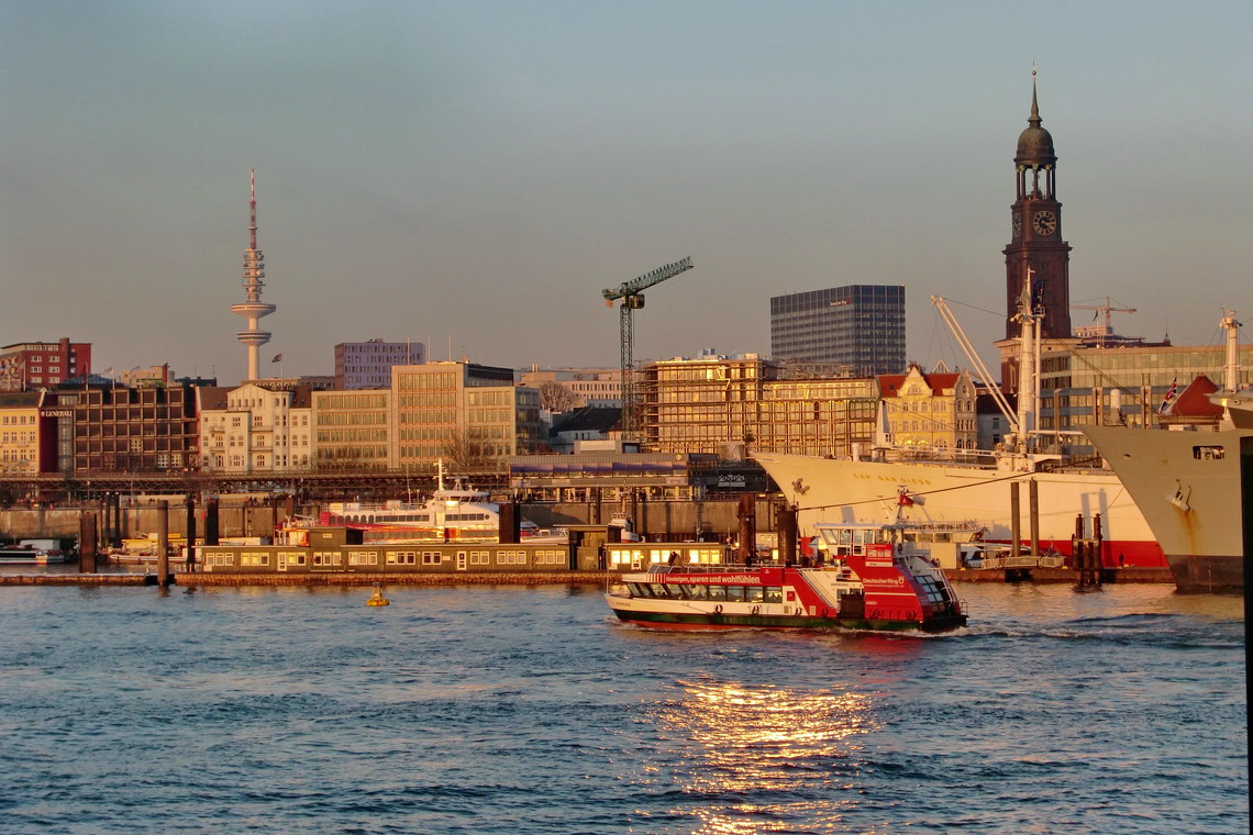
Finally November 29th, 2010 at 9:00PM we left Hamburg with the vessel Repubblica Argentina. Our original schedule was November 9th, but due to stormy weather and change of the vessel we had 20 days delay. This is not unusual for sea freighter cruises, so you have to be flexible!

Leaving Hamburg - Bye bye Germany


Read more …
Add new comment

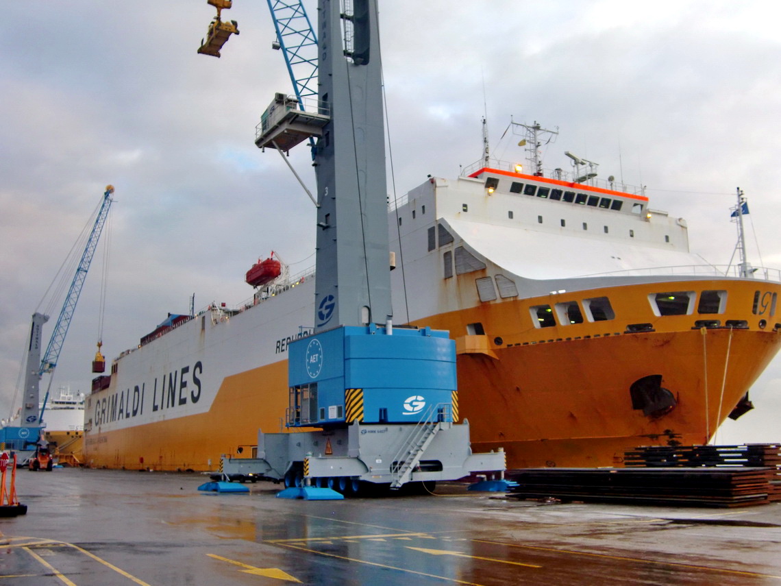
Our vessel, the Repubblica Argentina

The Repubblica Argentina belongs to the Italian Grimaldi Group. Grimaldi is one of the biggest sea freighter companies in the world, mainly between Europe, South America, Asia and Africa. Grimaldi is specialized on car transportation, but also on containers. They have some passenger cabins on most of their vessels, usually around six cabins. One big advantage of Grimaldi is that you can take a car with you. And a lot of equipment, for instance bicycles. Another one is the Italian flag, so the cook is from Italy! A good cook is very important, because you stay approximately 5 weeks on board till you reach Buenos Aires. If you want more information take a look to https://cargoholidays.com/.

Our vessel, the Repubblica Argentina

Read more …
2 comments

Monte Adamello

Adamello is one the most famous mountain group in the southern Italian Alps, closed to the lake Lago di Garda. The highest peak is the Monte Adamello, which is 3539 meters high. It overlooks a vast glacier plateau, the Pian di Neve. Adamello has a very sad history: Many soldiers died there during the First World War; mainly due to coldness, avalanches and crevasses. But there were also heavy fights between the Austrian and Italian armies. You still find a lot of relicts of this war like shoes, barbwires, cooking stuff, stations, ...
 
We climbed Monte Adamello mid of October 2010, which is relatively late for such a big glacier tour. You should have all glacier equipment like crampons, ice-pick and ropes. There are huge crevasses on the Pian di Neve, more than 50 meters deep. So we started our trip which heavy backpacks at the Capanna Stella Alpina, south west of Monte Adamello. The Capanna Stella Alpina is accessible for smaller cars via the Valle del' Igna. It is a very narrow and steep street, starting from the small village Cevo. Our VW California fitted exactly, we were happy that it is not wider! Cevo can be reached easily from the town Lovere at the lake Lago Iseo, driving up the river Fiume Oglio to the town Malonno.
 
The Capanna Alpina is just 1400 meters high, so it is more than 2100 meters to the top of Monte Adamello. Fortunately there are many mountain huts and bivouacs on the way. But we had to carry additional gear like sleeping bag, cooker and all the food.  Our backpacks were definitely heavier than 20 kilograms!
 
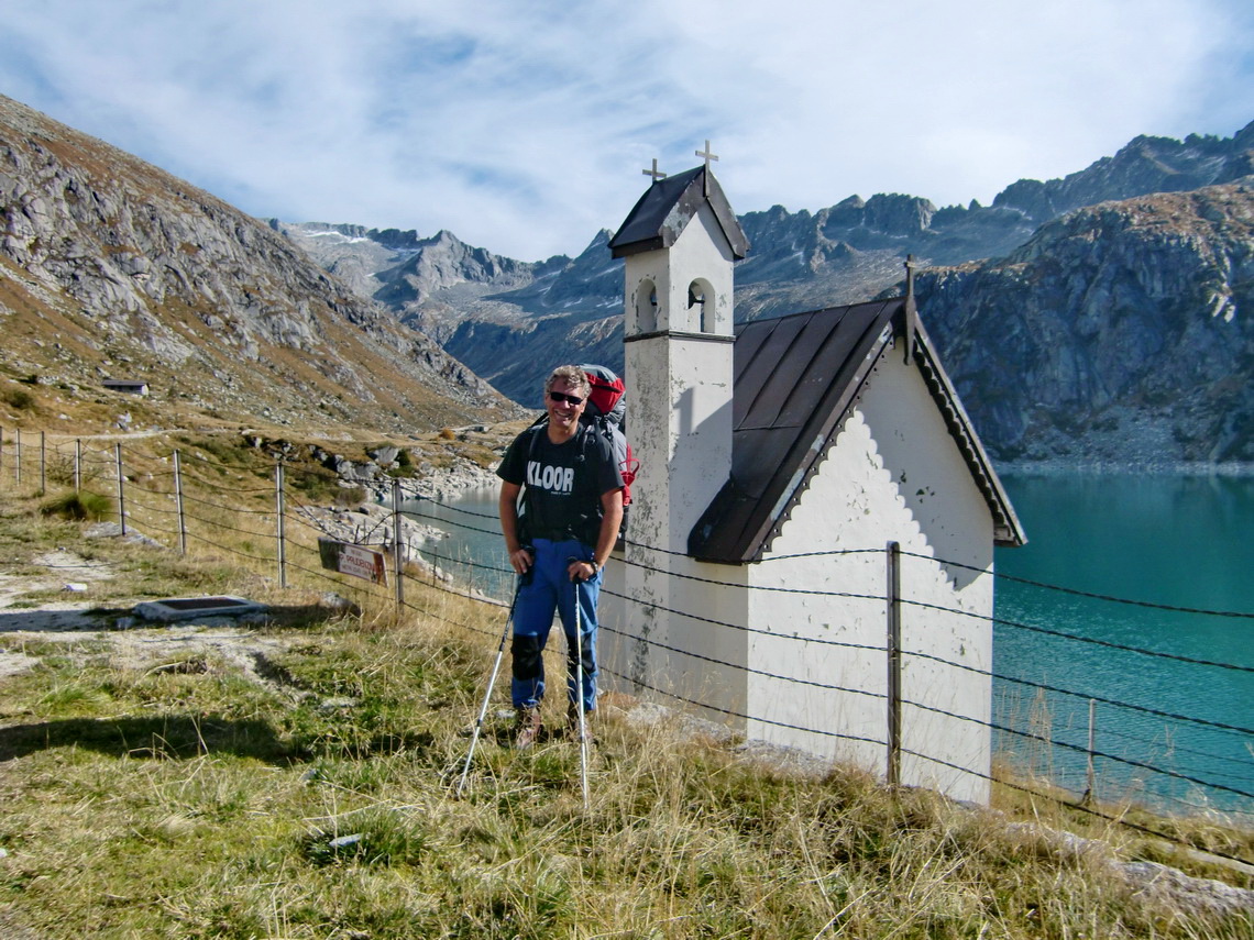
On the first day we walked to the bivouac Bivacco Salerno, located closed to the Salerno saddle 3100 meters high. It is a beautiful way along the artificial lakes Lago Salerno and Lago Dasazzo.
 
Lake Lago Salerno
Read more …

Dolomites - Piz Cunturines

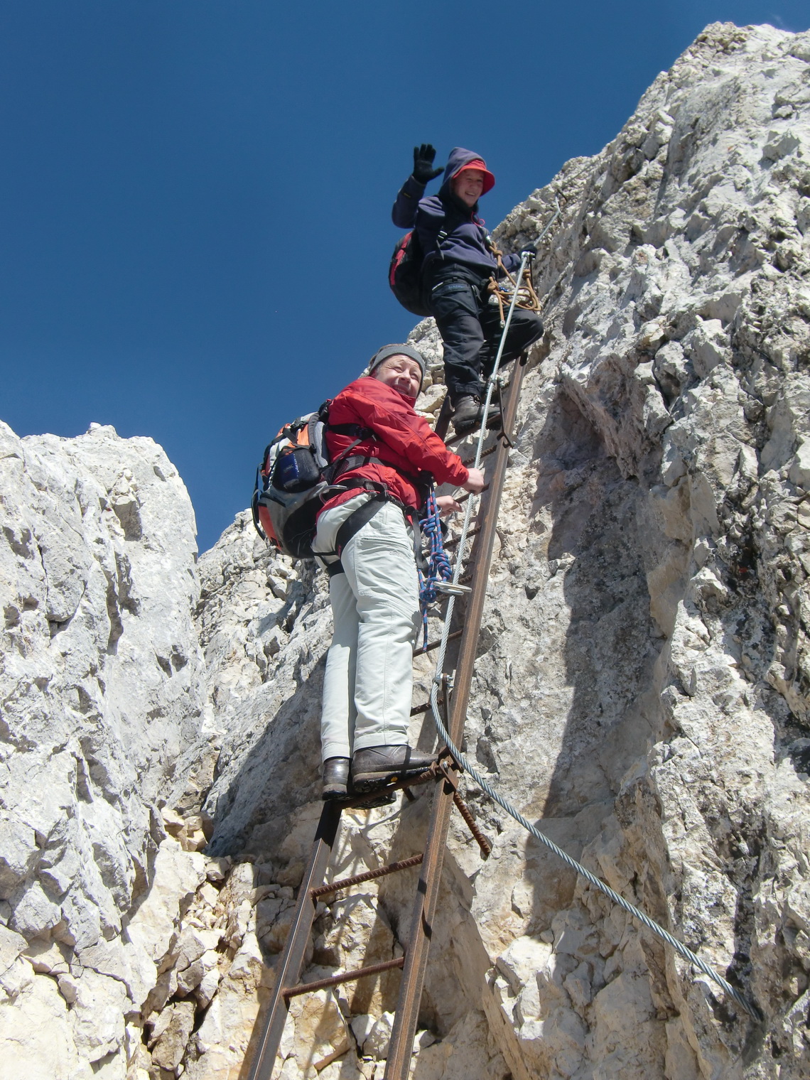
In September 2010 we spent some days in the Dolomites together with Marion's brother Tommy. Our first target was Piz Cunturines in the Fanes Group. It is one of the giants in the Dolomites, more than 3000m high. And some climbing is required. Fortunately there is an iron rope (Via Ferrata), so no heavy mountain equipment is needed. We started very early in the morning at the Capanna Alpina, closed to St. Kassian in the Gadertal. It was a wonderful day in an archaic environment. We walked approximately 4 hour through a very remote valley, passing the lake Cunturines, to the saddle between the peaks of Piz Cunturines and La Varella. There the ropes begin, also some iron ladders. Then it became very steep, more than 1700m above St. Kassian. The climbing was very motivating, but relatively short. The iron ropes and ladders were in excellent conditions. 
 
Marion and Tommy on the first ladder
Read more …
Page 6 of 6
  • Start
  • Prev
  • 1
  • 2
  • 3
  • 4
  • 5
  • 6
  • Next
  • End
Copyright © 2025 Marion and Alfred. All Rights Reserved. Designed by JoomlArt.com. Joomla! is Free Software released under the GNU General Public License.
Bootstrap is a front-end framework of Twitter, Inc. Code licensed under MIT License. Font Awesome font licensed under SIL OFL 1.1.
Powered by T3 Framework