Marion and Alfred Lorenz Marion and Alfred Lorenz
  • Home
  • Itineraries
    • Africa
      • Tanzania
      • Morocco
    • Central America
      • Belize
      • Costa Rica
      • Guatemala
      • Honduras
      • Nicaragua
      • Panama
    • North America
      • Canada
      • Mexico
      • United States
    • South America
      • Argentina
      • Bolivia
      • Brazil
      • Chile
      • Colombia
      • Ecuador
      • Paraguay
      • Peru
      • Uruguay
    • From Hamburg to Buenos Aires
    • Asia
      • Cambodia
      • Laos
      • Thailand
      • Vietnam
    • Europe
      • Central Europe
      • France
      • Italy
      • Portugal
      • Scandinavia
      • Spain
  • Mountains
    • Africa - Overview
    • Central America - Overview
    • North America - Overview
    • South America - Overview
    • Asia - Overview
    • Europe / Scandinavia - Overview
    • Europe / South - Overview
  • Pictures
    • Pictures Africa
      • Pictures Morocco
      • Pictures Tansania
    • Pictures Central America
    • Pictures North America
      • Pictures Canada
      • Pictures Mexico
      • Pictures United States
    • Pictures South America
      • Pictures Argentina
      • Pictures Bolivia
      • Pictures Brazil
      • Pictures Chile
      • Pictures Colombia
      • Pictures Ecuador
      • Pictures Paraguay
      • Pictures Peru
      • Pictures Uruguay
    • Pictures Asia
      • Pictures Cambodia
      • Pictures Laos
      • Pictures Thailand
      • Pictures Vietnam
    • Pictures Europe
      • Pictures Central Europe
      • Pictures France
      • Pictures Italy
      • Pictures Portugal
      • Pictures Scandinavia
      • Pictures Spain
    • Pictures - From Hamburg to Buenos Aires with a cargo ship
  • Maps
    • Maps Africa
      • Map Morocco
      • Map Tanzania
    • Map America Entire
    • Map Central America
    • Maps North America
      • Map Alaska and Canada - West
      • Map Mexico
      • Map United States - Northwest
      • Map United States - Southwest
    • Maps South America
      • Map South America - Northwest
      • Map South America - Central
      • Map South America - South
    • Map Southeast Asia
    • Maps Europe
      • Map Central Europe
      • Map France
      • Map Italy
      • Map Portugal and Spain
      • Map Scandinavia
      • Map Spain - Mallorca
  • GPS Coordinates
    • GPS - Africa
    • GPS - Central America
    • GPS - North America
    • GPS - South America
    • GPS - Asia
    • GPS - Europe
  • Guestbook
  • About
    • About Marion and Alfred
    • Chronology
    • Newsletter Subscription
  1. You are here:  
  2. Home

Pacific Coast North of Lima

Southern Peru has Machu Picchu, Cusco and many other historical sites of the Incas but on the Pacific coast north of Lima are innumerable testimonies of ancient Peru, many still not detected or buried in the sand of the extreme dry Atacama desert which is a perfect conservation medium. The UNESCO world heritage site Caral is supposed to be one of oldest city on earth, founded 4500 to 5000 years ago. Other top highlights are the ruins of the pre Inca cultures Chavin, Moche, Sican and Chimu like Chan Chan the mightiest town of our world built with adobe, which we had visited in the year 1980.

Today there are huge cities like Trujillo or Chiclayo in the desert, where the sweet water from the glaciers of the Andes flows into the Pacific Ocean. Close are beautiful beaches, which are popular holiday destinations in the austral summer. The coast turns 90 degree on the most western point of the continent and the the impact of the cold Humboldt ocean current weakens. The landscape becomes more green and tropical the closer you come to Ecuador. The water temperature is pleasant and on the border are the only mangrove forests of Peru located. This region is very fruitful with many rice, bananas and sugarcane fields.

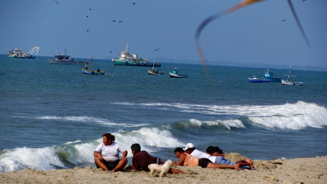
Peruvian family enjoying the beach of Zorritos

Approximately hundred kilometers Northwest of Lima is the incredible lush national park Reservas Nacional Lomas de Lachay, a true oasis in the dryest desert of our planet. The mist of the ocean is sticking so long on its crests that a rich fauna including raptors and flora with trees are able to exist. Lachay has a remote campground and superb hiking trails over and around its ridges. We were lucky because we spent a sunny day in Lachay, which is very rare.

Read more …
Add new comment

Cordillera Huayhuash

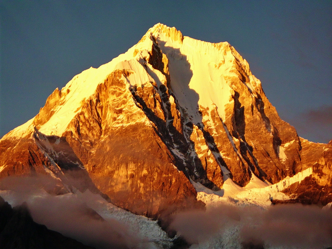
The spectacular Cordillera Huayhuash lies few kilometers North of the famous Cordillera Blanca and its main city Huaraz. It is a relative small range with stunning pinnacles sugared with enormous mass of ice and snow. Nevado Yerupaja is with 6617 meters sea-level its tallest peak and the second highest mountain of both: Peru and the tropics. Like all other major peaks of the Cordillera Huayhuash access to its summit is extremely difficult and dangerous. Even today some peaks are without any successful ascents for years.

North-east face of Nevado Yerupaja at sunrise


Thanks to the book and movie Touching the Void Cordillera Huayhuash became very popular in the last years: It shows the unbelievable story of Joe Simpson and Simon Yates when they climbed up the south-west face of 6344 meters high Siula Grande in the year 1985. On the way down Joe Simpson broke his leg. His companion roped him down the steep, dangerous and difficult north-west ridge. Suddenly Joe Simpson hung under an overhang and he couldn't move. There was no more rope. Simon was standing in deep powder on the very steep ridge. The weight of Joe Simpson moved him slowly but constantly to the abyss. His only choice to survive was to cut the rope. Joe fell into an huge crevasse. Simon searched him desperately but couldn't find him. He returned to the camp and was sure that Joe didn't survive the crash but Joe found a way out of the crevasse through the glacier with his broken leg. After three days he came back totally exhausted to the camp in the night just before his companion wanted to leave.

Cordillera Huayhuash can be circled in a 10 days hike with many high cols (two more than 5000 meters sea-level), pristine lagoons and beautiful campsites. Only one little village is on its way - a lot of food and other stuff must be carried. Thus we searched for mules in Chiquian, the last bigger settlement on the western side of Cordillera Huayhuash and reachable via a decent paved road.

Read more …
1 comment

Ayacucho, Huancavelica and Lima

Ayacucho is supposed to be the second most attractive and fascinating town in the Peruvian Andes (after Cusco). Ayacucho, also called Huamanga by its 180,000 inhabitants, has a huge colonial inheritance with many beautiful churches and buildings. Andean life is very traditional and authentic because the tourism industry has neglected it more or less so far. The region of Ayacucho was the center of the Wari culture (700 - 1100 AD), which dominated the southern part of Peru between the city Chiclayo and lake Titicaca.

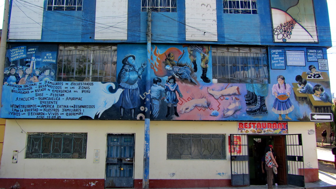
The name Ayacucho means corner of the death. It is located in a poor, rural and remote region. In the early 1980th the Maoist guerrilla organization Sendero Luminoso (Shining Path) was founded here and a brutal civil war with Peru's military government broke out. More than 70,000 people were killed until 1992, mainly innocents in the villages of this region. The shadows of this terrible time are still visible and perceptible, for instance most of the elderly people are very shy or there are doors secured with eight heavy locks.

Wall of the sad Memorial Museum for the murdered people


We came to Ayacucho from Cusco on Saturday late afternoon, August 10th 2013. This street had been partially horrible because it was under construction. Two times we were nearly in detonations with huge falling rocks. Sometimes we had to pass awful deviations on narrow and steep rugged or muddy dirt roads. Like in most cities of South America there were high bumps every few meters on the street to prevent drivers from speeding. On a very high one our car gave a loud strange bang and the left top side moved down a little bit weirdly.

Read more …
Add new comment

Amazonia - Peru

The grandiose river Amazon is with its uncountable tributaries with a length of more than 6000 kilometers the biggest river system and tropical rain forest on earth. The complete basin of Amazonia covers more than a third of South America. Besides exploitation, deforestation and environmental pollution wild life is abundant and biodiversity unique. Thus it is called the green lung of our planet. Amazonia is a remote, lush, green, hot, humid and wet area covered with rain jungle but with just few streets and settlements. Transportation on its rivers and by air is very often the only choice, for instance to Iquitos which is with more than 400,000 inhabitants the largest city in the Peruvian Amazona. Indigenous life still exists with many legends, myths and priceless knowledge about the secrets of the rain forest.

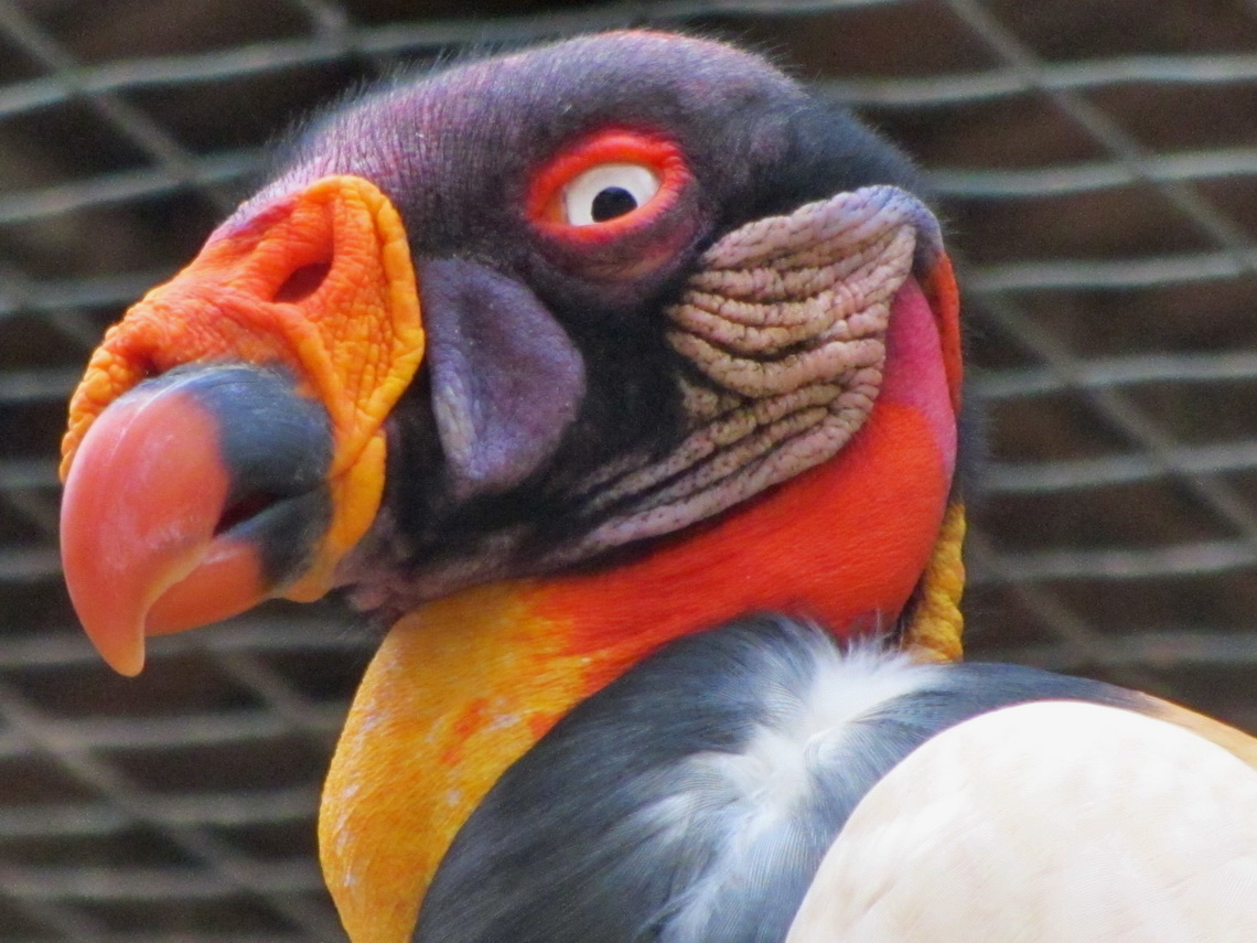
Condor of Amazonia in the zoo of Pucallpa

Its main sources Rio Marañon and Rio Ucayali rise in the Peruvian Andes on its eastern slopes. Peru has a proportion of 12 percent of Amazonia. It covers more than 60 percent of Peru's size but less 10 percent of its people are living there. The Peruvian people call their Amazonia La Selva - virgin forest. After our car had gotten broken in Ayacucho we realized that we had to wait more than three weeks for spare parts from Germany. Thus we took light backpacks and traveled by public transportation into the Peruvian heart of Amazonica, which was an unforgettable stunning itinerary for us.

Read more …
Add new comment

Cusco, Machu Picchu and Puno

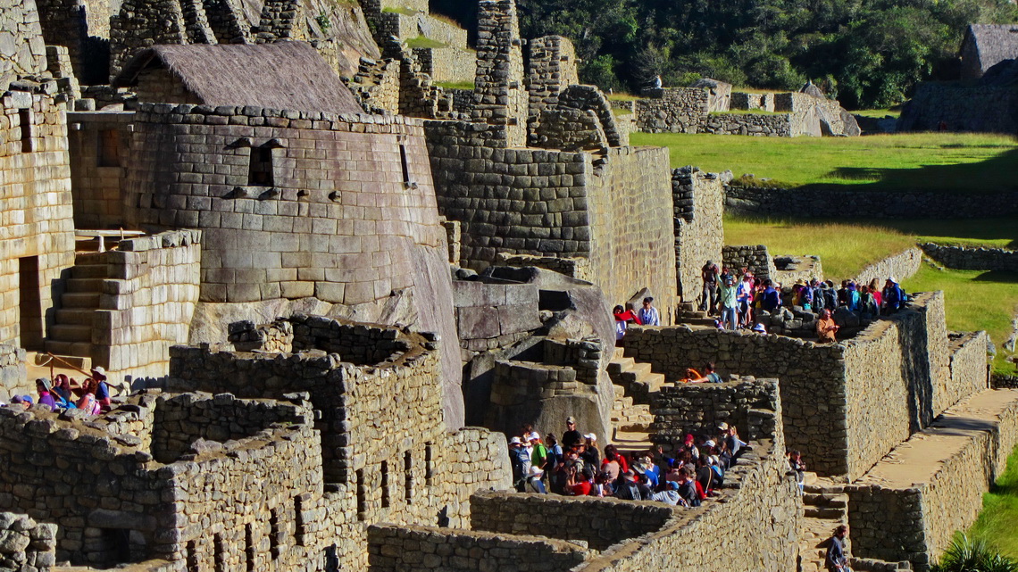
Machu Picchu is probably the most famous tourist destination in South America. The mystic Inca site is located isolated on the eastern slope of the Andes in a marvelous and nearly tropical environment. Its buildings are in very good conditions. Thus life of the Incas can be imagined well besides thousands of visitors every day. In addition it shows the fabulous engineering and construction capabilities of the Incas.

Buildings of Machu Picchu with the only round shaped house


But Machu Picchu is not the only historical site of the Incas in southern Peru. Cusco was the navel and center of the Inca world. Today the city with more than 300,000 people is the major hub for tourists in Peru but also here you can feel former Inca life. Close to the town is the Inca fortress Saqsaywaman, on the way to Machu Picchu in the sacred valley are Ollantaytambo and Pisaq.

After crossing the Bolivian border we traveled along the western shore of lake Titicaca. The main city Puno is famous for its festivals and the floating islands on the lake Titicaca, established and inhabited by the indigenous Uro people. Nearby are Chullpas, large tomb towers put up by the pre Inca culture Colla for their important people. Later the Incas used and enhanced their Chullpas.

Read more …
Add new comment

Ancohuma and Copacabana

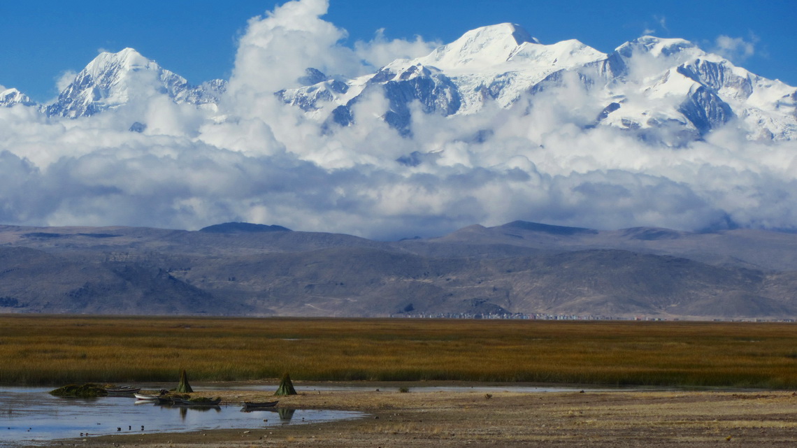
Ancohuma is with 6427 meters sea-level the tallest peak around the largest lake of Bolivia and Peru Lago Titicaca which is with 3810 meters sea-level the highest navigable lake on earth. It is a ice and snow castle and the second highest summit of the awesome mountain range Cordillera Real of the Bolivian Andes. Our dream was to achieve its top but we had bad conditions in the early morning like heavy snowfall, unusual high temperatures and groundless deep snow. Consequently we decided to turndown at 6256 sea-level below the last steep slopes. Especially we didn't want to accept the serious risk of avalanches. Nevertheless this trip was an outstanding nice experience for us.

Illampu and Ancohuma seen from lake Lago Titicaca


The tour to Ancohuma starts in Sorata, a pleasant and warm village on the eastern slopes of the Cordillera Real at 2700 meters sea-level. After struggling with its narrow and steep streets we found the heavenly campsite Altai Oasis with wonderful people (GPS coordinates: S15 46.179 W68 39.306). Johny and Simon thank you so much for your extraordinary support and creating this marvelous place.

Read more …
1 comment

Cerro Austria

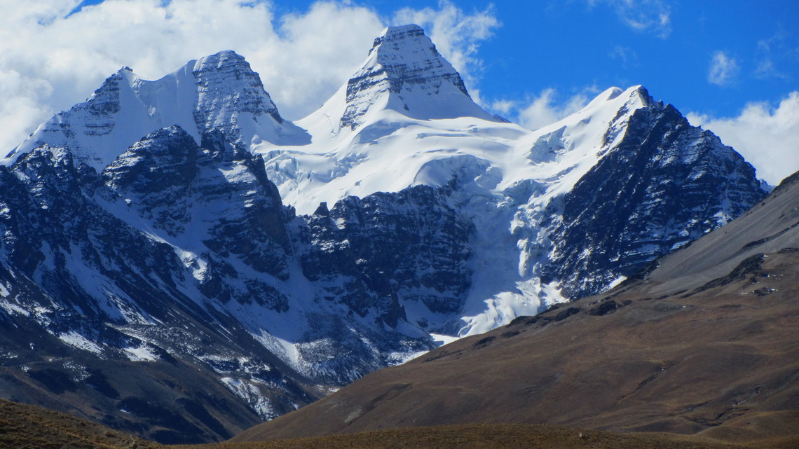
The marvelous Condoriri range of the Cordillera Real is close to La Paz nearby the village Estancia Tuni. It is named after its most striking mountain which looks like a Condor seeing from West. It is "just" about 5600 meters high but very difficult to access due to serious technical ice and rock climbing. West of the main peak is the much easier Cerro Austria (5328 meters sea-level) which provides stunning views to nearly the whole range of the Cordillera Real.

Cerro Condoriri with the head and its two wings


There are other nice trekking mountains in this area like Cerro Mulamania (4949 meters high) and Cerro Thipala (5045 meters sea-level). But before we came in this region we had crossed Bolivia from Tupiza to La Paz. Outstanding were the rocky mountains Cerros Kari Kari close to Potosi.

Read more …
Add new comment

Most northern part of Ruta 40

The more than 5200 km long street Ruta 40 strechtes from the very South of Patagonia to the Northwest corner of Argentina along the Andes. It is one of the most famous, legendary and scenic roads on earth. Few years ago travelers had to deal with difficult dirt and gravel parts including severe river crossing. Nowadays most of the street is tarred or pavement is in construction or planned.

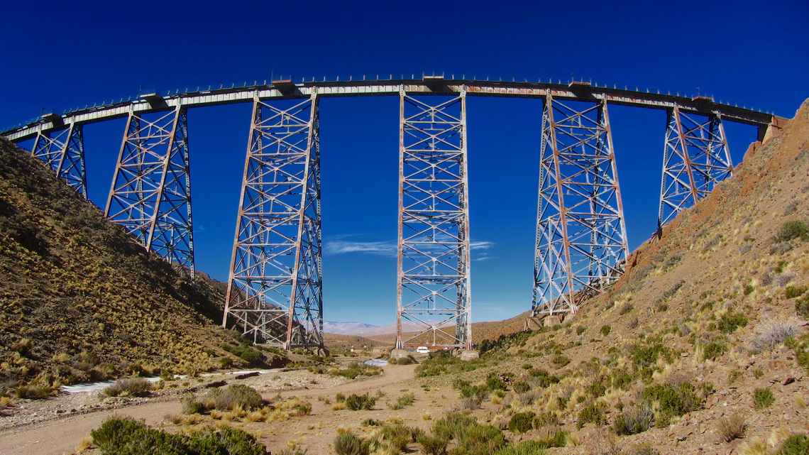
But the most northern part is still as rough as in former times. In addition it passes its highest point, the dreaded Abra del Acay. With 4895 meters sea-level it is higher than the summit of Montblanc, the tallest peak of the Alps. South of this col are beautiful villages like Cachi, Payogasta and La Poma with some touristic infrastructure. North is the mining town San Antonio de los Cobres with its engineering masterpiece La Polvorilla, an impressive railway viaduct with about 50 meters high. The largest salt lake of Argentina Salinas Grandes follows. Finally the Ruta 40 merges with Ruta 9 to the border to Bolivia via the town Quiaca.

Railway bridge Viaducto La Polvorilla

Read more …
2 comments

Cafayate and the Yungas of Argentina

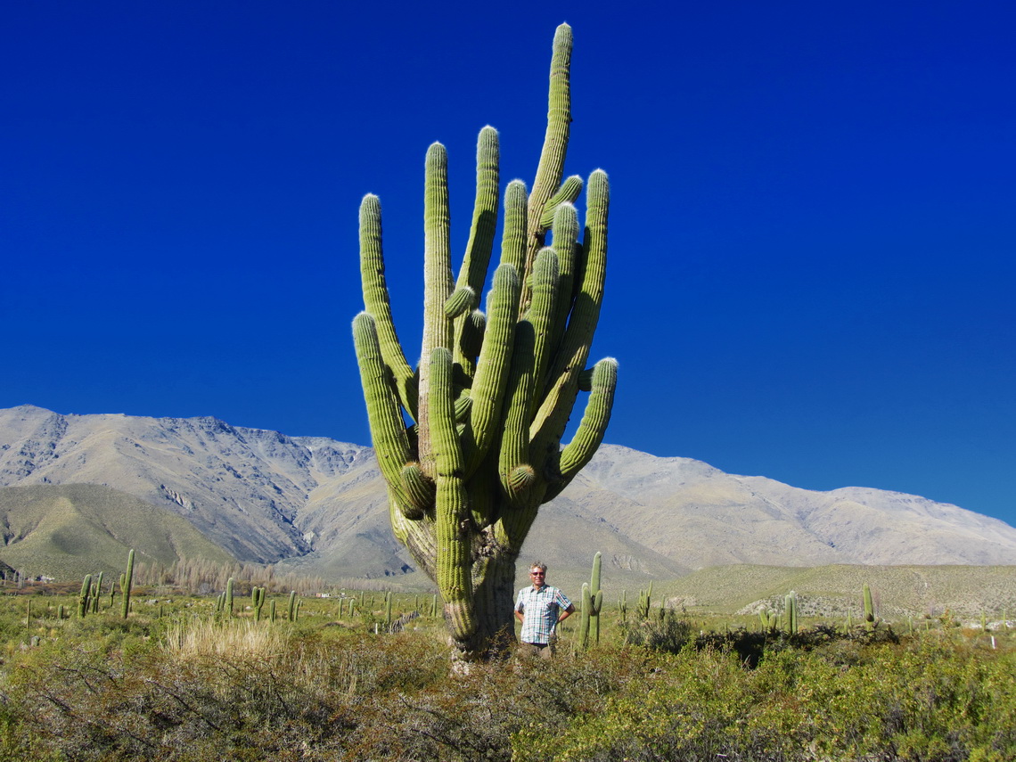
The little town Cafayate and its environment is a natural treasury on foot of the Andes in the northwest corner of Argentina, more than 1500km away from Buenos Aires. After Mendoza it is the second most important wine region in Argentina. 200km North of Cafayate is the pleasant holiday destination Tafi del Valle in the first valley of the mountains.

The Yungas are the rainforests on the eastern shore of the Andes at lower altitudes from 500 meters to 2000 meters sea-level. The are situated nearly the entire Andes ranges from Venezuela to the province Salta in Argentina. Clouds from the Atlantic Ocean are sticking on the first mountain ranges. In Argentina these clouds are sometimes renewed in the Brazilian highlands, which are covered with  thick jungle. Thanks to tropical temperatures and high precipitation wildlife is abundant in the Yungas zones. For instance in Argentina's Yungas are: Tapirs, Peccaries, Pumas, Monkeys and a lot of different kind of birds.

Landscape between Tafi del Valle and Cafayate


End of February 2013 we had parked our VW California in the premises of our friends Cristian and Sebastian in the northern suburban Tigre of Buenos Aires to fly to Germany. They have several medium-sized motor-homes which they rent to tourists, see their webpage www.andeanroads.com. In addition they offer a small but cozy campsite in the region of Buenos Aires and a parking lot for motor-homes (GPS coordinates: S34 27.058 W58 40.916). Cristian loves Volkswagen Bullies, especially campers. When we came back to Argentina on May 22nd 2013, he had a nice welcome surprise for us.

Read more …
4 comments

Esteros del Ibera

600 km North of Buenos Aires the terrific wetland reserve Esteros del Ibera offers abundant wildlife like crocodiles, capybaras, monkeys, deers and a lot of different kind of birds, reptiles and insects. It is a pristine flat lowland with many lakes, swamps and morasses. Thanks to its remoteness only few people live in this fantastic region and tourism is a little bit underdeveloped. Colonia Carlos Pellegrini is the only larger settlement with few hundred inhabitants but all needed facilities like little hostels, some basic food shops and one campsite.

But access to this paradise can be difficult because a 80km dirt road leads from the South (Mercedes) to Carlos Pellegrini with some ugly, muddy and watery parts after rainfalls, which are quite often. The more rough northern course from San Tome is twice the way and includes some long sandy stages.

Half the way to Buenos Aires is the superb Parque Nacional El Palmar on the western shore of Rio Uruguay with the last bigger forests of the origin Yatay Palm Trees in Argentina, nice beaches and also stunning wild life. 

We came back to Argentina on February 15th 2013 and we decided to drive directly the northern road to Carlos Pellegrini, which was a little bit sandy but dry - no big deal with our car.

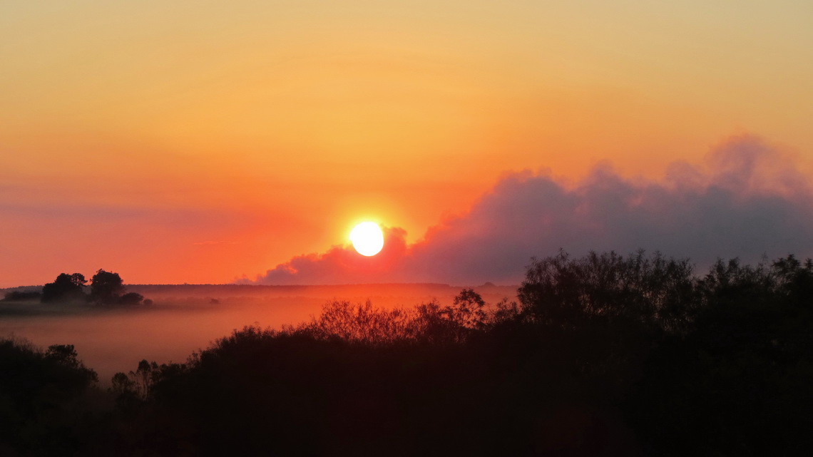
Sunset on the way to Carlos Pellegrini with some smoke from burning fields

Read more …
Add new comment

Santa Catarina

The state Santa Catarina is famous for its spectacular coastline. Green mountains covered with dense rain forest hit the Atlantic Ocean. Thus it is one of the major holiday destinations within Brazil, especially in the hot summer period. But the tourism has some negative impacts like environmental pollution, high prices and exceeding building boom. Some cities like Balnerario Camboriu have a skyline like Manhattan. We wonder if all Brazilians have apartments on Santa Catarina's beaches.

But we found some pristine beaches, mainly on the island Ilha de Santa Catarina. It is the heart of this state, also its beautiful capital Florianopolis is located on the isthmus between the continent and the island. More marvelous beaches are on the peninsula Bombinhas.

The population of Santa Catarina have their roots generally in Germany and Italy. There are town names like Nova Trento or Alfredo Wagner. In its third largest city, Blumenau and its surroundings most of the people speak fluently German. Blumenau hosts the second biggest Oktoberfest in the world (after Munich).

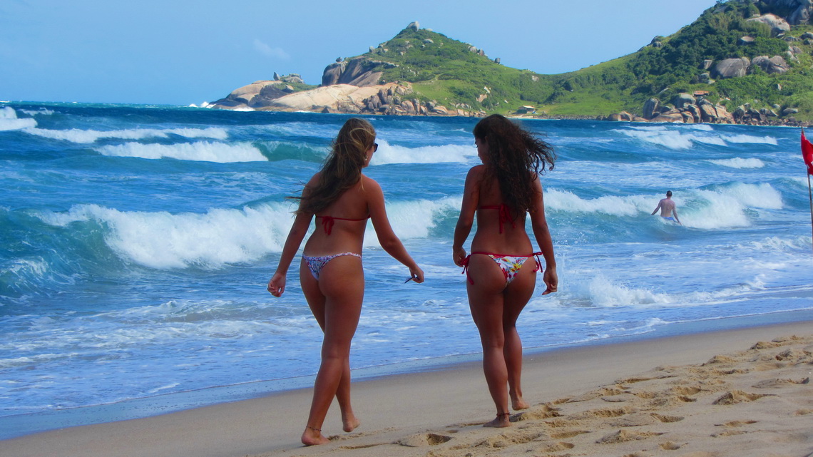
Two beauties on the beach Praia Mole on the eastern shore of the island Ilha de Santa Catarina

Read more …
1 comment

Sao Paulo and Costa Verde

Sao Paulo is a city of superlatives: According to lonely planet it is with more than 20 millions inhabitants the third-largest metropolis on earth. It is the economical, financial and cultural center of Brazil, even of South America. But it is a huge cluster of skyscrapers and urban developments with few green parks. Like in Rio the gap between rich and poor is intolerable. Consequently Sao Paulo suffers an enormous high crime rate with many killed people every day. It is infected deeply by the war of drugs.

The outstanding marvelous Costa Verde stretches along the Atlantic coast East of the city of Rio de Janeiro. It is the place where the steep and green mountains of Serro de Mar hit the Ocean. Thus there are many pristine islands, beautiful bays and terrific beaches. Costa Verde becomes Litoral Paulista, when it crosses the state border to Sao Paulo.

A major tourist destination is the lovely and lively village Paraty with many picturesque buildings and remote beaches. Most of them are accessible only by boat and some by foot through the lush and dense rain forest. 

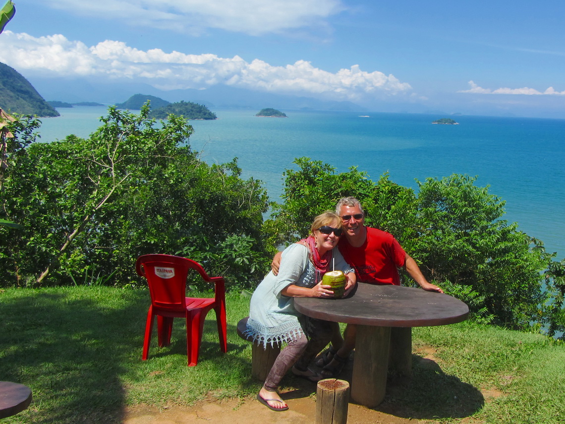
Pristine islands in the Baia de Ilha Grande, seen from the viewpoint South of Corumbe (approximately 10km East of Paraty)

Read more …
Add new comment

Rio de Janeiro

A Cidade Marvilhosa - The Marvelous City offers its visitors and inhabitants nearly everything like endless dreamlike beaches; lush, dense and remote jungle with wild animals, stunning trees and beautific flowers; sharp and rocky pinnacles; numberless interesting museums and galleries; huge football stadiums and famous teams; bustling exiting nightlife; and large shopping malls. It is a worldwide unique and spectacular synthesis between ocean, mountains, rain forest and human settlements including a lot of skyscrapers.

We felt not being in a metropolis with more than 7 million people because it has many different centers and quarters with large green oasis in between, even a National Park - Tijuca. Its size is really gigantic, for instance: The beeline is more than 40km from the pristine beaches of Guaratiba to the center of the city.

But the host of the Olympic Games 2016 and final game of the Soccer World Championship 2014 has also some drawbacks like poverty, social inequalities, high crime rate, endless traffic jams and still massive pollution. 

It was a sunny day when we traversed the more the 10km long bridge over the bay Baia de Guanabara between Rio de Janeiro and its little sister town Niteroi. The views from the bridge were fantastic. A huge vessel looked very familiar.

The center of Rio with Sugar Loaf and a white-orange vessel of Grimaldi

Read more …
Add new comment

Teresopolis, Nova Friburgo and Arraial do Cabo

The main attraction of Teresopolis is the marvelous Parque Nacional Serra dos Orgaos with stunning shaped mountains like Dedo do Deus (God's finger) with altitudes up to approx. 2300 meters. It stretches Northeast of Rio de Janeiro along the coast of the Atlantic Ocean. It is part of the rain forest and consequently precipitation is huge. Two entrances into the park are close to Teresopolis with trails, natural swimming pools and good campsites.

Between the two mid-sized cities of Teresopolis and Nova Friburgo is the scenic Tere-Fri circuit with gorgeous winding roads. Teresopolis is named after the Empress Maria Teresa from Habsburg. She was the wife of Dom Pedro II, the Emperor of Brazil in the second half of the 19th century for 49 years. Families emigrated from the Swiss canton Friburgo founded Nova Friburgo in 1818.

The charming village Arraial do Cabo is one of the first settlement in America: Amerigo Vespucci landed here in 1503 and left 24 men. It is located on the beautiful peninsula Cabo Frio with islands, mountains, cliffs and beaches with clear and turquoise waters. 

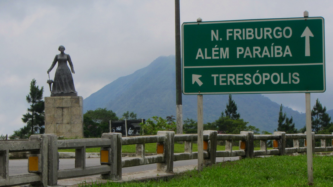
Maria Teresa is watching Teresopolis

Read more …
1 comment

Pico da Bandeira, Domingos Martins and Ouro Preto

The Caparao National Park on the border between the Brazilian states Espirito Santo and Minas Gerais contains southern Brazil tallest mountains including 2892 meters high Pico da Bandeira. Besides its relative modest altitude (for South America) it is a geographical point of superlative because no other mountain in a circle of more than 2500 km is higher. Just two peaks on the Brazilian / Venezuelan borders are a little bit taller in Brazil. Accessibility of this mountain is easy including fabulous hiking trails and cozy campsites.

Thanks to gold found in its mines, Minas Gerais is famous for its baroque colonial towns like Ouro Preto, the jewel in the crown and Brazil's first World Heritage site.

100km East of Caparao is the pretty German-style town Domingos Martins. Street names are in German and there are clubs like the Bergfreunde to preserve the culture of the immigrants, mainly from Pomerania and Hunsrück. Natural treasures like the waterfall Cascado do Galo and the dramatic rock Pedra Azul are nearby.

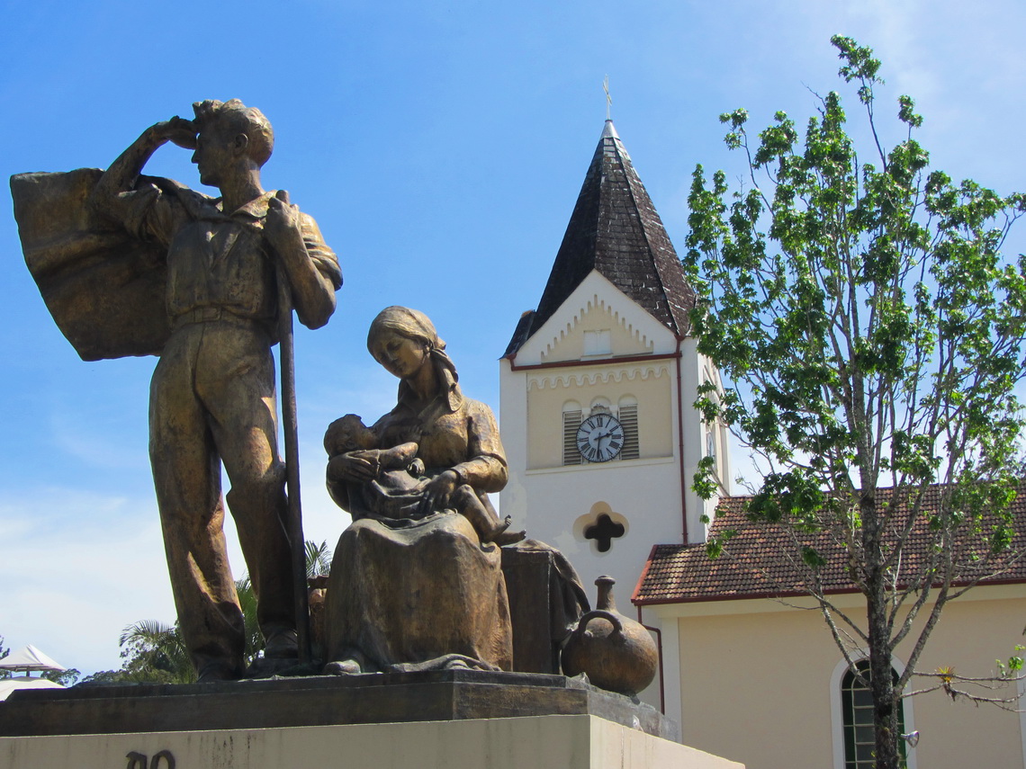
Lutheran church of Domingos Martins

Read more …
Add new comment

Salvador and the coast of Bahia

Salvador de Bahia was the former capital of the Portuguese New World colony and is now the stunning Afro-Brazilian metropolis in South America with more than 3 million inhabitants. It is a magnificent jewel with beautiful colonial buildings, powerful people and gorgeous coastline. It might be the best place outside of Africa where the descendants of the slaves have preserved mostly their culture and heritage.

40 kilometers North of Salvador is the outstanding beach village Praia do Forte with a TAMAR station, which is a research project to protect Sea Turtles. Eggs are collected on dangerous places on the nearby beaches and embedded here till the little Sea Turtles are hatching. It includes an interesting visitor's center.

South of Salvador are the touristic paradise Morro de Sao Paulo on the island Ilha de Tinhare, the wild beaches of Itacare and the marvelous home town Ilheus of Jorge Amado, maybe the most famous novelist of Brazil. Terrific and touching is the National Park Monte Pascoal, which is managed by the gentle indigenous Pataxo people.  

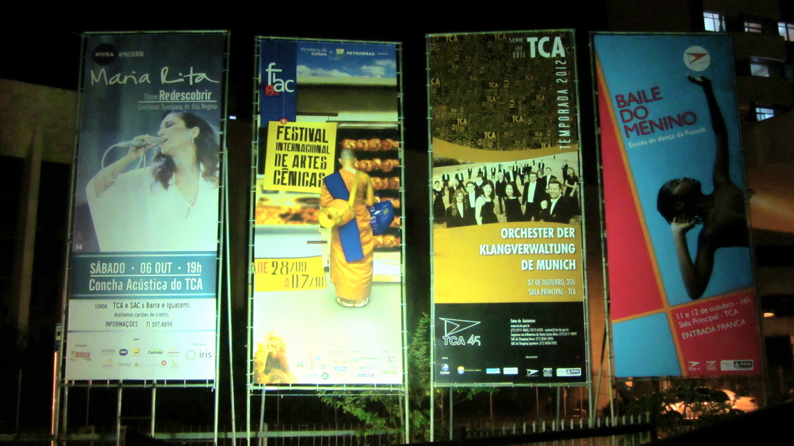
We came in time to Salvador to meet Alfred's cousin Vera, who had organized a tour of the orchestra Klangverwaltung München (Management of sounds, Munich) in South America. For us it was an unforgettable wonderful experience to listen to this orchestra, conducted by Enoch zu Gutenberg. They played classical music from Mozart, Haydn and Schubert.

Announcement of the concert in Salvador

Read more …
Add new comment

Chapada dos Veadeiros and Chapada Diamantina

The marvelous highlands Chapada Veadeiros and Chapada Diamantina are treasures of nature with unique landscapes, scenic canyons, grassy valleys, beautiful cascades, nice swimming pools with crystal clear water, abundant flora and fauna. 

The first one is 200km North of Brasilia. Its main entrance gate is the kooky town Alto Paraiso de Goias with some spiritualization and many interesting people from overall the world. Few kilometers west is the pretty little village Sao Jorge where a lot of youngsters and oldies wear dreadlocks. Between the two sites is one of the main attraction: The Vale da Lua, the Brazilian Moon Valley.

The 400km West of Salvador located huge Chapada Diamantina achieves altitudes of more than 2000 meters sea-level and has the highest mountains in the Northeast of Brazil. Morro do Pai Inacio is probably one of the most climbed mountain in Brazil. The former diamond-mining town Lencois is a perfect base to explore the Chapada Diamantina.

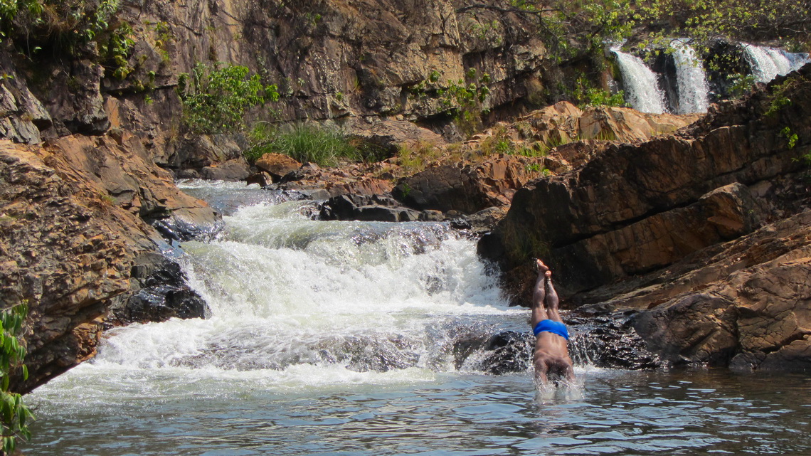
Thanks to geocaching we enjoyed the superb hike Indaia after we had left Brasilia. There are six waterfalls on its way and finally we arrived at the top of the 168 meters high Itiquira Falls after few hours walking, bathing and swimming. All details including useful way-points are described in the Geocache GC265JH (Guardando na memoria ...).

Jumping into the cold water of the Indaia river on a hot day

Read more …
Add new comment

Brasilia, Cidade de Goias and Pirenopolis

Brasilia is Brazil's futuristic capital in the center of the vast country since the year 1960. It was built in the 1950s after a long period of planning and struggle to move the capital from Rio de Janeiro to the middle of nowhere. Former President Juscelino Kubischek - JK - was the main driver of this urban project, unique in the world. Besides the military the architect Oscar Niemeyer was one of the key players for its construction. It is a city of bureaucrats and government with modern, remarkable and some stunning buildings. It is the only city in the world created in the 20th century awarded UNESCO World Cultural Heritage.

The little town Pirenopolis is one of the main weekend destination of the inhabitants of Brasilia. It is a mixture of Portuguese colonial architecture, art decor and hippie vibe in a marvelous hilly landscape with wonderful waterfalls.

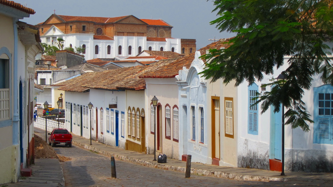
Cidade de Goias is another city in this region which achieved UNESCO World Heritage status. It is like an open museum with many beautiful baroque churches, colorful colonial buildings and narrow cobblestone streets.

In Cidade de Goias


Read more …
Add new comment

Crocodiles and more - Pantanal

Pantanal is with 210,000 sq km the hugest wetland on earth located in the center of South America. According to lonely planet it is the number two attraction in Brazil, after Rio's Sugar Loaf. It is wilderness abundant of wildlife with few farms and no bigger settlement. Many kinds of birds, monkeys, capybaras and crocodiles are easily visible in their natural environment due to much open space like savannah, rivers and lakes. September is the end of the dry season, many water holes vanished or are at low level. They are filled more or less completely with fish, crocodiles and other game seeking for some coldness in the merciless burning sun. It is quite hot during the day, more than 40°C!

But there are two other treasures in the state Mato Grosso close to Cuiaba, its capital. 150km North is in the jungle the village Bom Jardim with crystal clear rivers and lakes with uncountable colorful fishes. Snorkeling here is a stunning experience, you feel like being in an aquarium. Northeast are the marvelous pinnacles, cascades and gorges of the national park Chapada dos Guimaraes.  

We arrived at the Brazilian border in Friday afternoon. There was the usual fruit and vegetable inspection and we lost some eggs, tomatoes and onions. Asking them for official immigration they told us that we have to go to the Police station in the first city, Caceres, more then 100km far away from the border.

It was already dark when we arrived in Caceres and found the right Police station for immigration (GPS coordinates: S16° 05.186' W57° 40.540'). They gave us the stamps in our passport and the needed paper. For our car we had to go to the customs office, but they have closed between Friday, 2:00PM and Monday 9:00AM. Thus we had stayed the weekend in Caceres. We used the time to investigate its bars and to enjoy Brazilian beer in the hot evenings.

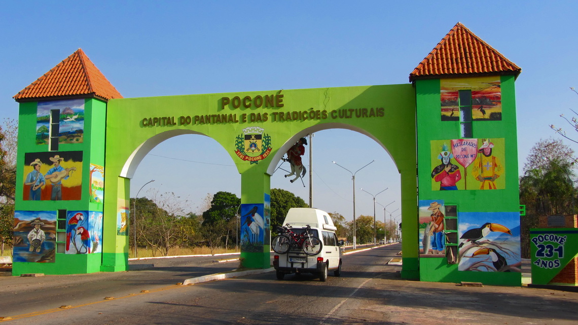
Thanks to the Transpananeira, the heart of the Pantanal is accessible with some efforts. It is a dirt road of more that 100km, starting at the village of Pocone, which lies between Caceres and Cuiaba.

Welcome to the capital of the Pantanal

Read more …
Add new comment

Torotoro National Park and the way to the Brazilian border

The Torotoro National Park is a superb area in the eastern range of the Andes, the Cordillera Oriental, 150km South of Cochabamba. It is a magic and wonderful world with caves, pinnacles, cold streams, canyons, wildlife and dinosaur footprints. Due its complicated access via steep cobbled or dirt roads it is relatively remote.  

100km Northeast, close the main road between Cochabamba and Santa Cruz are the most important Inca ruins of Bolivia, Incallatja in a marvelous landscape.

The best way from Bolivia to Brazil is through Chiquitania, more than 1000km through the hot jungle with some huge cattle farms and picturesque villages, mainly originated by Jesuits. Outstanding are San Javier and San Ignacio, both with beautiful churches and UNESCO world heritage states. Thanks to the Jesuits fine arts like music or carving is quite popular.

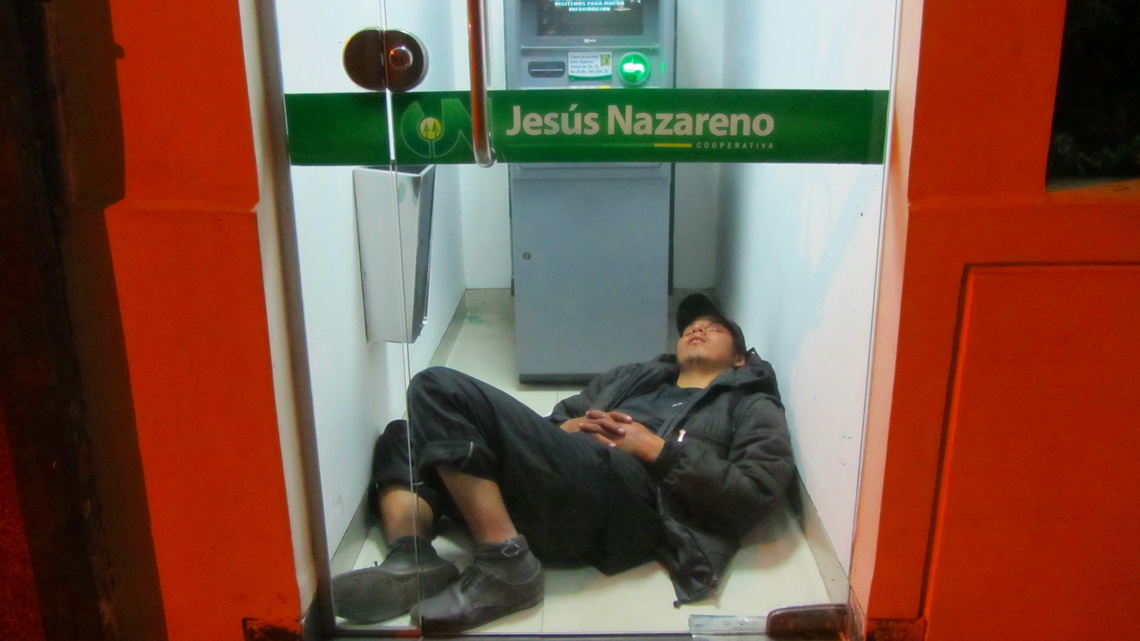
But we had some serious trouble to reach the Brazilian border. We came in the evening of Saturday (August 18th 2012) to Cochabamba and enjoyed its night life a little bit on a street restaurant. We met their three Carlos, one elderly pastor from Argentina, a young man driving a green Volkswagen T3 with his wife and son - Carlos. We had a lot of fun and learned some new Spanish words, Thanks Carlos I, II and III.

A cozy sleeping place in Cochabamba with some money from Jesus?


Read more …
Add new comment

Volcan Parinacota

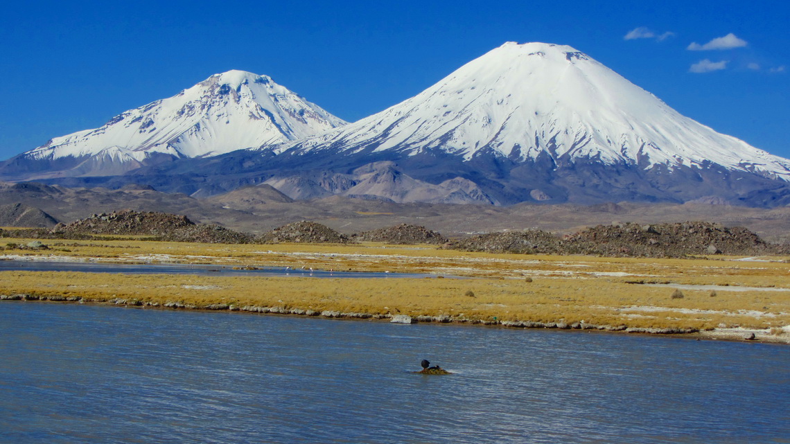
The dominating mountains in the Chilean Lauca National Park are the two Payachatas (twins) Volcan Parinacota and Volcan Pomerape. The first one is with 6342 meters sea-level slightly higher and it is a perfect cone, one of the most beautiful mountains on earth. Both are covered with snow and ice. They are located on the border to Bolivia, there in the Sajama National Park .

On foot of the Payachatas are the picturesque villages Parinacota (Chile - West side) and Sajama (Bolivia - East side). The most popular and common ascent to Volcan Parinacota is from Sajama via the northern ridge, which arises from the saddle between the two volcanoes. It provides beautiful views to the southern glacial face of Volcan Pomerape and to Bolivia's highest mountain on the opposite side of the village: Majestic but icy Nevado Sajama (6542 meters sea-level).

Due to the high altitude of the village Sajama (more than 4200 meters) good acclimatization is mandatory. On the Chilean side are some nice tours to gain it properly.  

West (Chilean) side of Volcan Pomerape and Volcan Parinacota


Read more …

Cerro Yana Sanca Grande and Cotahuasi Canyon

Cerro Yana Sanca Grande is an unknown mountain directly on the street between Arequipa to the Cotahuasi Canyon, which is to Peruvian definition the deepest gorge on earth. Besides its height of 5496 meters sea-level, this mountain is dwarfed by the giants of Nevado Coropuna and Nevado Solimana, but it provides stunning and superb views.

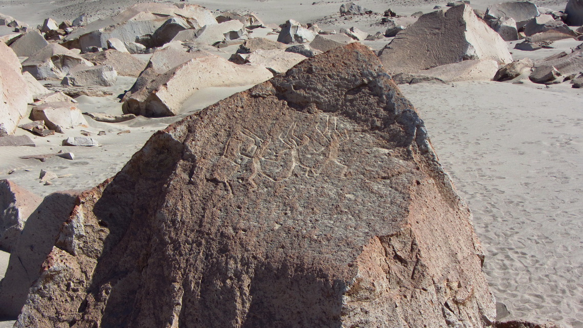
The area around Cotahuasi Canyon is quite remote because it can be accessed only by dirty roads of more than 150km and high passes over 4700 meters. It is a beautiful valley with hot springs, Inca ruins and picturesque villages. On the way to the Cotahuasi Canyon is the lower valley of the Colca river, now named Rio Majes. It it a fruitful region with pleasant warm climate and interesting archaeological sites like the petroglyphs of Toro Muerte. There are other nice petroglyphs in Miculla which is close to the town Tacna on the frontier to Chile.

We came in the late evening of July 20th 2012 to Toro Muerte and could stay the night in the solitary parking lot in front of the petroglyphs. It is located in a dry side valley of Rio Majes near the village Corire.

Line drawings in the desert


Read more …
2 comments

Condors and more - Colca Canyon

The Colca Canyon is one of the more famous and attractive tourist destinations of Peru in the vicinity of Arequipa. It is with approximately 3200 meters (south side) respectively 4200 meters (north side) depth mightier than the Grand Canyon in USA. The upper valley is a fruitful gorge with many terraces and picturesque little villages like Chivay and Cabanaconde. Thanks to the glaciers on the upper slopes of the valley and a perfect irrigation system, water is plentifully available.

Other highlights are some hot springs and trekking down to the bottom of the canyon, to the little paradise Sangalle. In this oasis bananas and other tropical fruits are growing.

But the star of the Colca Canyon is the Condor, the king of the Andes and biggest raptor on earth. Cruz del Condor is a holy place of the local people because every morning many Condors start their daily journey from here. The steep eastern walls provide perfect nestling places for them.

Condors fly mainly by thermal up winds; thus they have to wait until the sun heated the rocky walls. We came to Chivay at lunch time on July 8th 2012 and it begun to rain, which is very unusual in the dry season. Chivay is the local district capital with reasonable facilities like good restaurants.

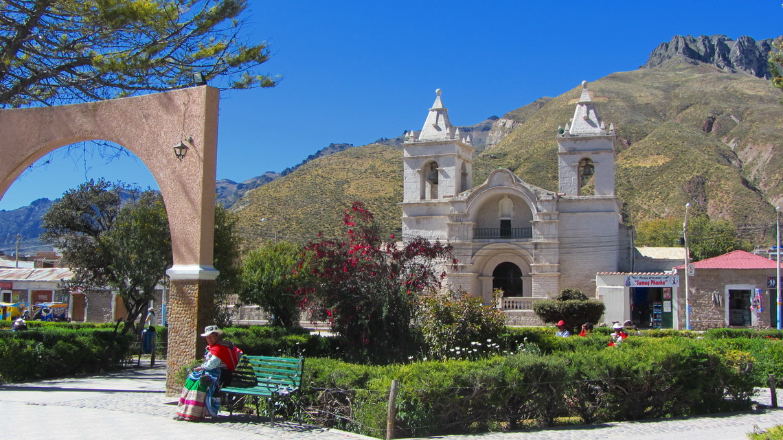
Main square of Chivay

Read more …
Add new comment

Nevado Chachani and Volcan El Misti

Arequipa is with more than 1 million inhabitants the 2nd biggest city in Peru. It is located on the edge of the Atacama desert to the Cordillera Volcanica at 2400 meters see-level. Its major landmark is the still active Volcan El Misti, a perfect cone of 5822 meters high. North of the volcano is the huge snowy mountain Nevado Chachani with several peaks. Its main summit achieves 6075 meters and it is supposed to be one of the most accessible and easiest 6000er on earth. South of the volcano and also in the townscape of Arequipa is the very eroded volcano Nevado Pichu Pichu with seven summits. On its northern side is the marvelous lake Laguna Salinas Blanca with abundant bird life.

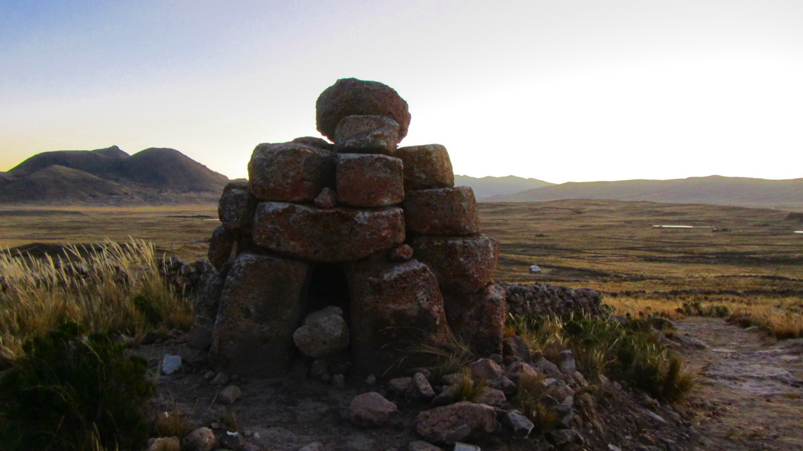
Approximately 100km southwest of Arequipa is its coastal resort village Mollendo, which is very busy in the austral summer. This was our first destination after we had crossed the Bolivian / Peruvian border in Desaguadero on June 22nd 2012 to meet a friend from Germany. We spent our first night in Peru after 31 years on a side street to ruins in the Aymara - Lupaca reservation. In the evening we explored the area and found some strange cairns.

Cairns with human bones - tombstones?

Read more …
Add new comment

Huayna Potosi

The mountain Huayna Potosi is with 6088 meters sea-level one of the ice castles of the Cordillera Real. This mountain range is the eastern boundary of the Altiplano, the 2nd widest plateau on earth after Tibet, with about 4000 meters altitude. On the east side of the Cordillera Real follows the Amazon basin, with vast amounts of clouds, rain and snow in the Bolivian winter period (December to April). Consequently the glaciation of the Cordillera Real is enormous.

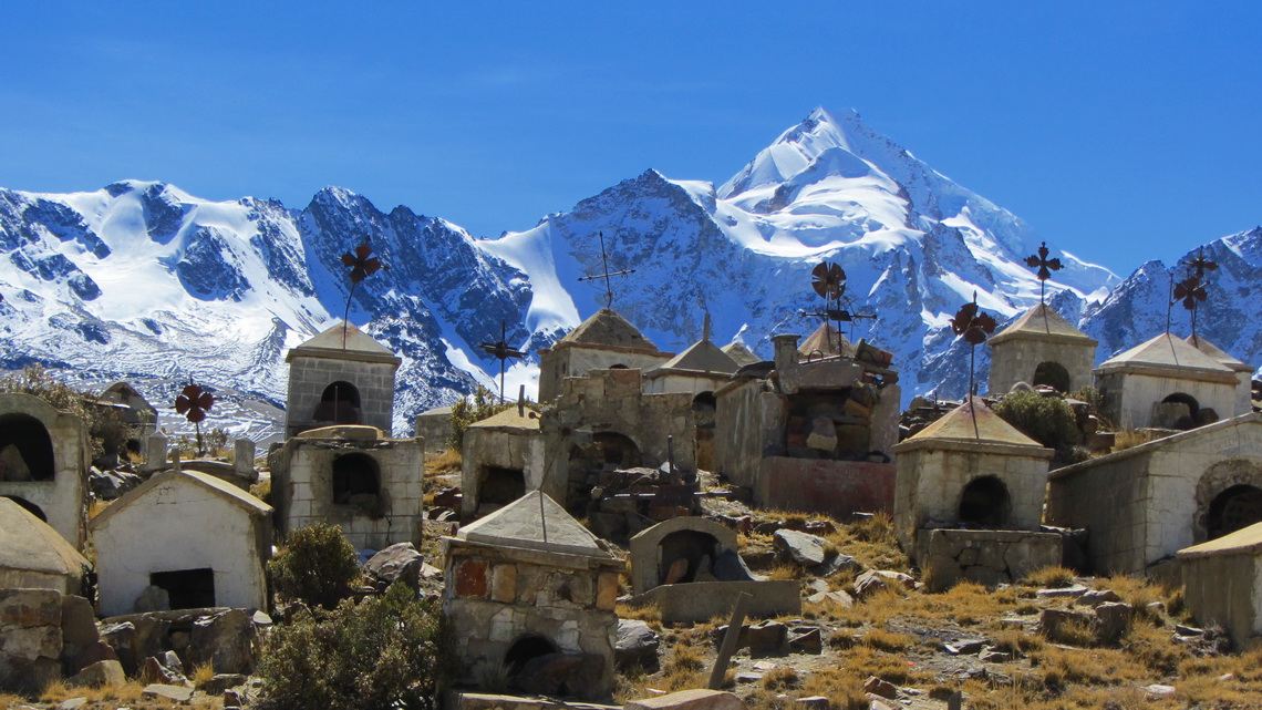
Graveyard of Milluni with Huayna Potosi


Life on Altiplano is hard and tough with very cold nights, excessive sun burning during the day and heavy precipitation in the rainy season. The indigenous tribe are the proud Aymara people. They achieved that their tongue is the second official language of native people in South America (after Guarani in Paraguay). The Aymara new year, Willkakuti is celebrated on their sacred place Tiwanaku in the longest night of the year at June 21st, when the sun turns. 

Read more …
8 comments

More Articles …

  1. Iquique and Arica
  2. Volcan Tinguiririca
  3. Chiloe and Valdivia
  4. Volcan Chillan and Volcan Antuco
  5. Volcan Lanin, the king of the lake districts
  6. Volcan Calbuco
  7. Carretera Austral
  8. Perito Moreno Parque Nacional and Cueva de los Manos
  9. Cerro Torre, Cerro Fitz Roy and Glaciar Perito Moreno
  10. Pali Aike and Torres del Paine - Christmas 2011
  11. Tierra del Fuego - Argentina
  12. Tierra del Fuego - Chile
  13. Punta Arenas and its surroundings
  14. Torres del Paine - Circuito Grande
  15. Penguins and more - Atlantic Coast of Patagonia South of Puerto Madryn
  16. Whales and more - Atlantic Coast of Patagonia North of Puerto Madryn
  17. Sierra de la Ventana
  18. Buenos Aires
  19. Uruguay - From Salto to Colonia
  20. Northeast Argentina and the Cascades of Iguazu
  21. From Asuncion to Ciudad del Este
  22. Samaipata and its environment
  23. From La Paz to Santa Cruz and the National Park Amboro
  24. Cordillera Real 2011 and Yungas
  25. From Uyuni to La Paz via Potosi
  26. Volcan Uturuncu and Laguna Colorada
  27. Volcan Tunupa and Salar de Uyuni
  28. Salta and Quebrada de Humahuaca
  29. Volcan Licancabur and Cerro Incahuasi
  30. San Pedro de Atacama and its environment
  31. Volcan Lascar
  32. From Copiapo to Antofagasta
  33. Ojos del Salado, the highest volcano on earth
  34. Cerro San Francisco
  35. From San Juan to La Rioja
  36. Mercedario, one of the giants in the Andes
  37. Cordon del Plata
  38. Sierra de las Quijadas
  39. Sierras de Cordoba
  40. South America - Brazil and Argentina
  41. Crossing the Equator - Baptism and Christmas
  42. Africa - Senegal, Guinea and Sierra Leone
  43. Europe - From Hamburg to Tenerife
  44. Our vessel, the Repubblica Argentina
  45. Monte Adamello
  46. Dolomites - Piz Cunturines
Page 4 of 6
  • Start
  • Prev
  • 1
  • 2
  • 3
  • 4
  • 5
  • 6
  • Next
  • End
Copyright © 2025 Marion and Alfred. All Rights Reserved. Designed by JoomlArt.com. Joomla! is Free Software released under the GNU General Public License.
Bootstrap is a front-end framework of Twitter, Inc. Code licensed under MIT License. Font Awesome font licensed under SIL OFL 1.1.
Powered by T3 Framework