Marion and Alfred Marion and Alfred
  • Home
  • Itineraries
    • Africa
      • Tanzania
    • Central America
      • Belize
      • Costa Rica
      • Guatemala
      • Honduras
      • Nicaragua
      • Panama
    • North America
      • Canada
      • Mexico
      • United States
    • South America
      • Argentina
      • Bolivia
      • Brazil
      • Chile
      • Colombia
      • Ecuador
      • Paraguay
      • Peru
      • Uruguay
    • From Hamburg to Buenos Aires
    • Asia
      • Cambodia
      • Laos
      • Thailand
      • Vietnam
    • Europe
      • Italy
      • Scandinavia
      • Spain
  • Mountains
    • Africa - Overview
    • Central America - Overview
    • North America - Overview
    • South America - Overview
    • Asia - Overview
    • Europe / Scandinavia - Overview
  • Pictures
  • Maps
    • Map Africa - Tanzania
    • Map America Entire
    • Map Central America
    • Maps North America
      • Alaska and Canada - West
      • Mexico
      • United States - Northwest
      • United States - Southwest
    • Maps South America
      • South America - Northwest
      • South America - Central
      • South America - South
    • Map Southeast Asia
    • Maps Europe
      • Italy
      • Portugal and Spain
      • Scandinavia
      • Spain - Mallorca
  • GPS Coordinates
    • Africa
    • Central America
    • North America
    • South America
    • Asia
    • Europe
  • Guestbook
  • About
    • About Marion and Alfred
    • Chronology
    • Newsletter
    • Contact
  1. You are here:  
  2. Home
  3. Itineraries
  4. South America
  5. Peru

Pacific Coast North of Lima

Southern Peru has Machu Picchu, Cusco and many other historical sites of the Incas but on the Pacific coast north of Lima are innumerable testimonies of ancient Peru, many still not detected or buried in the sand of the extreme dry Atacama desert which is a perfect conservation medium. The UNESCO world heritage site Caral is supposed to be one of oldest city on earth, founded 4500 to 5000 years ago. Other top highlights are the ruins of the pre Inca cultures Chavin, Moche, Sican and Chimu like Chan Chan the mightiest town of our world built with adobe, which we had visited in the year 1980.

Today there are huge cities like Trujillo or Chiclayo in the desert, where the sweet water from the glaciers of the Andes flows into the Pacific Ocean. Close are beautiful beaches, which are popular holiday destinations in the austral summer. The coast turns 90 degree on the most western point of the continent and the the impact of the cold Humboldt ocean current weakens. The landscape becomes more green and tropical the closer you come to Ecuador. The water temperature is pleasant and on the border are the only mangrove forests of Peru located. This region is very fruitful with many rice, bananas and sugarcane fields.

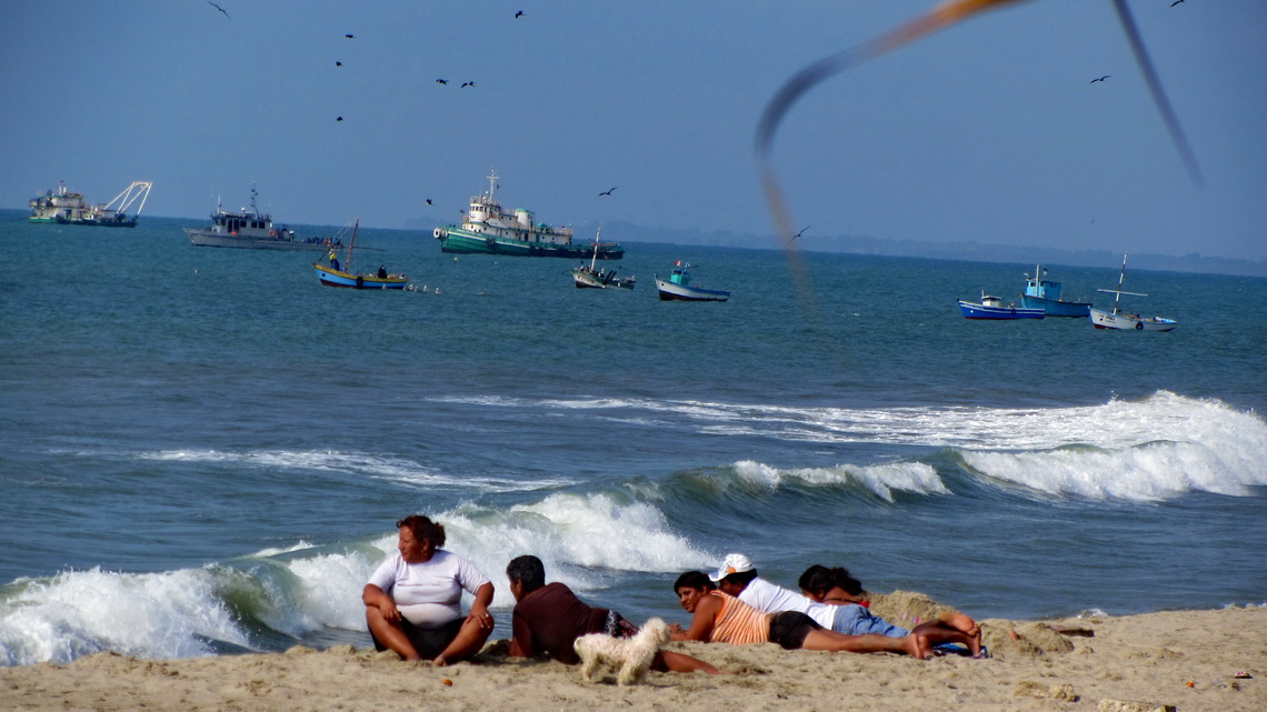
Peruvian family enjoying the beach of Zorritos

Approximately hundred kilometers Northwest of Lima is the incredible lush national park Reservas Nacional Lomas de Lachay, a true oasis in the dryest desert of our planet. The mist of the ocean is sticking so long on its crests that a rich fauna including raptors and flora with trees are able to exist. Lachay has a remote campground and superb hiking trails over and around its ridges. We were lucky because we spent a sunny day in Lachay, which is very rare.

Read more ... Add new comment

Cordillera Huayhuash

The spectacular Cordillera Huayhuash lies few kilometers North of the famous Cordillera Blanca and its main city Huaraz. It is a relative small range with stunning pinnacles sugared with enormous mass of ice and snow. Nevado Yerupaja is with 6617 meters sea-level its tallest peak and the second highest mountain of both: Peru and the tropics. Like all other major peaks of the Cordillera Huayhuash access to its summit is extremely difficult and dangerous. Even today some peaks are without any successful ascents for years.

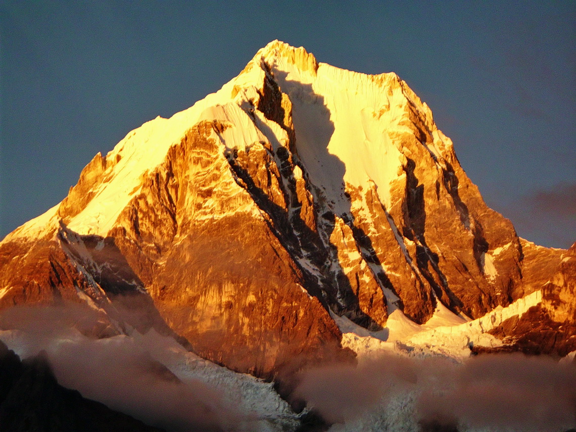
North-east face of Nevado Yerupaja at sunrise


Thanks to the book and movie Touching the Void Cordillera Huayhuash became very popular in the last years: It shows the unbelievable story of Joe Simpson and Simon Yates when they climbed up the south-west face of 6344 meters high Siula Grande in the year 1985. On the way down Joe Simpson broke his leg. His companion roped him down the steep, dangerous and difficult north-west ridge. Suddenly Joe Simpson hung under an overhang and he couldn't move. There was no more rope. Simon was standing in deep powder on the very steep ridge. The weight of Joe Simpson moved him slowly but constantly to the abyss. His only choice to survive was to cut the rope. Joe fell into an huge crevasse. Simon searched him desperately but couldn't find him. He returned to the camp and was sure that Joe didn't survive the crash but Joe found a way out of the crevasse through the glacier with his broken leg. After three days he came back totally exhausted to the camp in the night just before his companion wanted to leave.

Cordillera Huayhuash can be circled in a 10 days hike with many high cols (two more than 5000 meters sea-level), pristine lagoons and beautiful campsites. Only one little village is on its way - a lot of food and other stuff must be carried. Thus we searched for mules in Chiquian, the last bigger settlement on the western side of Cordillera Huayhuash and reachable via a decent paved road.

Read more ... Add new comment

Ayacucho, Huancavelica and Lima

Ayacucho is supposed to be the second most attractive and fascinating town in the Peruvian Andes (after Cusco). Ayacucho, also called Huamanga by its 180,000 inhabitants, has a huge colonial inheritance with many beautiful churches and buildings. Andean life is very traditional and authentic because the tourism industry has neglected it more or less so far. The region of Ayacucho was the center of the Wari culture (700 - 1100 AD), which dominated the southern part of Peru between the city Chiclayo and lake Titicaca.

The name Ayacucho means corner of the death. It is located in a poor, rural and remote region. In the early 1980th the Maoist guerrilla organization Sendero Luminoso (Shining Path) was founded here and a brutal civil war with Peru's military government broke out. More than 70,000 people were killed until 1992, mainly innocents in the villages of this region. The shadows of this terrible time are still visible and perceptible, for instance most of the elderly people are very shy or there are doors secured with eight heavy locks.

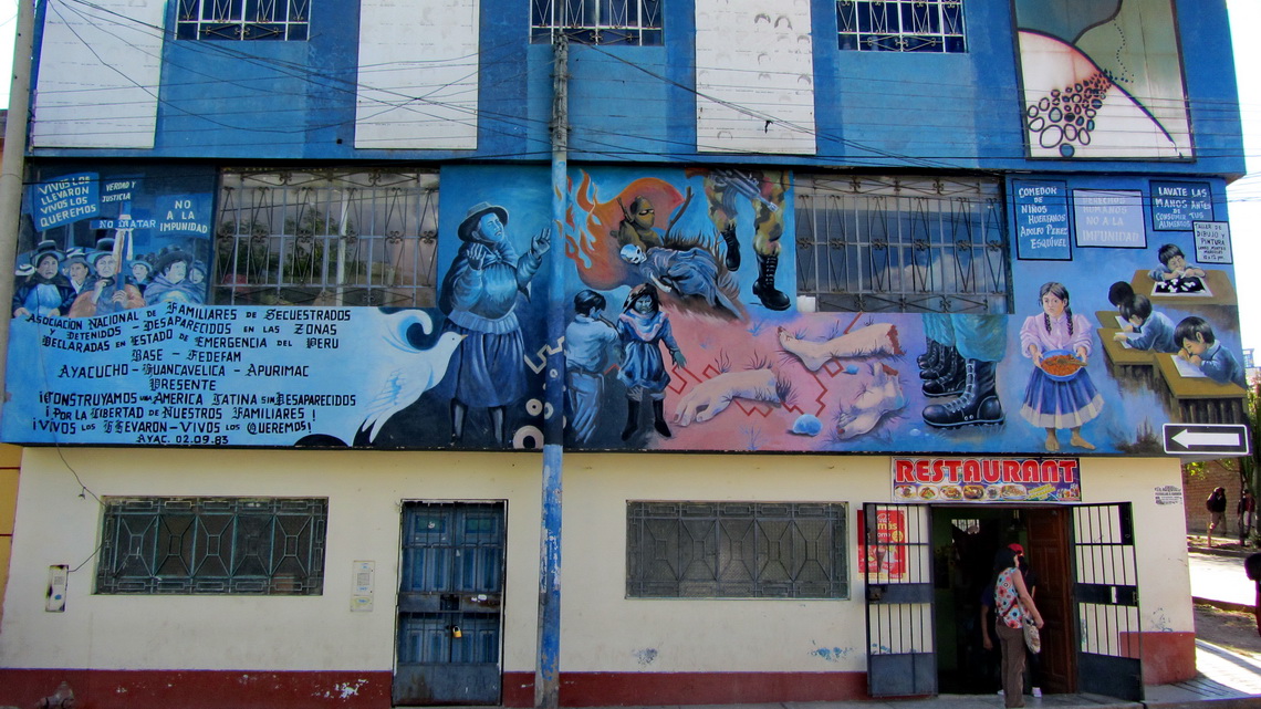
Wall of the sad Memorial Museum for the murdered people


We came to Ayacucho from Cusco on Saturday late afternoon, August 10th 2013. This street had been partially horrible because it was under construction. Two times we were nearly in detonations with huge falling rocks. Sometimes we had to pass awful deviations on narrow and steep rugged or muddy dirt roads. Like in most cities of South America there were high bumps every few meters on the street to prevent drivers from speeding. On a very high one our car gave a loud strange bang and the left top side moved down a little bit weirdly.

Read more ... Add new comment

Amazonia - Peru

The grandiose river Amazon is with its uncountable tributaries with a length of more than 6000 kilometers the biggest river system and tropical rain forest on earth. The complete basin of Amazonia covers more than a third of South America. Besides exploitation, deforestation and environmental pollution wild life is abundant and biodiversity unique. Thus it is called the green lung of our planet. Amazonia is a remote, lush, green, hot, humid and wet area covered with rain jungle but with just few streets and settlements. Transportation on its rivers and by air is very often the only choice, for instance to Iquitos which is with more than 400,000 inhabitants the largest city in the Peruvian Amazona. Indigenous life still exists with many legends, myths and priceless knowledge about the secrets of the rain forest.

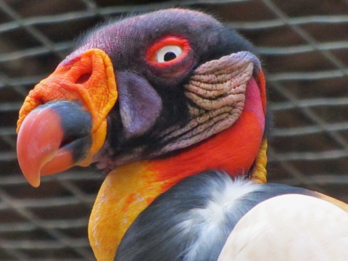
Condor of Amazonia in the zoo of Pucallpa

Its main sources Rio Marañon and Rio Ucayali rise in the Peruvian Andes on its eastern slopes. Peru has a proportion of 12 percent of Amazonia. It covers more than 60 percent of Peru's size but less 10 percent of its people are living there. The Peruvian people call their Amazonia La Selva - virgin forest. After our car had gotten broken in Ayacucho we realized that we had to wait more than three weeks for spare parts from Germany. Thus we took light backpacks and traveled by public transportation into the Peruvian heart of Amazonica, which was an unforgettable stunning itinerary for us.

Read more ... Add new comment

Cusco, Machu Picchu and Puno

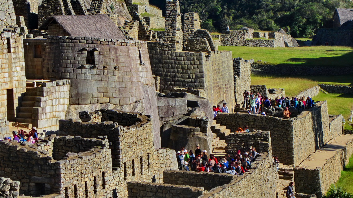
Machu Picchu is probably the most famous tourist destination in South America. The mystic Inca site is located isolated on the eastern slope of the Andes in a marvelous and nearly tropical environment. Its buildings are in very good conditions. Thus life of the Incas can be imagined well besides thousands of visitors every day. In addition it shows the fabulous engineering and construction capabilities of the Incas.

Buildings of Machu Picchu with the only round shaped house


But Machu Picchu is not the only historical site of the Incas in southern Peru. Cusco was the navel and center of the Inca world. Today the city with more than 300,000 people is the major hub for tourists in Peru but also here you can feel former Inca life. Close to the town is the Inca fortress Saqsaywaman, on the way to Machu Picchu in the sacred valley are Ollantaytambo and Pisaq.

After crossing the Bolivian border we traveled along the western shore of lake Titicaca. The main city Puno is famous for its festivals and the floating islands on the lake Titicaca, established and inhabited by the indigenous Uro people. Nearby are Chullpas, large tomb towers put up by the pre Inca culture Colla for their important people. Later the Incas used and enhanced their Chullpas.

Read more ... Add new comment

Cerro Yana Sanca Grande and Cotahuasi Canyon

Cerro Yana Sanca Grande is an unknown mountain directly on the street between Arequipa to the Cotahuasi Canyon, which is to Peruvian definition the deepest gorge on earth. Besides its height of 5496 meters sea-level, this mountain is dwarfed by the giants of Nevado Coropuna and Nevado Solimana, but it provides stunning and superb views.

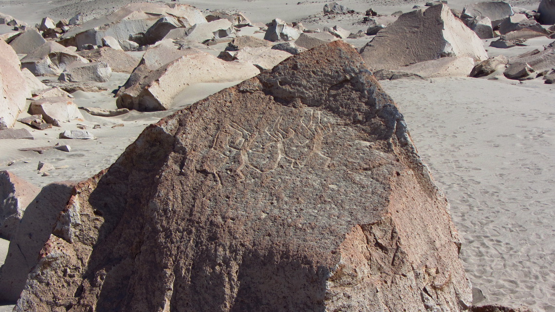
The area around Cotahuasi Canyon is quite remote because it can be accessed only by dirty roads of more than 150km and high passes over 4700 meters. It is a beautiful valley with hot springs, Inca ruins and picturesque villages. On the way to the Cotahuasi Canyon is the lower valley of the Colca river, now named Rio Majes. It it a fruitful region with pleasant warm climate and interesting archaeological sites like the petroglyphs of Toro Muerte. There are other nice petroglyphs in Miculla which is close to the town Tacna on the frontier to Chile.

We came in the late evening of July 20th 2012 to Toro Muerte and could stay the night in the solitary parking lot in front of the petroglyphs. It is located in a dry side valley of Rio Majes near the village Corire.

Line drawings in the desert


Read more ... Add new comment

Condors and more - Colca Canyon

The Colca Canyon is one of the more famous and attractive tourist destinations of Peru in the vicinity of Arequipa. It is with approximately 3200 meters (south side) respectively 4200 meters (north side) depth mightier than the Grand Canyon in USA. The upper valley is a fruitful gorge with many terraces and picturesque little villages like Chivay and Cabanaconde. Thanks to the glaciers on the upper slopes of the valley and a perfect irrigation system, water is plentifully available.

Other highlights are some hot springs and trekking down to the bottom of the canyon, to the little paradise Sangalle. In this oasis bananas and other tropical fruits are growing.

But the star of the Colca Canyon is the Condor, the king of the Andes and biggest raptor on earth. Cruz del Condor is a holy place of the local people because every morning many Condors start their daily journey from here. The steep eastern walls provide perfect nestling places for them.

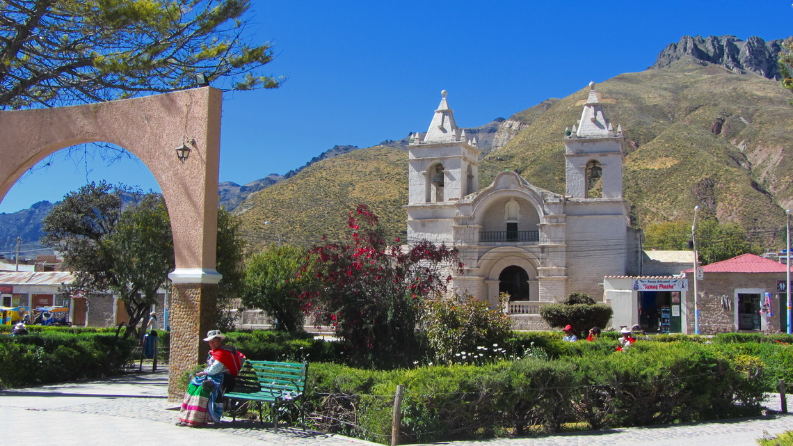
Condors fly mainly by thermal up winds; thus they have to wait until the sun heated the rocky walls. We came to Chivay at lunch time on July 8th 2012 and it begun to rain, which is very unusual in the dry season. Chivay is the local district capital with reasonable facilities like good restaurants.

Main square of Chivay

Read more ... Add new comment

Nevado Chachani and Volcan El Misti

Arequipa is with more than 1 million inhabitants the 2nd biggest city in Peru. It is located on the edge of the Atacama desert to the Cordillera Volcanica at 2400 meters see-level. Its major landmark is the still active Volcan El Misti, a perfect cone of 5822 meters high. North of the volcano is the huge snowy mountain Nevado Chachani with several peaks. Its main summit achieves 6075 meters and it is supposed to be one of the most accessible and easiest 6000er on earth. South of the volcano and also in the townscape of Arequipa is the very eroded volcano Nevado Pichu Pichu with seven summits. On its northern side is the marvelous lake Laguna Salinas Blanca with abundant bird life.

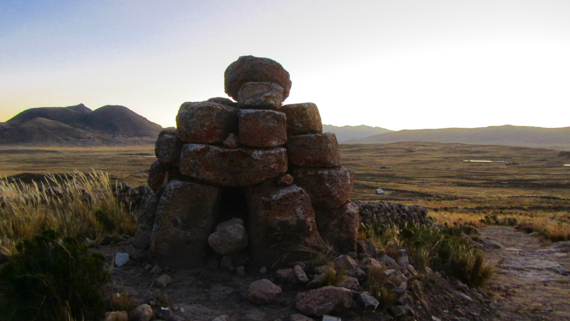
Approximately 100km southwest of Arequipa is its coastal resort village Mollendo, which is very busy in the austral summer. This was our first destination after we had crossed the Bolivian / Peruvian border in Desaguadero on June 22nd 2012 to meet a friend from Germany. We spent our first night in Peru after 31 years on a side street to ruins in the Aymara - Lupaca reservation. In the evening we explored the area and found some strange cairns.

Cairns with human bones - tombstones?

Read more ... Add new comment
Copyright © 2023 Marion and Alfred. All Rights Reserved. Designed by JoomlArt.com. Joomla! is Free Software released under the GNU General Public License.
Bootstrap is a front-end framework of Twitter, Inc. Code licensed under MIT License. Font Awesome font licensed under SIL OFL 1.1.
Powered by T3 Framework