Marion and Alfred Marion and Alfred
  • Home
  • Itineraries
    • Africa
      • Tanzania
    • Central America
      • Belize
      • Costa Rica
      • Guatemala
      • Honduras
      • Nicaragua
      • Panama
    • North America
      • Canada
      • Mexico
      • United States
    • South America
      • Argentina
      • Bolivia
      • Brazil
      • Chile
      • Colombia
      • Ecuador
      • Paraguay
      • Peru
      • Uruguay
    • From Hamburg to Buenos Aires
    • Asia
      • Cambodia
      • Laos
      • Thailand
      • Vietnam
    • Europe
      • Italy
      • Scandinavia
      • Spain
  • Mountains
    • Africa - Overview
    • Central America - Overview
    • North America - Overview
    • South America - Overview
    • Asia - Overview
    • Europe / Scandinavia - Overview
  • Pictures
  • Maps
    • Map Africa - Tanzania
    • Map America Entire
    • Map Central America
    • Maps North America
      • Alaska and Canada - West
      • Mexico
      • United States - Northwest
      • United States - Southwest
    • Maps South America
      • South America - Northwest
      • South America - Central
      • South America - South
    • Map Southeast Asia
    • Maps Europe
      • Italy
      • Portugal and Spain
      • Scandinavia
      • Spain - Mallorca
  • GPS Coordinates
    • Africa
    • Central America
    • North America
    • South America
    • Asia
    • Europe
  • Guestbook
  • About
    • About Marion and Alfred
    • Chronology
    • Newsletter
    • Contact
  1. You are here:  
  2. Home
  3. Itineraries
  4. South America
  5. Argentina

Most northern part of Ruta 40

The more than 5200 km long street Ruta 40 strechtes from the very South of Patagonia to the Northwest corner of Argentina along the Andes. It is one of the most famous, legendary and scenic roads on earth. Few years ago travelers had to deal with difficult dirt and gravel parts including severe river crossing. Nowadays most of the street is tarred or pavement is in construction or planned.

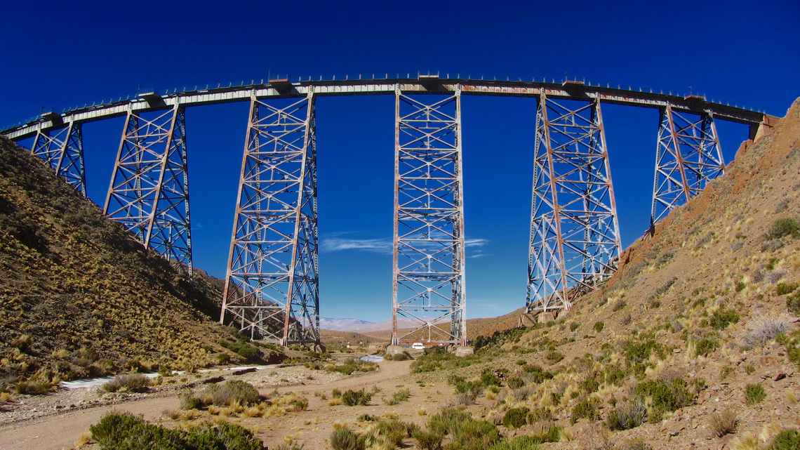
But the most northern part is still as rough as in former times. In addition it passes its highest point, the dreaded Abra del Acay. With 4895 meters sea-level it is higher than the summit of Montblanc, the tallest peak of the Alps. South of this col are beautiful villages like Cachi, Payogasta and La Poma with some touristic infrastructure. North is the mining town San Antonio de los Cobres with its engineering masterpiece La Polvorilla, an impressive railway viaduct with about 50 meters high. The largest salt lake of Argentina Salinas Grandes follows. Finally the Ruta 40 merges with Ruta 9 to the border to Bolivia via the town Quiaca.

Railway bridge Viaducto La Polvorilla

Read more ... 2 comments

Cafayate and the Yungas of Argentina

The little town Cafayate and its environment is a natural treasury on foot of the Andes in the northwest corner of Argentina, more than 1500km away from Buenos Aires. After Mendoza it is the second most important wine region in Argentina. 200km North of Cafayate is the pleasant holiday destination Tafi del Valle in the first valley of the mountains.

The Yungas are the rainforests on the eastern shore of the Andes at lower altitudes from 500 meters to 2000 meters sea-level. The are situated nearly the entire Andes ranges from Venezuela to the province Salta in Argentina. Clouds from the Atlantic Ocean are sticking on the first mountain ranges. In Argentina these clouds are sometimes renewed in the Brazilian highlands, which are covered with  thick jungle. Thanks to tropical temperatures and high precipitation wildlife is abundant in the Yungas zones. For instance in Argentina's Yungas are: Tapirs, Peccaries, Pumas, Monkeys and a lot of different kind of birds.

Landscape between Tafi del Valle and Cafayate


End of February 2013 we had parked our VW California in the premises of our friends Cristian and Sebastian in the northern suburban Tigre of Buenos Aires to fly to Germany. They have several medium-sized motor-homes which they rent to tourists, see their webpage www.andeanroads.com. In addition they offer a small but cozy campsite in the region of Buenos Aires and a parking lot for motor-homes (GPS coordinates: S34 27.058 W58 40.916). Cristian loves Volkswagen Bullies, especially campers. When we came back to Argentina on May 22nd 2013, he had a nice welcome surprise for us.

Read more ... 2 comments

Esteros del Ibera

600 km North of Buenos Aires the terrific wetland reserve Esteros del Ibera offers abundant wildlife like crocodiles, capybaras, monkeys, deers and a lot of different kind of birds, reptiles and insects. It is a pristine flat lowland with many lakes, swamps and morasses. Thanks to its remoteness only few people live in this fantastic region and tourism is a little bit underdeveloped. Colonia Carlos Pellegrini is the only larger settlement with few hundred inhabitants but all needed facilities like little hostels, some basic food shops and one campsite.

But access to this paradise can be difficult because a 80km dirt road leads from the South (Mercedes) to Carlos Pellegrini with some ugly, muddy and watery parts after rainfalls, which are quite often. The more rough northern course from San Tome is twice the way and includes some long sandy stages.

Half the way to Buenos Aires is the superb Parque Nacional El Palmar on the western shore of Rio Uruguay with the last bigger forests of the origin Yatay Palm Trees in Argentina, nice beaches and also stunning wild life. 

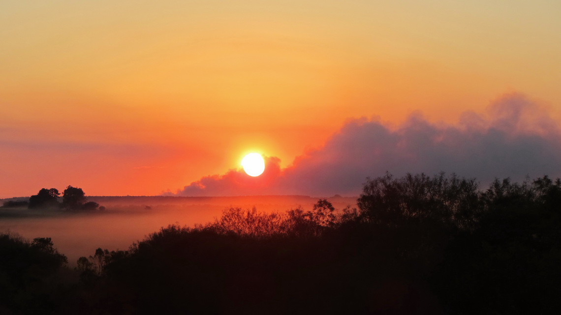
We came back to Argentina on February 15th 2013 and we decided to drive directly the northern road to Carlos Pellegrini, which was a little bit sandy but dry - no big deal with our car.

Sunset on the way to Carlos Pellegrini with some smoke from burning fields

Read more ... Add new comment

Volcan Lanin, the king of the lake districts

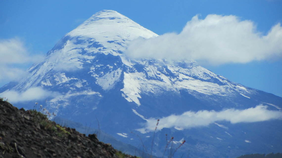
Volcan Lanin is with 3746 meters sea level the highest point of both lake districts, Argentina and Chile. It overtowers all nearby mountains more than several hundreds meters, only Cerro Tronador more 200km South achieves with 3478 meters a similar altitude. Volcan Lanin is a perfect cone of more than 2500 meters vertical highness and it is supposed to be one of the most beautiful mountains on earth. 

Majestic Volcan Lanin seen from the ascent to Volcan Achen Niyeu

The access to the summit of Volcan Lanin is relatively easy: First a six to seven hike to the upper hut Refugio CAJA from the ranger's office on the Paso Mamuil Malal or Tromen on its Argentine side, followed by another six hours trip over snow, scree and some rocks to the top. Due to several accidents on the mountains are the rangers very strict; they check your whole equipment like crampons and if you can use them properly.

In Argentina is the marvelous and huge park Parque Nacional Lanin North and South of the volcano with superb hiking capabilities, magical forests and beautific lakes.

Read more ... Add new comment

Perito Moreno Parque Nacional and Cueva de los Manos

Parque Nacional Perito Moreno is with approximately 1200 visitors one of the remotes national park in Argentina. Perito (master) Francisco Moreno explored the geography, fauna and flora of Patagonia at the turn of the 19th / 20th century. Not only this park is named after him, also a small town and the famous glacier (see article Cerro Torre, Cerro Fitz Roy and Glaciar Perito Moreno).

This park is a rough and windswept area decorated with cobalt and aquamarine blue lakes, snowy peaks and glaciers. It is located on the southeast side of Cerro San Lorenzo, which is with 3706 meters sea level one of the highest mountains in Patagonia. The entrance to the Perito Moreno national park is free of charge as well as two basic campsites.

200km northeast is the cave Cueva de los Manos, which had been declared as world heritage by the UNESCO in 1999. There are fabulous and more than 9000 years old paintings, mainly of left hands.

We had some stormy weather, when we came to the lake Lago Burmeister in the Perito Moreno national park on January 10th 2012. The campsite is very nice in forest directly on the lake. Fortunately it provides good wind protection. We walked half the way on the north shore of the lake and we enjoyed the nature besides the hefty wind.

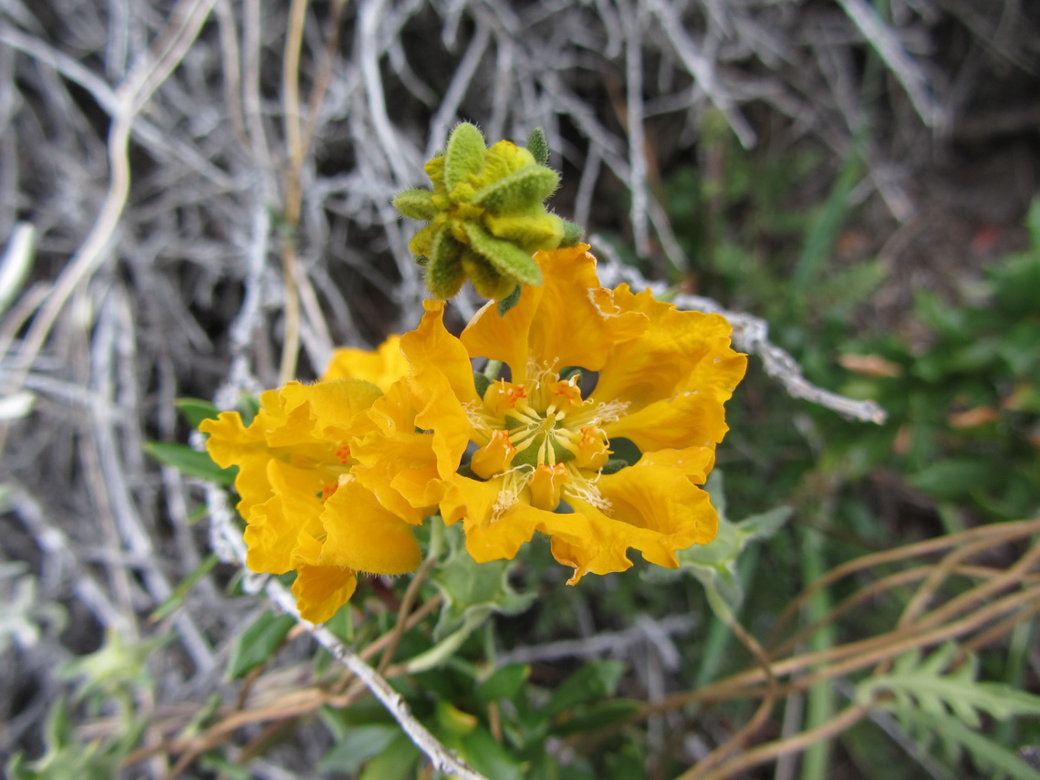
Yellow flowers


Read more ... Add new comment

Cerro Torre, Cerro Fitz Roy and Glaciar Perito Moreno

UNESCO declared the Los Glaciares National Park in the province Santa Cruz a World Heritage Site in 1981. In the southern part it includes the Perito Moreno glacier, a white giant whose 5 km long front rises 60 meters above the lake Lago Argentina, the largest lake in Argentina. Perito Moreno is one of the last glaciers which increases still and it moves more than 2 meters per day. Great masses of ice crash every hour into the lake.

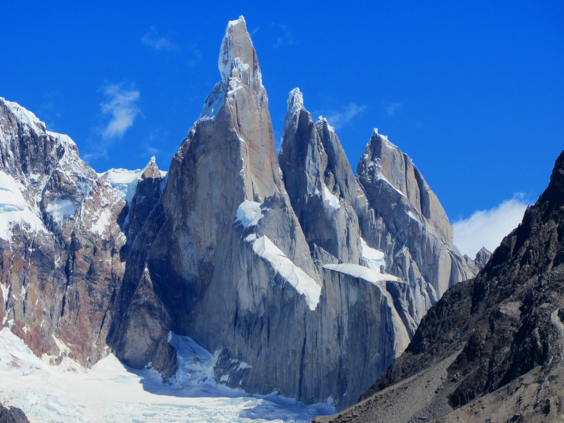
In the northern part of the Los Glaciares National Park are some of the most imposing mountains of on earth. The granite monolith Cerro Fitz Roy is with 3405 meters the highest point of southern Patagonia, which rises which its satellites directly over the Argentine steppe. Behind is a chain of pinnacle, which are the eastern border of the Campo del Hielo Sur, the biggest ice-field outside the poles and Greenland. The most famous, tallest and challenging is 3102 meter high Cerro Torre, both  dream and nightmare of every top climber.

Cerro Torre, Torre Egger and Cerro Standhardt

Read more ... Add new comment

Tierra del Fuego - Argentina

There are two bigger cities in the Argentine part of Tierra del Fuego: Rio Grande and Ushuaia. The first one is a military base and famous for sport fishing. The latter one is the perfect synthesis of sea, ice and mountains. Ushuaia is situated on the Beagle Channel with huge, steep and glaciated pinnacles in its background. The natural Beagle Channel connects the Atlantic with the Pacific Ocean. It was discovered by Charles Darwin's expedition in the 19th century and named after the used vessel.

But Ushuaia has more superlatives: It is the main gateway to the Antarctic, 90% of the visitors start from here. It is the southernmost city of the world if you consider the Chilean Puerto Williams as a village (60,000 inhabitants versus 2,500). It is literally the end of the world. It has the most southern ski resort, starting more or less at sea level. It is the main touristic destination of Tierra del Fuego and consequently a little crowded in its seasons.

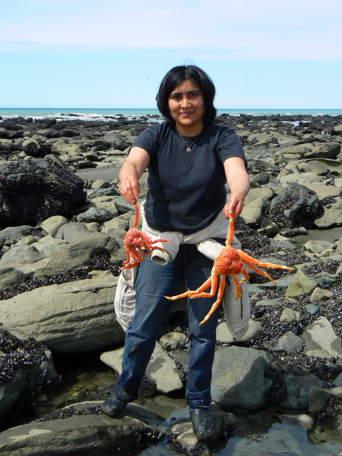
On the way to Rio Grande we made a rest on the shore of the Atlantic Ocean and strolled a little bit on its beach. Several other people were looking for sea food. Suddenly Marion detected something red under the rocks in the water - two very big sea spiders. She called two girls and they were very exited and happy!

Lucky Argentine girl with two Centollas - Sea Spiders


Read more ... 1 comment

Penguins and more - Atlantic Coast of Patagonia South of Puerto Madryn

South of Puerto Madryn are several highlights like the Museo Paleontologico Egido Feruglio in Trelew with stunning life-sized dinosaur exhibits, the Natural Park Cabo Dos Bahias with rich wildlife, the Monumento Natural Bosques Petrificados with its fossilized gigantic trees and the Parque Nacional Monte Leon with more than 75,000 breeding Penguin pairs in springtime and early summer.

Trelew is a midsized town of about 100,000 people, located 65 km South of Puerto Madryn. Its origin is Welsh and its name is a homage to Lewis Jones, who promoted railway expansion in the province Chubut: tre - town and lew - Lewis. We arrived in Trelew in the late afternoon of October 26th 2011 and spent the night on the shore of the Parque Recreativo Laguna Cacique Chiquichano, close to the planetarium.

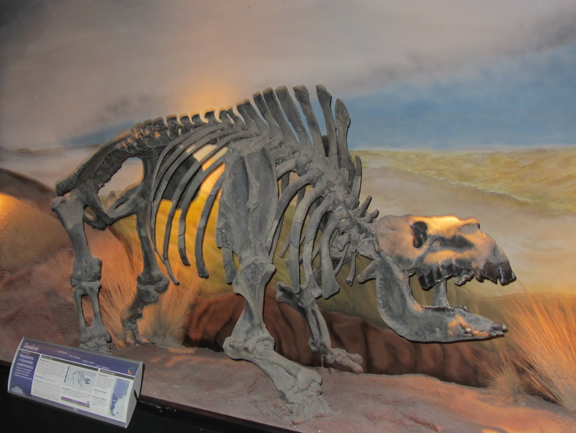
Trelew is famous for its outstanding natural-history museum Museo Paleontologico Egido Feruglio with more than 1700 fossils. It is the paleontological center in Patagonia with the university of Trelew.

2.5 million years old Rhino or Hippo

Read more ... 1 comment

Whales and more - Atlantic Coast of Patagonia North of Puerto Madryn

The 3600 sq km big Peninsula Valdez in the province Chubut is one of the nature treasures of Argentina. It bustles of abundant wildlife: Sea Lions, Elephant Seals, Guanacos, Rheas, Penguins and different kinds of birds. But the star is the nearly 12 meters long and 27 tonnes heavy Southern Right Whale. Female bear young and breed in springtime in the shallow waters of the bays between the peninsula and continent. Peninsula Valdez is a World Heritage and consequently protected accordingly. In its center is one of the lowest depression in South America with salt lakes up to 42 meters below sea level. 

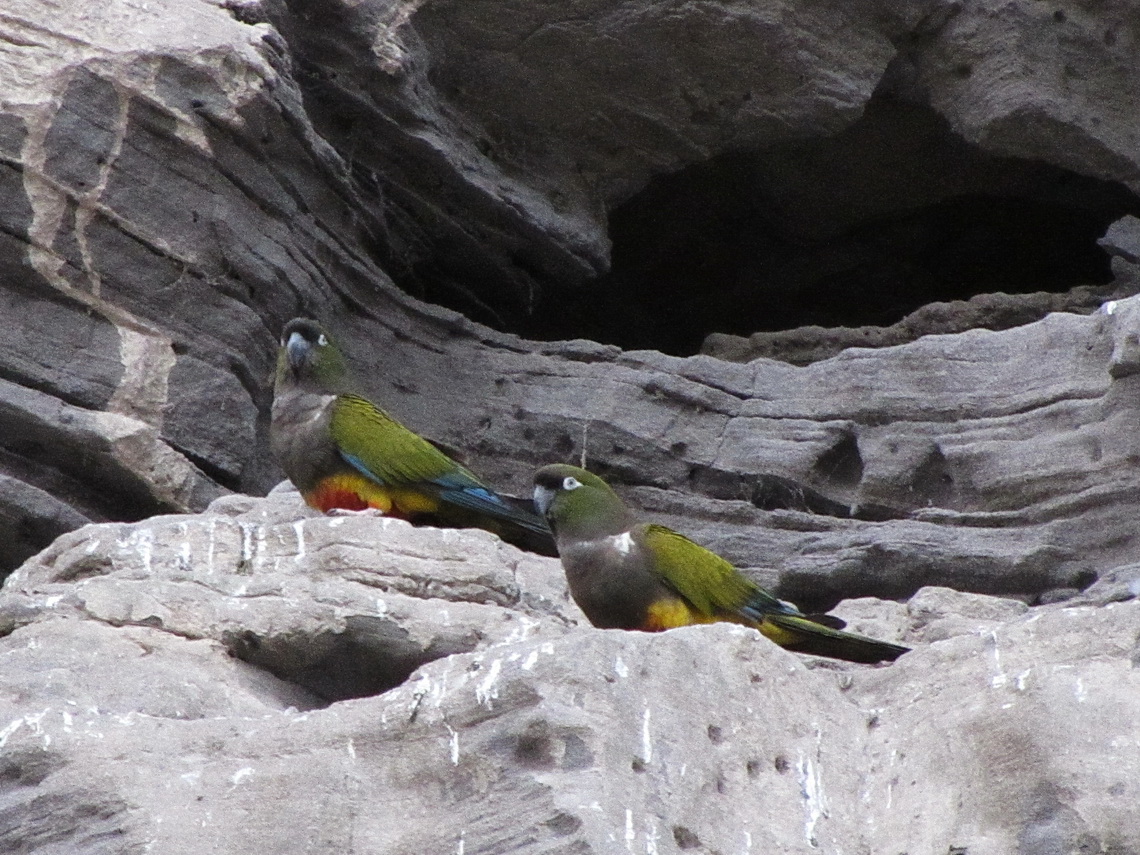
Few hundred km North and 40 km East of the city Viedma is the village Balnerio El Condor with maybe the largest Parrot colony of the world: More or less 35,000 dens of parrots are in its cliff faces. Close is an outstanding Sea Lion colony in La Loberia with several hundred animals.

Pair of Parrots

Read more ... 2 comments

Sierra de la Ventana

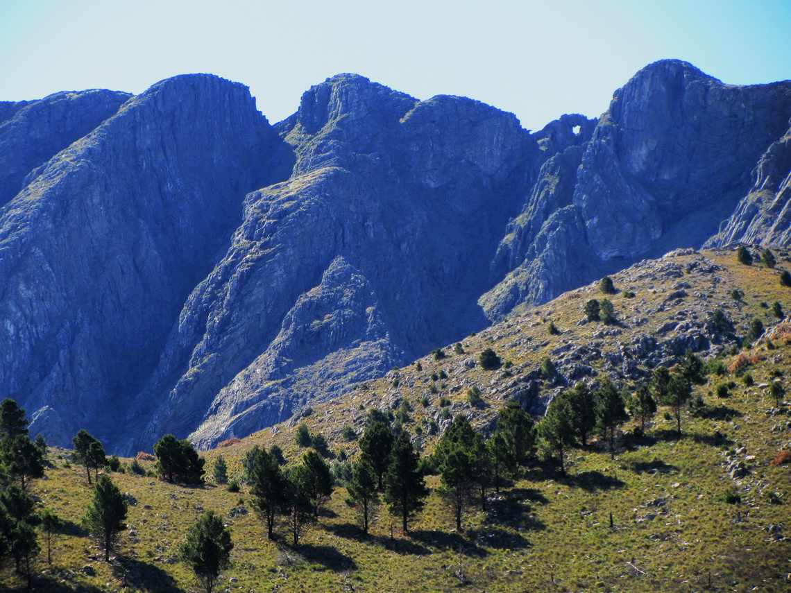
The Sierra de la Ventana is the highest mountain range in the vast province Buenos Aires few kilometers North of Bahia Blanca and 800 Southeast of the capital. There is also the tallest peak close to the Atlantic coast of Argentina, the Cerro Tres Picos with 1239 meters sea level. Ventana means windows: There is a huge one (approx 8 by 5 meters) close to the summit of the Cerro la Ventana. These mountains are supposed to be the oldest in Argentina, but they are relatively rocky.

This region is one of the top holiday destinations with a lot of nature and outdoor activities like hiking, but sometimes a little bit crowded. Some parts of these mountains are protected by the Provincial Park Ernesto Tornquist and consequently regulated by rangers. Ernesto Tornquist is the founder of the biggest town Tornquist in this area.

 Cerro de la Ventana with the window (top right part)


Read more ... Add new comment

Buenos Aires

Buenos Aires is the capital of Argentina and it is supposed to be one the ten most populated urban centers of the world. According to Jorge Luis Borges, one of the greatest and famous writers of Argentina, Buenos Aires is breathtaking ugly. On the other hand it is an overwhelming cosmopolitan metropolis with unbelievable nice people, marvelous places and stunning buildings.

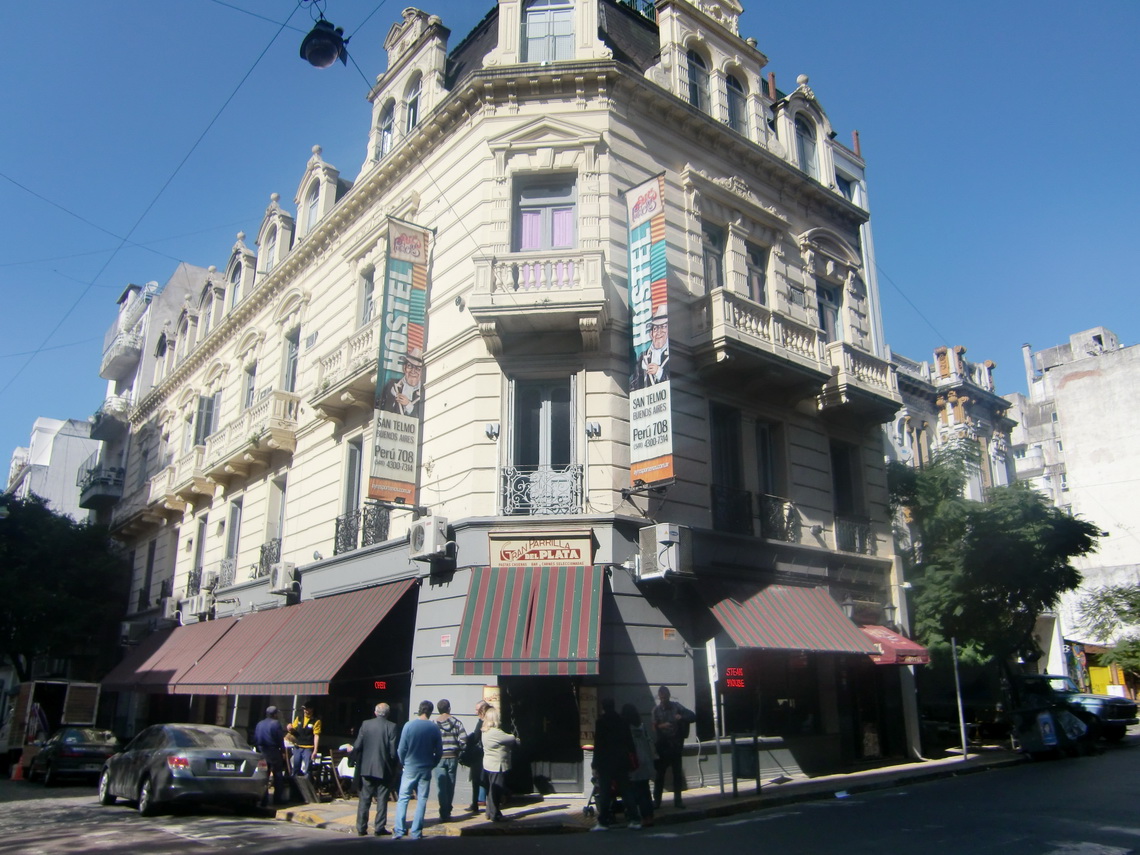
We spent 3 days in Buenos Aires mid of August 2011 before we flew to Germany and 2 days after our return beginning of October. We parked our camper in Colonia del Sacramento in Uruguay, close to the ferry port. Colonia is on the other side of the Rio de la Plata and there is a  frequent  ferry boar service to Buenos Aires. We found the very nice hostel San Telmo (Peru 708) in San Telmo, one of the most exciting quarters of Buenos Aires.  

Our hostel San Telmo


Read more ... 1 comment

Northeast Argentina and the Cascades of Iguazu

The Northeast of Argentina is a little bit different to the other parts: Lush and dense vegetation with some forests thanks to lots of water due to huge rivers and swamps. The absolute highlight is the Cascades of Iguacu in the very North of the province Misiones. The Southern part belongs to Argentina, the Northern to Brazil. Enormous amount of water is falling 70 meters down in more than 250 hundred cascades from a flat Basalt plateau. These waterfalls are ones of the top destinations in South America; thus many tourists visit them and there is a good infrastructure.

Interesting are the ancient Jesuit villages like San Ignacio Mini in Misiones, some other National Parks like Rio Pilcomayo in the province Formosa on the border to Paraguay and hot springs in the county Entre Rios.

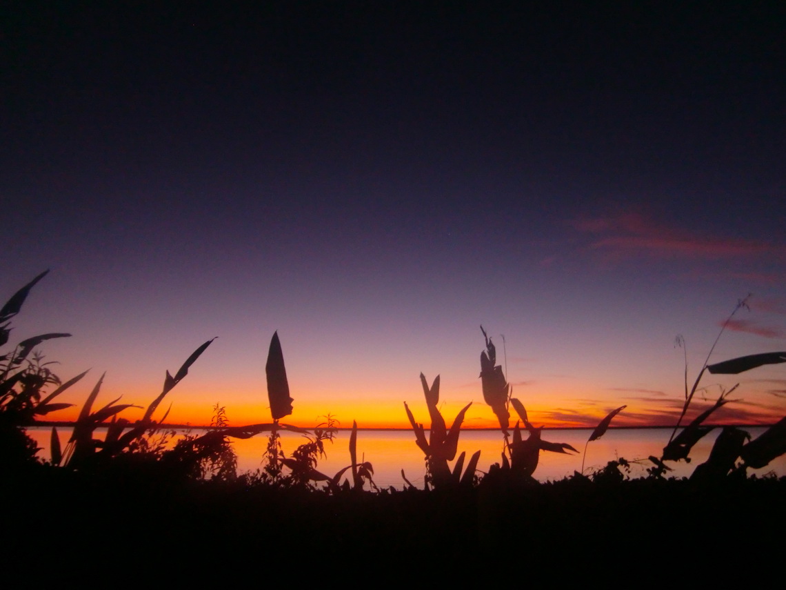
After returning to Argentina and fixing our starter problems with the car (see article Samaipata and its environment) we visited the beautiful lake Laguna Blanca in the National Park Rio Pilcomayo. There was a lot of water because it had rained the last two days, but now the sun was shining on a clear sky and it was pleasant warm during the day. It was the first time this year we used our rubber boots and we were happy about them.

Laguna Blanca after sunset 

Read more ... 1 comment

Salta and Quebrada de Humahuaca

Salta is one of the most marvelous cities in South America. It is the only one in Argentina with the add-on "La Linda", which means The Beautiful. No other city in Argentina has so many historical buildings, places and parks. Salta is with approximately 400,000 inhabitants the second biggest city in northwest Argentina. Salta has a pleasant warm climate even in late autumn because it is situated just 1200 meters high on the eastern slopes of the Andes. Closed to Salta is the valley Quebrada de San Lorenzo with more or less tropical flora and fauna. North of Salta in the province Jujuy is the famous gorge Quebrada de Humahuaca, which directs to the border of Bolivia.

A side valley of the Quebrada de Humahuaca leads to the pass Paso de Jama to Chile. We came down this way from Chile, after our disaster with the shock absorbers; see last section in the article about San Pedro de Atacama and its environment. It turned out in Salta that the shock absorbers we had found in Chile were working in the wrong direction. Now we knew why we had become nearly seasick in our car! And we had two Indian Ladies in our car.

We found original German shock absorbers in Salta and a very good Volkswagen technician: Javier L. Torres, whose workshop is in the Catamarca 1050. He is a specialist for engines and he realized that some of the hydraulic tappets of our engine are not tight. Indeed 4 of them had scratches and oil was leaking into the cylinders which weakened the power of the engine and might reduce its life time. He had to disassemble the engine more or less completely, fortunately it worked afterwards perfectly without the buzzing noise it had before.

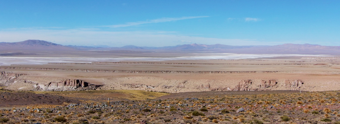
On the way down of Paso de Jama we passed wonderful salt lakes, villages and landscapes in the province Jujuy.

The Argentine side of the Paso de Jama

Read more ... Add new comment

From San Juan to La Rioja

Between San Juan and La Rioja are the National Parks Talampaya and Ischigualasto / Valle de la Luna in the deserts few km East of the Andes. Both are UNESCO world heritages sites and famous for the dinosaurs, which were found there.

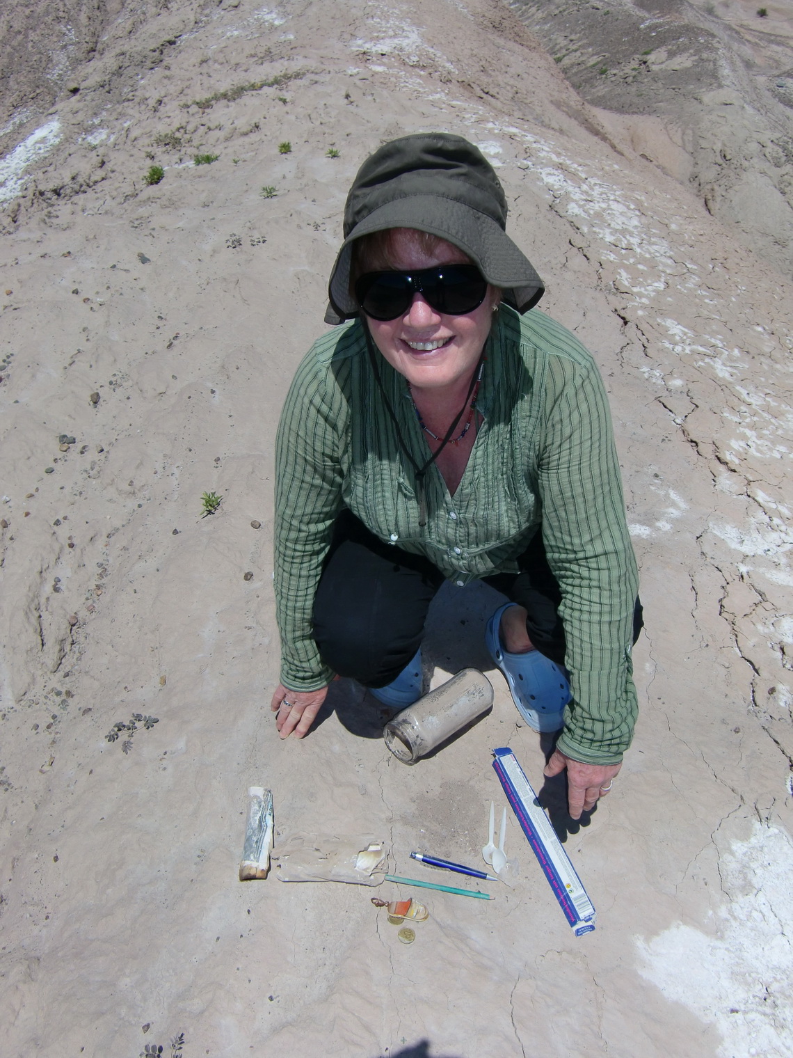
After our ascent to Mercedario we stayed two days at the very nice camping place Palmar del Lago on the artificial lake  Dique Ullum, 30km west of San Juan. In this very dry area we found two Geocaches. Both were in miserably conditions and need consequently some rescue. On the first one (Falla La Laja), we were the first who found it after 10 months. The latter one (Ullum) had been found in September 2009 the last time!

Marion rescues the Ullum Geocache 

Read more ... Add new comment

Cerro San Francisco

Cerro San Francisco is with 6018 meter high probably the easiest 6000er of our world, both access and ascent. It is situated on the border between Argentina and Chile and closed to the Paso San Francisco, which is with 4753 meters one of the highest pass in the Andes. This pass has the highest density of 6000er on earth outside of the Himalayas. Five of the ten tallest peaks of the Andes are closed to it, including Ojos de Salado which is the second after Aconcagua.

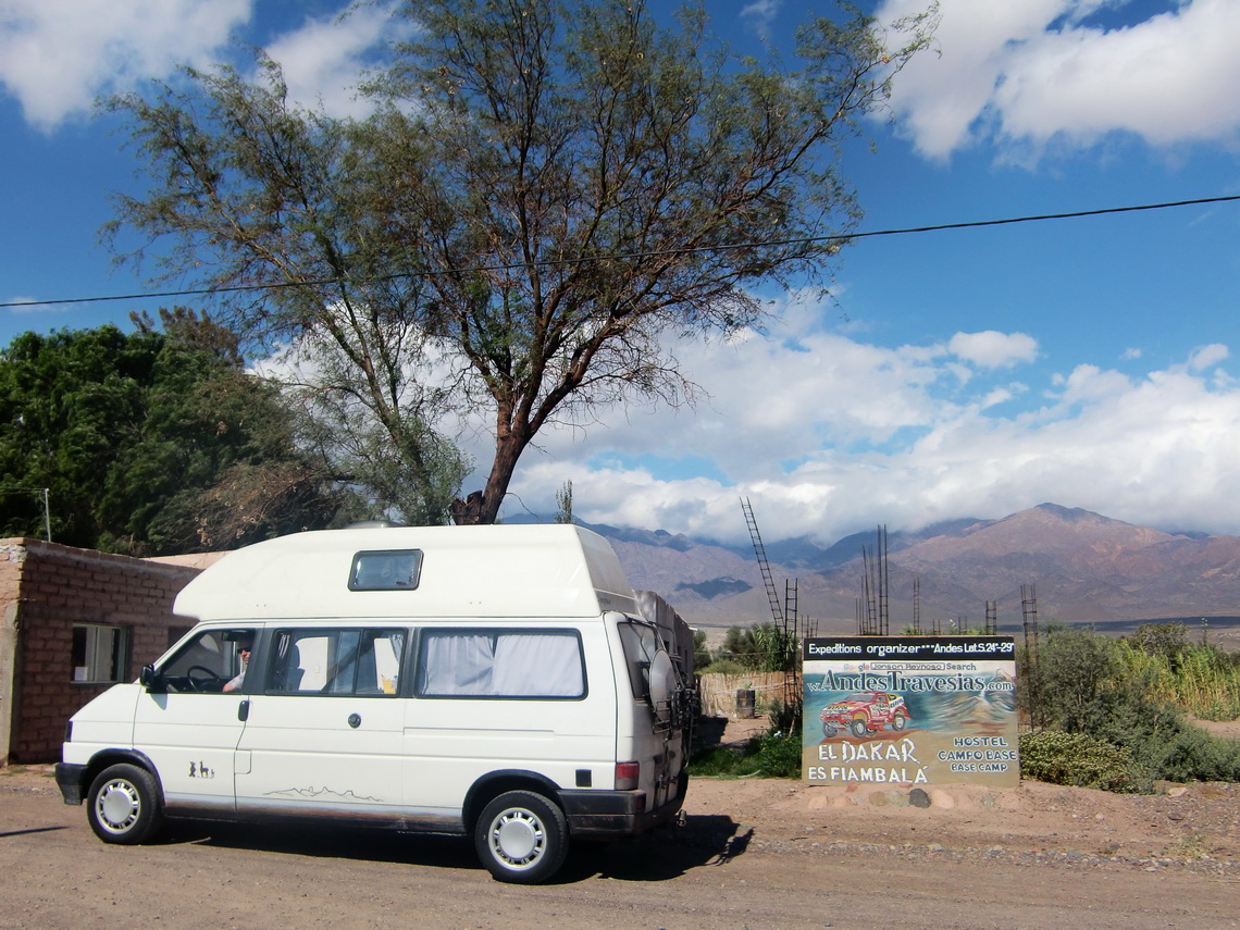
We started our trip to the Paso San Francisco in Fiambala, which is the last bigger settlement on the Argentine side, more than 3000 vertical meters below. Fiambala is a pleasant village with all facilities like Internet and famous thermal springs. It is also one of the major points of the rally Paris Dakar, which had passed Fiambala few weeks before we were there.

Rally Paris Dakar in Argentina - Fiambala is Dakar?

Read more ... 1 comment

Mercedario, one of the giants in the Andes

Mercedario is with 6770 meters one of the highest summits in the Andes. It lies approximately 80km North of Aconcagua and is very good choice to climb up. In comparison to Aconcagua it is without red tape (no climbing fee!), very remote and a pristine landscape. The ascent is quite long: You start at the Refugio Laguna Blanca with a sea level of 3161 meters, so it is more than 3600 meters difference to the summit. The base town is Barreal, approximately 120km West of San Juan or 200km Northwest of Mendoza. The only paved street to Barreal from San Juan is quite long (more than 250km), because you have circle the first ranges of the Andes in the North.
 
On the way to Barreal
 
Read more ... 2 comments

Cordon del Plata

The mountain range Cordon del Plata lies about 100 km west of Mendoza, the biggest town in West Argentina. Mendoza has approximately 1 Million inhabitants, so it is a quite large city. Cordon del Plata is one of the most popular mountain destination for the people of Mendoza. It is also a perfect acclimatization area, because a lot of mountains can be climbed, starting from 3000 meters up to 5930 meters. We started our trip in Mendoza, because there are all facilities like Internet, showers and shopping malls.  

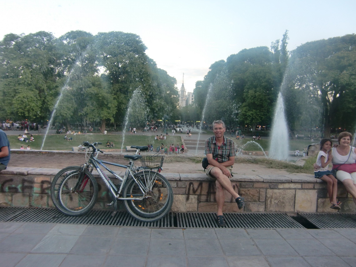
We had been in Mendoza six years ago, and we were impressed about its progress. 2005, few years after the Argentine economical crisis, the streets and a lot of buildings were in a shabby status. Many people were demotivated and frustrated. But now we had the feeling that Mendoza is a pleasant city with modern shopping malls, beautiful places, nice buildings and friendly people.

Plaza Independencia of Mendoza


Read more ... 1 comment

Sierra de las Quijadas

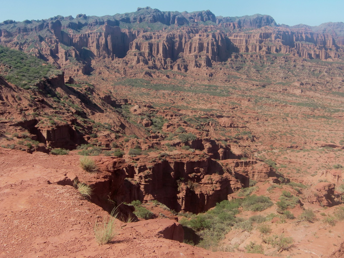
Parque Nacional de Sierra de las Quijadas is located approximately 200km North East of Mendoza. It is very dry region with small mountains up to 1200 meters, deep gorges, cacteens, a lot of dust and so on. The scene is very romantic, a little bit Wild West like. The entry to the park is free, also the Camping place, which is very basic, hot and sunny, but also very clean and remote.

There is just one tree which spends some shadow and a table which benches under its branches. Fortunately we could use this unique place, when we arrived very late in the evening of January 17th 2011. In the morning we walked to several view points (Miradores), which can be accessed easily and without a guide.

Sierra de Quijadas from South Viewpoint

Read more ... Add new comment

Sierras de Cordoba

Sierras de Cordoba is the biggest mountain range in Central Argentina. They are located west of the city Cordoba and more than 500km long, North to South direction. Their highest point is the Cerro Champaqui with 2884 meters. We started our trip in Cordoba, the second biggest city in Argentina. Cordoba is very well known in Austria as well as in Germany, because the German soccer team lost against Austria 2:3 at the 1978 world championship. Cordoba's size is similar to Munich; approximately 1.3 Million people are living there. It has a pleasant inner city and it is famous for the university, its buildings and churches, which are some of the nicest in Argentina.

Cathedral of Cordoba


Read more ... 1 comment
Copyright © 2023 Marion and Alfred. All Rights Reserved. Designed by JoomlArt.com. Joomla! is Free Software released under the GNU General Public License.
Bootstrap is a front-end framework of Twitter, Inc. Code licensed under MIT License. Font Awesome font licensed under SIL OFL 1.1.
Powered by T3 Framework